Gesamtpreis (1 Artikel Artikel):
Versandziel:

southeast early maps annotated check von cumming william (11 Ergebnisse)
Direkt zu den wichtigsten Suchergebnissen
Produktart
- Alle Produktarten
- Bücher (11)
- Magazine & Zeitschriften
- Comics
- Noten
- Kunst, Grafik & Poster
- Fotografien
- Karten
-
Manuskripte &
Papierantiquitäten
Zustand
- Alle
- Neu
- Antiquarisch/Gebraucht
Einband
- alle Einbände
- Hardcover (10)
- Softcover
Weitere Eigenschaften
- Erstausgabe (3)
- Signiert
- Schutzumschlag (4)
- Angebotsfoto (5)
- Kein Print-on-Demand
Gratisversand
Land des Verkäufers
Verkäuferbewertung
-

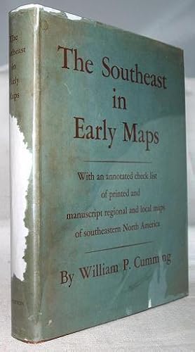
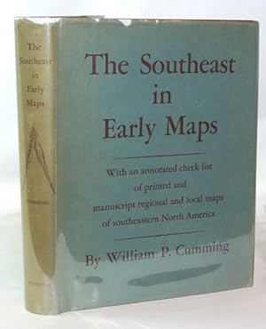
THE SOUTHEAST IN EARLY MAPS With An Annotated Check List Of Printed And Manuscript Regional And Local Maps Of Southeastern North America During The Colonial Period
Verlag: The University of North Carolina Press, Chapel Hill, 1962
Hardcover. Zustand: Very Good. 2nd edition. 2nd edition, 1962. A Very Good copy. 4to., 284 pp., bound in tan cloth with title in gilt on spine. Previous owners bookplate inside front cover; end pages foxed with some scattered spots on text edges. Pages are clean and unmarked.
-

The Southeast in Early Maps. With an annotated check list of printed and manuscript regional and local maps of southeastern north America during the colonial period.
Verlag: University Press. Princeton, New Jersey., 1958
Buch
Zustand: Gut. IX, 275 P. Binding and inside in very clean condition. English Language. The Southeast in Early Maps is a study and descriptive bibliography of the historical cartography of the southeastern region of the North American continent during the period of exploration and settlement before the American Revolution.; - With Maps. deu B06-01-05C|13|13690BB Sprache: Deutsch Gewicht in Gramm: 444 28,5 x 22,5 cm. Original Cloth binding with gilt back and dust jacket (slightly shop-soiled and ripped).
-

The Southeast in Early Maps: With an Annotated Check List of Printed and Manuscript Regional and Local Maps of Southeastern North America During the Colonial Period
Verlag: Princeton University Press, 1958
Erstausgabe
Hardcover. Zustand: Very Good. 1st Edition; 1st Printing. Large format hardcover, no dustjacket, "This is a study of the historical cartography of the southeastern region of the North American continent before the American Revolution," the cloth cover has some edge-rubbing and scuff-marks on the back, an ownership inscription is present on the inside of the front cover and there is a brief ink note on the rear inside cover stating "Some errors p 63 p 108." The errors have been corrected on these pages, the ink notes were apparently provided by a reviewer of the book and this is referenced in the inscrption on the inside front cover, the binding is clean and tight and the contents are in nice shape ; 275 pages.
-
The Southeast in Early Maps. With an Annotated Check List of Printed and Manuscript Regional and Local Maps of Southeastern North America During the Colonial Period.
Verlag: Chapel Hill, NC: The University of North Carolina Press, ()., 1962
Quarto, gray cloth (hardcover), gilt letters, ix, 284 pp. Near Fine. From Preface: This is a study of the historical cartography of the southeastern region of the North American continent before the American Revolution. It attempts to analyze the manuscript and printed maps of that area, showing the expansion of geographical knowledge through the periods of discovery and colonization, and at times relates these maps to other primary documents of the period. Through these cartographical records one can trace the origin and development of the fascinating misconceptions of the continent in the minds of the early explorers; they show vividly the expansion of the frontier and the shifting location of Indian tribes; they throw light on the complex history of the imperialistic struggles of France, Spain, and England during the period; and they delineate -- often erroneously -- shifting political divisions and boundary surveys. The very misconceptions and errors concerning the New World, graphically portrayed on these maps, are as important to the student of history in understanding the deeds and actions of our ancestors as are their correction and improvement on later maps. A cartographical study of this kind requires the setting of limitations, often arbitrary, to prevent unwieldy growth. The List of Maps attempts to make an exhaustive check of all regional maps of the Southeast and of local maps south of Virginia and north of the Florida peninsula. The inclusion of all local maps of Florida and Virginia would have more than doubled the size of the volume and greatly increased the ancillary cartographical problems; their inclusion would also have largely duplicated other map lists of those regions already made or now in progress. The List of Maps does not attempt to include world maps or maps of the North American continent (with a few notable exceptions), although the Introductory Essay does contain a survey of important sixteenth century world maps in their delineantion of the Southeast. United States History, U. S. History, American History, Americana, U.S.-iana, Reference, Books about Books, Books about Maps, Geography. zxsli.
-
The Southeast in early maps, with an annotated check list of printed and manuscript regional and local maps of southeastern North America during the colonial period.
Verlag: Princeton Press, 1958
Buch
Hardcover. Zustand: Good. ix, 275 pages 67 maps, 29 cm. Hardcover and dust jacket. Good binding and cover. Unmarked pages. Faint mustiness. DJ in mylar, some loss to dj. "Lists of maps of the Southeast during the colonial period, including local maps and plans of the region south of Virginia and north of the Florida peninsula": p. [103]-258. This is an oversized or heavy book, which requires additional postage for international delivery outside the US.
-
the Southeast in Early Maps with an Annotated Check List of Printed and Manuscript Regional and Local Maps of Southeastern North America During the Colonial Period
Verlag: University of North Carolina, Chapel Hill, 1962
Buch
Buckram. Zustand: Very Good. No Jacket. Second Edition. A really clean, tight second edition copy. In gray buckram, no DJ. From the Center for Learning Resources with their namestamp.
-
THE SOUTHEAST IN EARLY MAPS WITH AN ANNOTATED CHECK LIST OF PRINTED AND MANUSCRIPT REGIONAL AND LOCAL MAPS OF SOUTHEASTERN NORTH AMERICA DURING THE COLONIAL PERIOD
Verlag: Princeton, 1958
Anbieter: William Reese Company - Americana, New Haven, CT, USA
Verbandsmitglied: ABAA ESA ILAB SNEAB
Bewertung:

284pp. Quarto. Original cloth, spine gilt. Very light wear to corners and spine ends. Spine of dust jacket somewhat faded. Very good. First edition of a useful reference guide. Profusely illustrated with maps.
-
Southeast in Early Maps With an Annotated Check List of Printed
Anbieter: G.S. MacManus Co., ABAA, Bryn Mawr, PA, USA
Bewertung:

CUMMING, William P. The Southeast in Early Maps, With an Annotated Check List of Printed and Manuscript Regional and Local Maps of Southeastern North America During the Colonial Period. 4to. Orig. cloth. Illus. with 57 facs. Chapel Hill, N.C.: The University of North Carolina Press, [1962]. Second edition, revised. A fine copy.
-
The Southeast in Early Maps With An Annotated Check List Of Printed And Manuscript Regional And Local Maps Of Southeastern North America During The Colonial Period
Verlag: Princeton University Press,, Princeton, New Jersey:, 1958
Erstausgabe
Hardcover. First Edition. Near fine in burgundy cloth covered boards with gilt text on the spine. A small quarto of 10 7/8 by 8 3/8 inches with a gift inscription on the first free end page and light rubbing to the cloth at the head and heel of the spine. In a very good, unclipped dust jacket with 1/8" deep chips across the upper edge of the spine area and a 1/4" deep chip at the upper edge of the front panel. 275 pages including several indexes and text listing 450 pages. Illustrated with collotype reproductions of numerous (67) maps.
-

The Southeast in Early Maps. With an annotated check list of printed and manuscript regional maps of southeastern North America.
Verlag: Princeton University Press
Anbieter: Powell's Bookstores Chicago, ABAA, Chicago, IL, USA
Bewertung:
Zustand: Used - Very Good. 1958. First Edition Quarto. Cloth, dj., 275 pp., illus. (map facsimiles). Very sound in a slightly rubbed dj.;.
-
Southeast in Early Maps, With an Annotated Check List of Printed
Anbieter: G.S. MacManus Co., ABAA, Bryn Mawr, PA, USA
Bewertung:
Erstausgabe
CUMMING, William P. The Southeast in Early Maps, With an Annotated Check List of Printed and Manuscript Regional and Local Maps of Southeastern North America During the Colonial Period. 4to. Orig. cloth, dust jacket. Princeton: Princeton University Press, 1958. First edition. Fine in a torn d/j.