
Gesamtpreis (1 Artikel Artikel):
Versandziel:

truro von ordnance survey (145 Ergebnisse)
Direkt zu den wichtigsten Suchergebnissen
Produktart
- Alle Produktarten
- Bücher (123)
- Magazine & Zeitschriften
- Comics
- Noten
- Kunst, Grafik & Poster
- Fotografien
- Karten (22)
-
Manuskripte &
Papierantiquitäten
Zustand
Einband
Weitere Eigenschaften
- Erstausgabe (1)
- Signiert
- Schutzumschlag
- Angebotsfoto (45)
- Kein Print-on-Demand
Gratisversand
Land des Verkäufers
Verkäuferbewertung
-
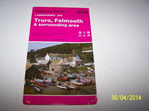
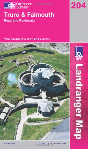
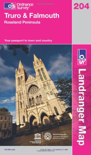
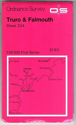
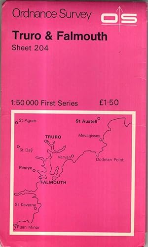
Truro, Falmouth and Surrounding Area (Sheet 204) (OS Landranger Map)
Verlag: Ordnance Survey, United Kingdom, Hants, 1992
ISBN 10: 0319222047ISBN 13: 9780319222041
Buch
Paperback. Zustand: Very Good. This map is part of the Landranger (Pink) series and is designed for people who really want to get to know an area. It includes the following information: tourist information, camping and caravan sites, picnic areas and viewpoints, selected places of interest and rights of way information for England and Wales. Each map in the series covers an area of 40 km by 40 km (25 miles by 25 miles) and like other Ordnance Survey maps, National Grid squares are provided so that any feature can be given a unique reference number. Perfect for planning ahead and local excursions, these maps are full of useful information that will help you really get to know an area. The book has been read, but is in excellent condition. Pages are intact and not marred by notes or highlighting. The spine remains undamaged.
Mehr Angebote von anderen Verkäufern bei AbeBooks
Gebraucht ab EUR 0,92
-

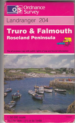
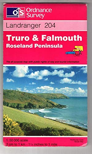
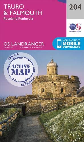
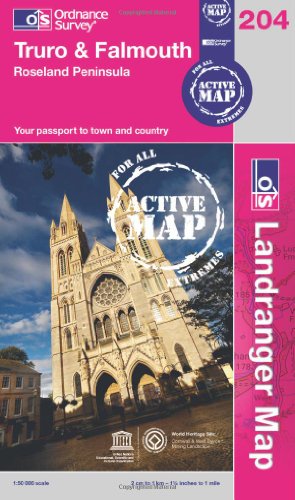
Truro and Falmouth, Roseland Peninsula (OS Landranger Map): Sheet 204
Verlag: Ordnance Survey, 2009
ISBN 10: 0319231496ISBN 13: 9780319231494
Buch
Paperback. Zustand: Very Good. The book has been read, but is in excellent condition. Pages are intact and not marred by notes or highlighting. The spine remains undamaged.
Mehr Angebote von anderen Verkäufern bei AbeBooks
Neu ab EUR 28,07
Gebraucht ab EUR 0,92
Mehr entdecken Softcover
-
Truro and Falmouth (Roseland Peninsula) (Sheet 204) (OS Landranger Map)
ISBN 10: 0319222586ISBN 13: 9780319222584
Buch
Paperback. Zustand: Very Good. The book has been read, but is in excellent condition. Pages are intact and not marred by notes or highlighting. The spine remains undamaged.
Mehr Angebote von anderen Verkäufern bei AbeBooks
Gebraucht ab EUR 1,49
-
Truro and Falmouth, Roseland Peninsula (Landranger Maps)
Verlag: Ordnance Survey, 1999
ISBN 10: 031922418XISBN 13: 9780319224182
Buch
Paperback. Zustand: Good. The book has been read but remains in clean condition. All pages are intact and the cover is intact. Some minor wear to the spine.
Mehr Angebote von anderen Verkäufern bei AbeBooks
Gebraucht ab EUR 1,75
-
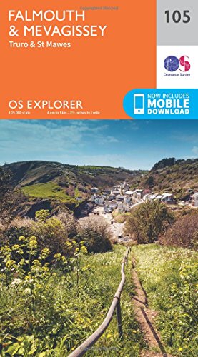
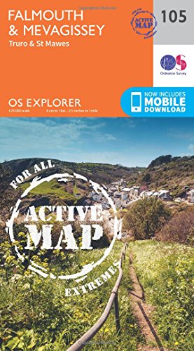
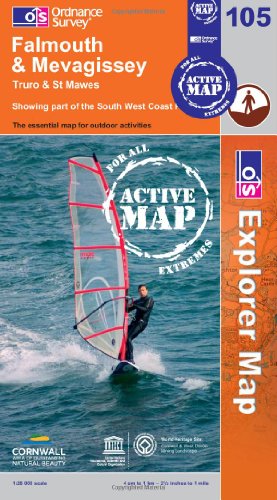
Falmouth & Mevagissey Map | Truro & St Mawes | Ordnance Survey | OS Explorer Map 105 | England | Walks | Hiking | Maps | Adventure
Verlag: Ordnance Survey, United Kingdom, Hants, 2015
ISBN 10: 0319243079ISBN 13: 9780319243077
Buch
Paperback. Zustand: Very Good. OS Explorer is the Ordnance Survey's most detailed map and is recommended for anyone enjoying outdoor activities like walking, horse riding and off-road cycling. The OS Explorer range now includes a digital version of the paper map, accessed through the OS smartphone app, OS Maps. Providing complete GB coverage the series details essential information such as youth hostels, pubs and visitor information as well as rights of way, permissive paths and bridleways. The book has been read, but is in excellent condition. Pages are intact and not marred by notes or highlighting. The spine remains undamaged.
Mehr Angebote von anderen Verkäufern bei AbeBooks
Neu ab EUR 16,27
Gebraucht ab EUR 2,37
Mehr entdecken Softcover
-
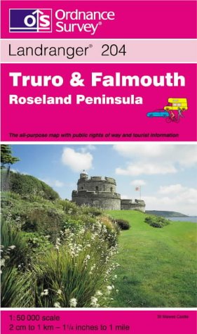
Landranger Map 204 Truro and Falmouth, Roseland Peninsula: Sheet 204
Verlag: Ordnance Survey, 2002
ISBN 10: 0319228045ISBN 13: 9780319228043
Buch
Paperback. Zustand: Very Good. The book has been read, but is in excellent condition. Pages are intact and not marred by notes or highlighting. The spine remains undamaged.
Mehr Angebote von anderen Verkäufern bei AbeBooks
Gebraucht ab EUR 2,66
-
Truro and Falmouth, Roseland Peninsula: Sheet 204 (Landranger Maps)
Verlag: Ordnance Survey, 1997
ISBN 10: 031922323XISBN 13: 9780319223239
Buch
map. Zustand: Good. All orders are dispatched the following working day from our UK warehouse. Established in 2004, we have over 500,000 books in stock. No quibble refund if not completely satisfied.
Mehr Angebote von anderen Verkäufern bei AbeBooks
Gebraucht ab EUR 2,80
-
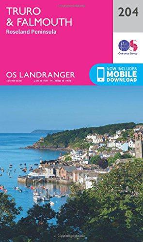
Truro & Falmouth Map | Roseland Peninsula | Ordnance Survey | OS Landranger Map 204 | England | Walks | Cycling | Days Out | Maps | Adventure
Verlag: Ordnance Survey, 2020
ISBN 10: 0319263967ISBN 13: 9780319263969
Buch
Paperback. Zustand: Very Good. The book has been read, but is in excellent condition. Pages are intact and not marred by notes or highlighting. The spine remains undamaged.
Mehr Angebote von anderen Verkäufern bei AbeBooks
Neu ab EUR 15,28
Gebraucht ab EUR 5,90
Mehr entdecken Softcover
-
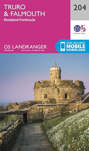
Landranger (204) Truro & Falmouth, Roseland Peninsula (OS Landranger Map)
Verlag: Ordnance Survey, 2016
ISBN 10: 0319263029ISBN 13: 9780319263020
Buch
Zustand: VeryGood. Most items will be dispatched the same or the next working day.
Mehr Angebote von anderen Verkäufern bei AbeBooks
Gebraucht ab EUR 2,54
-
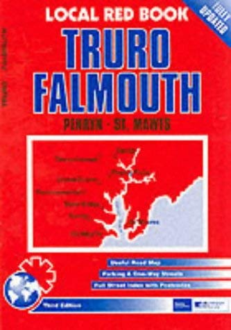
Truro and Falmouth (Local Red Book S.)
Verlag: Estate Publications, 2001
ISBN 10: 1841921319ISBN 13: 9781841921310
Buch
Paperback. Zustand: Very Good. The book has been read, but is in excellent condition. Pages are intact and not marred by notes or highlighting. The spine remains undamaged.
Mehr Angebote von anderen Verkäufern bei AbeBooks
Gebraucht ab EUR 8,66
-
Truro & Falmouth, Roseland Peninsula (OS Landranger Map): Sheet 204
Verlag: Ordnance Survey, 2012
ISBN 10: 0319232905ISBN 13: 9780319232903
Buch
Paperback. Zustand: Very Good. The book has been read, but is in excellent condition. Pages are intact and not marred by notes or highlighting. The spine remains undamaged.
Mehr Angebote von anderen Verkäufern bei AbeBooks
Gebraucht ab EUR 9,00
-
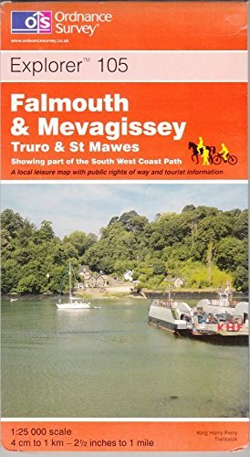
Falmouth & Mevagissey Map | Weatherproof | Truro & St Mawes | Ordnance Survey | OS Explorer Active Map 105 | England | Walks | Hiking | Maps | Adventure
Verlag: Ordnance Survey, 2015
ISBN 10: 0319469867ISBN 13: 9780319469866
Buch
Paperback. Zustand: Very Good. The book has been read, but is in excellent condition. Pages are intact and not marred by notes or highlighting. The spine remains undamaged.
Mehr Angebote von anderen Verkäufern bei AbeBooks
Neu ab EUR 19,79
Gebraucht ab EUR 9,86
Mehr entdecken Softcover
-

fine map in original sleeve, folded to booklet size.
-
Falmouth and Mevagissey: Truro and St.Mawes (Explorer Maps)
Verlag: Ordnance Survey, 2001
ISBN 10: 0319234215ISBN 13: 9780319234211
Buch
Map. Zustand: Good. All orders are dispatched the following working day from our UK warehouse. Established in 2004, we have over 500,000 books in stock. No quibble refund if not completely satisfied.
Mehr Angebote von anderen Verkäufern bei AbeBooks
Gebraucht ab EUR 13,63
-
LANDRANGER MAP 204, Truro & Falmouth, 1:50 000
Verlag: ORDNANCE SURVEY, Southampton, 1979
Anbieter: K Books Ltd ABA ILAB, York, YORKS, Vereinigtes Königreich
Verbandsmitglied: ABA ILAB PBFA
Bewertung:

Buch
Soft cover. Zustand: Very Good. No Jacket. Reprint. This is a very good copy of this OS Landranger map, covering Truro & Falmouth. SOFT COVER, NO JACKET, NO MARKINGS, EXCELLENT CONDITION, SPLENDID VALUE. ORDNANCE SURVEY MAP OF TRURO AND FALMOUTH .
-
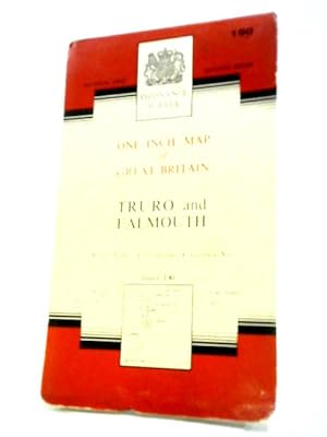
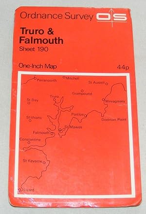
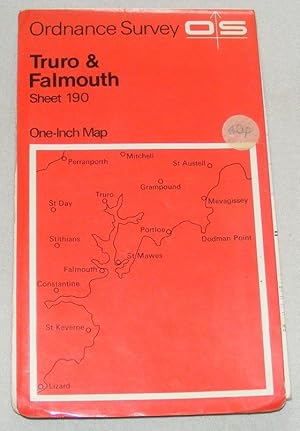
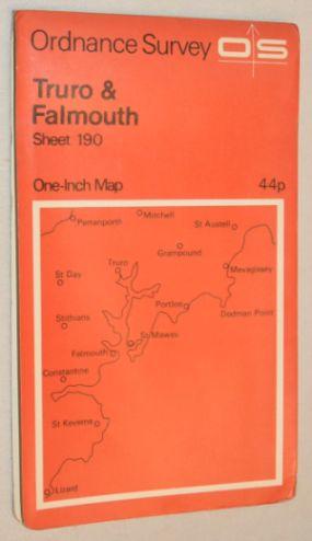
Ordnance Survey One-inch map of Great Britain Truro and Falmouth Sheet 190
Verlag: Ordnance Survey, 1961
Anbieter: World of Rare Books, Goring-by-Sea, SXW, Vereinigtes Königreich
Bewertung:
Zustand: Good. 1961. Unpaginated. Orange and white pictorial paperback. Sheet 190. Map is bright and clear with some light foxing and tanning. Slight creases to corners.
-
OS Landranger Active Map 204 Truro & Falmouth, Roseland Peninsula (OS Landranger Active Map)
Verlag: Ordnance Survey, 2020
ISBN 10: 0319475816ISBN 13: 9780319475812
Buch
Map. Zustand: New. BRAND NEW ** SUPER FAST SHIPPING FROM UK WAREHOUSE ** 30 DAY MONEY BACK GUARANTEE.
Mehr Angebote von anderen Verkäufern bei AbeBooks
Neu ab EUR 17,30
-
Map. Zustand: Good. Covers worn, map unmarked.
-
Falmouth, Mevagissey, Truro and St Mawes (OS Explorer Map Active): No. 105
Verlag: Ordnance Survey, 2009
ISBN 10: 0319468011ISBN 13: 9780319468012
Buch
Map. Zustand: Used; Good. **SHIPPED FROM UK** We believe you will be completely satisfied with our quick and reliable service. All orders are dispatched as swiftly as possible! Buy with confidence! Greener Books.
Mehr Angebote von anderen Verkäufern bei AbeBooks
Gebraucht ab EUR 16,26
-
Map. Zustand: Good. Covers worn, map unmarked.
-
Truro & Falmouth, Roseland Peninsula (OS Landranger Map Active): Sheet 204 (OS Landranger Active Map)
Verlag: Ordnance Survey, 2012
ISBN 10: 031948050XISBN 13: 9780319480502
Buch
hardcover. Zustand: Good. All orders are dispatched the following working day from our UK warehouse. Established in 2004, we have over 500,000 books in stock. No quibble refund if not completely satisfied.
-
Falmouth and Mevagissey: Truro and St.Mawes (Explorer Maps)
Verlag: Ordnance Survey, 2001
ISBN 10: 0319234215ISBN 13: 9780319234211
Anbieter: Trumpington Fine Books Limited, Gilmilnscroft, Ayrshire, Scotland, Vereinigtes Königreich
Bewertung:

Karte
Map. Zustand: Very Good. A lovely bright copy. Revised for selected change 2001. All the folds remain in very good condition. A nick to the tail of the rear card - hardly noticeable and slight rubbing to the card covers in a very few places. A well or very well preserved copy.
-
![Bild des Verkäufers für Ordnance Survey Contoured Road Map [One-inch Popular Edition], sheet 143, Truro. zum Verkauf von Cornell Books Limited](https://pictures.abebooks.com/inventory/md/md31090632373.jpg)
Ordnance Survey Contoured Road Map [One-inch Popular Edition], sheet 143, Truro.
Verlag: Southampton: Ordnance Survey, 1927., 1927
Anbieter: Cornell Books Limited, Tewkesbury, Vereinigtes Königreich
Verbandsmitglied: PBFA
Bewertung:
Karte
First printed in 1918, this is a reprint from 1927 (print code 3500/27). Mounted on cloth and folded in the original covers, with a front cover illustration by Ellis Martin. The map is in good to very good condition (light wear to the folds); the covers are in very good condition. Also covers Bodmin, St Austell, Newquay, Fowey, Mavagissey, Grampound, St Mawes and Redruth.
-
Map. Zustand: Good. Cover has some wear, map in very good condition. Revised 1972, major roads revised 1971. Edition B.
-
Map. Zustand: Good. Feels like it has been well used, but still in good condition. Fully revised 1958, major roads revised 1965. Edition A/.
-

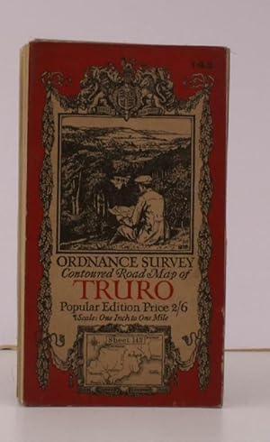
Truro & Falmouth. Sheet 190 One-Inch Map of England & Wales, New Popular Edition
Verlag: Ordnance Survey, 1946
Karte
Map. Zustand: Fair. Map (on cloth) is in almost very good condition, brown mark in middle of Falmouth Bay; card cover tanned and edgeworn with owner's name on front. Fully revised 1930 with later corrections. Print code 35046.
-
Map. Zustand: Very Good. Cover has slight shelfwear, , map in very good condition. Revised 1972, major roads revised 1971. Edition B.
-
Ordnance Survey Contoured Road Map of Truro and St. Austell. Sheet 143. Popular Edition. Scale: One Inch to to One Mile. BRIGHT, CLEAN COPY
Verlag: Ordnance Survey, Southampton, [1927], 1927
Anbieter: Island Books, Thakeham, West Sussex, Vereinigtes Königreich
Bewertung:
Karte
Folding coloured map on cloth measuring 26 x 35 ins (approx. 66.0 x 88.0 cms) folding in 36 panels to 7.0 x 4.0 ins (approx. 17.7 x 10.1 cms); original pictorial card wrappers, one or two small stains on map surface else a bright, clean copy. The famous Popular Edition One Inch series with striking 'cyclist' artwork by Ellis Martin was first issued in 1918. This is the 1927 revision. The covers are black with red sheet name and location map. Browne, 11.1.a.
-
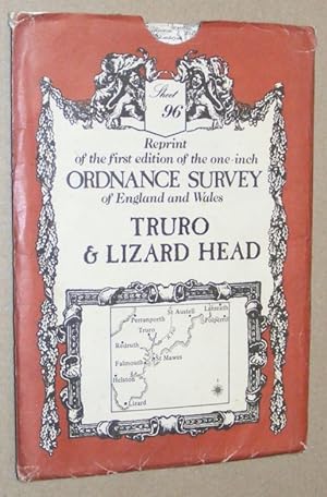
Truro and Lizard Head: Sheet 96, reprint of the first edition of the one-inch Ordnance Survey of England and Wales
Verlag: David & Charles, Newton Abbot, 1980
ISBN 10: 0715344005ISBN 13: 9780715344002
Karte
Map. Zustand: Very Good. Folded map in very good condition, a little tanned and a few grubby marks on one edge; slipcase is rubbed and worn.
Mehr Angebote von anderen Verkäufern bei AbeBooks
Gebraucht ab EUR 5,99
-
Ordnance Survey Contoured Road Map [One-inch Popular Edition], sheet 143, Truro and St Austell
Verlag: Ordnance Survey, Southampton, 1930
Buch
Soft cover. Zustand: Good ++. 1930 rep. Coloured map mounted on linen.
