nicolson maps ayrshire (56 Ergebnisse)
FeedbackSuchfilter
Produktart
- Alle Product Types
- Bücher (56)
- Magazine & Zeitschriften (Keine weiteren Ergebnisse entsprechen dieser Verfeinerung)
- Comics (Keine weiteren Ergebnisse entsprechen dieser Verfeinerung)
- Noten (Keine weiteren Ergebnisse entsprechen dieser Verfeinerung)
- Kunst, Grafik & Poster (Keine weiteren Ergebnisse entsprechen dieser Verfeinerung)
- Fotografien (Keine weiteren Ergebnisse entsprechen dieser Verfeinerung)
- Karten (Keine weiteren Ergebnisse entsprechen dieser Verfeinerung)
- Manuskripte & Papierantiquitäten (Keine weiteren Ergebnisse entsprechen dieser Verfeinerung)
Zustand
- Alle
- Neu (Keine weiteren Ergebnisse entsprechen dieser Verfeinerung)
- Antiquarisch (56)
Einband
Weitere Eigenschaften
- Erstausgabe (Keine weiteren Ergebnisse entsprechen dieser Verfeinerung)
- Signiert (Keine weiteren Ergebnisse entsprechen dieser Verfeinerung)
- Schutzumschlag (Keine weiteren Ergebnisse entsprechen dieser Verfeinerung)
- Angebotsfoto (Keine weiteren Ergebnisse entsprechen dieser Verfeinerung)
- Keine Print-on-Demand Angebote (56)
Gratisversand
- Kostenloser Versand nach USA (Keine weiteren Ergebnisse entsprechen dieser Verfeinerung)
Verkäuferbewertung
-
Nicholson Mini Atlas London
Verlag: Nicolson Maps, Ayrshire, 1995
ISBN 10: 070282786X ISBN 13: 9780702827860
Anbieter: 2Vbooks, Derwood, MD, USA
Trade paperback. Zustand: Fine. 2nd Revised edition. Revised. Nicholson mini atlas. Audience: General/trade. No previous owner's name. Clean, tight pages. No bent corners. PB 118.
-
Nicholson/Ordnance Survey Guide to the River Thames, River Wey and Basingstoke Canal
Verlag: Nicolson Maps, United Kingdom, Ayrshire, 1984
ISBN 10: 0905522826 ISBN 13: 9780905522821
Anbieter: WorldofBooks, Goring-By-Sea, WS, Vereinigtes Königreich
Paperback. Zustand: Very Good. The book has been read, but is in excellent condition. Pages are intact and not marred by notes or highlighting. The spine remains undamaged.
-
Glasgow Street Guide (Fourth Series)
Verlag: Nicolson Maps, United Kingdom, Ayrshire, 2011
ISBN 10: 1860973469 ISBN 13: 9781860973468
Anbieter: WorldofBooks, Goring-By-Sea, WS, Vereinigtes Königreich
Paperback. Zustand: Very Good. Fully indexed street map of central Glasgow. Covering from Jordanhill in the North west to Dalmarnock in the South east. The book has been read, but is in excellent condition. Pages are intact and not marred by notes or highlighting. The spine remains undamaged.
-
Guide to English Churches
Verlag: Nicolson Maps, United Kingdom, Ayrshire, 1984
ISBN 10: 0905522877 ISBN 13: 9780905522876
Anbieter: WorldofBooks, Goring-By-Sea, WS, Vereinigtes Königreich
Paperback. Zustand: Very Good. The book has been read, but is in excellent condition. Pages are intact and not marred by notes or highlighting. The spine remains undamaged.
-
Guide to the Greek Islands
Verlag: Nicolson Maps, United Kingdom, Ayrshire, 1986
ISBN 10: 090552294X ISBN 13: 9780905522944
Anbieter: WorldofBooks, Goring-By-Sea, WS, Vereinigtes Königreich
Paperback. Zustand: Fair. A readable copy of the book which may include some defects such as highlighting and notes. Cover and pages may be creased and show discolouration.
-
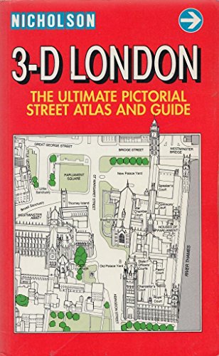
3-D London - A New Dimension
Verlag: Nicolson Maps, United Kingdom, Ayrshire, 1990
ISBN 10: 094857643X ISBN 13: 9780948576430
Anbieter: WorldofBooks, Goring-By-Sea, WS, Vereinigtes Königreich
Paperback. Zustand: Very Good. This guide offers a whole new perspective on London. Taking the pigeon's eye view, every street, every building, often every window in every building is shown in detail and it's much easier to use than a conventional map. A quick glance at your surroundings will enable you to check your location and find your way around. Covering the West End and City, Victoria, Knightsbridge, Kensington and Chelsea, plus Portobello, Greenwich, Little Venice, Regent's Park and the Zoo, the South Bank and the Tower of London. There are 58 double-page spreads (116pp) of 3 dimensional mapping with an informative text linked to each map. It includes masses of facts on historic buildings, former residents, famous sights, curiosities, museums and galleries. Details are provided of numerous specialist shops, pubs and restaurants (including price guide). Also included: visitor information, practical information for getting to and around London, public transport, sightseeing, opening hours, medical services, post and telephones. The book has been read, but is in excellent condition. Pages are intact and not marred by notes or highlighting. The spine remains undamaged.
-
Nicholson London Street Atlas 1994
Verlag: Nicolson Maps, United Kingdom, Ayrshire, 1994
ISBN 10: 0702819069 ISBN 13: 9780702819063
Anbieter: WorldofBooks, Goring-By-Sea, WS, Vereinigtes Königreich
Paperback. Zustand: Very Good. This street atlas has a main mapping of 1:20,000, with a 32-page super scale section of London at the increased scale of 1:10,000. Information highlighted on the maps includes colour-coded primary routes, A roads, B roads, street markets, pedestrian streets, cycle paths, footpaths, borough boundaries and postal district boundaries and codes. The grid system is based on the OS National Grid, with 1000 references every second grid square. Public buildings are colour-coded according to use, and additional land-use information includes classification of open spaces/green areas. There is also a comprehensive street index, an index to places of interest and an index to place names, as well as a theatres and cinemas map, shopping map, bus routes map and underground map. The book has been read, but is in excellent condition. Pages are intact and not marred by notes or highlighting. The spine remains undamaged.
-
London Dockland's Guide and Street Atlas
Verlag: Nicolson Maps, United Kingdom, Ayrshire, 1988
ISBN 10: 0948576170 ISBN 13: 9780948576171
Anbieter: WorldofBooks, Goring-By-Sea, WS, Vereinigtes Königreich
Paperback. Zustand: Very Good. The book has been read, but is in excellent condition. Pages are intact and not marred by notes or highlighting. The spine remains undamaged.
-
Bridge of Weir Street Guide (Nicolson Street Guides)
Verlag: Nicolson Maps, United Kingdom, Ayrshire, 1995
ISBN 10: 1874288909 ISBN 13: 9781874288909
Anbieter: WorldofBooks, Goring-By-Sea, WS, Vereinigtes Königreich
Paperback. Zustand: Very Good. The book has been read, but is in excellent condition. Pages are intact and not marred by notes or highlighting. The spine remains undamaged.
-
Greater London Street Atlas: Comprehensive Edition
Verlag: Nicolson Maps, United Kingdom, Ayrshire, 1991
ISBN 10: 0702812544 ISBN 13: 9780702812545
Anbieter: WorldofBooks, Goring-By-Sea, WS, Vereinigtes Königreich
Paperback. Zustand: Very Good. The atlas includes street maps, tube maps, a theatre and cinema map, an Inner London route map, an M25 route map and the M25 Junction Mileage Planner. The book has been read, but is in excellent condition. Pages are intact and not marred by notes or highlighting. The spine remains undamaged.
-
Irvine Street Guide (Nicolson Street Guides)
Verlag: Nicolson Maps, United Kingdom, Ayrshire, 1995
ISBN 10: 1874288917 ISBN 13: 9781874288916
Anbieter: WorldofBooks, Goring-By-Sea, WS, Vereinigtes Königreich
Paperback. Zustand: Very Good. The book has been read, but is in excellent condition. Pages are intact and not marred by notes or highlighting. The spine remains undamaged.
-
Scotland Tourist Map
Verlag: Nicolson Maps, United Kingdom, Ayrshire, 2001
ISBN 10: 1860972047 ISBN 13: 9781860972041
Anbieter: WorldofBooks, Goring-By-Sea, WS, Vereinigtes Königreich
Paperback. Zustand: Very Good. The book has been read, but is in excellent condition. Pages are intact and not marred by notes or highlighting. The spine remains undamaged.
-
Nicholson Greater London Street Atlas: Comprehensive Edition
Verlag: Nicolson Maps, United Kingdom, Ayrshire, 1997
ISBN 10: 0702831425 ISBN 13: 9780702831423
Anbieter: WorldofBooks, Goring-By-Sea, WS, Vereinigtes Königreich
Paperback. Zustand: Good. This revised edition includes central area enlarged maps, route-planning maps, theatre, cinema and shopping maps and the tube map. The range of indexes include lists of buildings and features of interest, place names and streets. The book has been read but remains in clean condition. All pages are intact and the cover is intact. Some minor wear to the spine.
Mehr Angebote von anderen Verkäufern bei AbeBooks
Gebraucht ab EUR 9,30
-
London Streetfinder
Verlag: Nicolson Maps, United Kingdom, Ayrshire, 1990
ISBN 10: 0948576472 ISBN 13: 9780948576478
Anbieter: WorldofBooks, Goring-By-Sea, WS, Vereinigtes Königreich
Paperback. Zustand: Good. The book has been read but remains in clean condition. All pages are intact and the cover is intact. Some minor wear to the spine.
-
Nicholson London Map
Verlag: Nicolson Maps, United Kingdom, Ayrshire, 1989
ISBN 10: 0948576405 ISBN 13: 9780948576409
Anbieter: WorldofBooks, Goring-By-Sea, WS, Vereinigtes Königreich
Paperback. Zustand: Very Good. The book has been read, but is in excellent condition. Pages are intact and not marred by notes or highlighting. The spine remains undamaged.
-
Nicholson London Street Atlas 1994
Verlag: Nicolson Maps, United Kingdom, Ayrshire, 1994
ISBN 10: 0702813281 ISBN 13: 9780702813283
Anbieter: WorldofBooks, Goring-By-Sea, WS, Vereinigtes Königreich
Paperback. Zustand: Good. This street atlas has a main mapping of 1:20,000, with a 32-page super scale section of London at the increased scale of 1:10,000. Information highlighted on the maps includes colour-coded primary routes, A roads, B roads, street markets, pedestrian streets, cycle paths, footpaths, borough boundaries and postal district boundaries and codes. The grid system is based on the OS National Grid, with 1000 references every second grid square. Public buildings are colour-coded according to use, and additional land-use information includes classification of open spaces/green areas. There is also a comprehensive street index, an index to places of interest and an index to place names, as well as a theatres and cinemas map, shopping map, bus routes map and underground map. The book has been read but remains in clean condition. All pages are intact and the cover is intact. Some minor wear to the spine.
-
South (Pt. 1) (Ordnance Survey Guide to the Waterways)
Verlag: Nicolson Maps, United Kingdom, Ayrshire, 1989
ISBN 10: 0948576316 ISBN 13: 9780948576317
Anbieter: WorldofBooks, Goring-By-Sea, WS, Vereinigtes Königreich
Paperback. Zustand: Good. The book has been read but remains in clean condition. All pages are intact and the cover is intact. Some minor wear to the spine.
-
London Guide: The Most Comprehensive Guide to London
Verlag: Nicolson Maps, United Kingdom, Ayrshire, 1993
ISBN 10: 070282237X ISBN 13: 9780702822377
Anbieter: WorldofBooks, Goring-By-Sea, WS, Vereinigtes Königreich
Paperback. Zustand: Good. This revised edition gives information on main historic sites, events, tours, trips, museums and galleries, shops, parks, pubs and restaurants, sport and leisure facilities, accommodation, transport, children's and student's London, and emergency and social services. The book has been read but remains in clean condition. All pages are intact and the cover is intact. Some minor wear to the spine.
-
A Guide to London by Bus and Tube
Verlag: Nicolson Maps, United Kingdom, Ayrshire, 1987
ISBN 10: 0948576081 ISBN 13: 9780948576089
Anbieter: WorldofBooks, Goring-By-Sea, WS, Vereinigtes Königreich
Paperback. Zustand: Very Good. The book has been read, but is in excellent condition. Pages are intact and not marred by notes or highlighting. The spine remains undamaged.
-
Greater London Street Atlas: Comprehensive Edition
Verlag: Nicolson Maps, United Kingdom, Ayrshire, 1993
ISBN 10: 0702821365 ISBN 13: 9780702821363
Anbieter: WorldofBooks, Goring-By-Sea, WS, Vereinigtes Königreich
Paperback. Zustand: Good. This revised edition of the Greater London Street Atlas includes eight pages of Central London maps, 12 pages of route planning maps as well as a London Boroughs map and an Underground map. Over 1500 square miles of street mapping are included, over 7500 streets listed and an M25 mileage planner is also included. The maps of Central London appear on a scale of 5.5 inches to one mile while the Greater London maps have a scale of 3.17 inches to one mile. The book has been read but remains in clean condition. All pages are intact and the cover is intact. Some minor wear to the spine.
-
Fife Atlas: Towns and Villages of Fife (Second Series)
Verlag: Nicolson Maps, United Kingdom, Ayrshire, 2002
ISBN 10: 1860971504 ISBN 13: 9781860971501
Anbieter: WorldofBooks, Goring-By-Sea, WS, Vereinigtes Königreich
Paperback. Zustand: Good. The book has been read but remains in clean condition. All pages are intact and the cover is intact. Some minor wear to the spine.
-
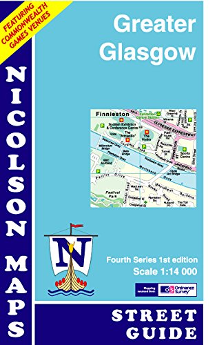
Nicolson Greater Glasgow Street Guide: Featuring Commonwealth Games Venues (Fourth Series)
Verlag: Nicolson Maps, United Kingdom, Ayrshire, 2014
ISBN 10: 1860973736 ISBN 13: 9781860973734
Anbieter: WorldofBooks, Goring-By-Sea, WS, Vereinigtes Königreich
Paperback. Zustand: Very Good. A new card covered street map covering most of the Greater Glasgow area. From Jordanhill in the north west to Pollock in the south west and Cambuslang in the south east to Easterhouse in the north east. The book has been read, but is in excellent condition. Pages are intact and not marred by notes or highlighting. The spine remains undamaged.
-
Scottish Borders Street Atlas (2nd)
Verlag: Nicolson Maps, United Kingdom, Ayrshire, 2000
ISBN 10: 1860970915 ISBN 13: 9781860970917
Anbieter: WorldofBooks, Goring-By-Sea, WS, Vereinigtes Königreich
Paperback. Zustand: Very Good. The book has been read, but is in excellent condition. Pages are intact and not marred by notes or highlighting. The spine remains undamaged.
-
Nicholson London Streetfinder
Verlag: Nicolson Maps, United Kingdom, Ayrshire, 1993
ISBN 10: 0702819034 ISBN 13: 9780702819032
Anbieter: WorldofBooks, Goring-By-Sea, WS, Vereinigtes Königreich
Paperback. Zustand: Very Good. Contains 160 pages of colour maps, with Outer London scaled at 3 inches to 1 mile, Central London at 5 inches to 1 mile, and a further enlargement of the City area. It features close gridding for rapid street finding, bold type, and also indicates one way streets. The index lists 44,840 entries. The book has been read, but is in excellent condition. Pages are intact and not marred by notes or highlighting. The spine remains undamaged.
-
Nicholson Greater London Street Atlas: Comprehensive Edition
Verlag: Nicolson Maps, United Kingdom, Ayrshire, 1999
ISBN 10: 0702831433 ISBN 13: 9780702831430
Anbieter: WorldofBooks, Goring-By-Sea, WS, Vereinigtes Königreich
Paperback. Zustand: Very Good. This revised edition includes central area enlarged maps, route-planning maps, theatre, cinema and shopping maps and the tube map. The range of indexes include lists of buildings and features of interest, place names and streets. The book has been read, but is in excellent condition. Pages are intact and not marred by notes or highlighting. The spine remains undamaged.
-
Nicholson London Guide: The Most Comprehensive Pocket Guide to London
Verlag: Nicolson Maps, United Kingdom, Ayrshire, 1995
ISBN 10: 0702827436 ISBN 13: 9780702827433
Anbieter: WorldofBooks, Goring-By-Sea, WS, Vereinigtes Königreich
Paperback. Zustand: Very Good. This edition has been revised to make it more relevant to residents and long stay visitors. It provides information on the main historic sights, events, tours, trips, museums and galleries, shops, pubs, parks and restaurants, children's and students' London and emergency and social services. The book has been read, but is in excellent condition. Pages are intact and not marred by notes or highlighting. The spine remains undamaged.
-
London Streetfinder
Verlag: Nicolson Maps, United Kingdom, Ayrshire, 1992
ISBN 10: 0702813265 ISBN 13: 9780702813269
Anbieter: WorldofBooks, Goring-By-Sea, WS, Vereinigtes Königreich
Paperback. Zustand: Very Good. This London streetfinder includes close gridding for quick reference. The atlas features one way streets, a London information section, theatre and cinema map, shopping map and underground map. The book has been read, but is in excellent condition. Pages are intact and not marred by notes or highlighting. The spine remains undamaged.
-
Oban and Mull Tourist Map
Verlag: Nicolson Maps, United Kingdom, Ayrshire, 2007
ISBN 10: 1860972195 ISBN 13: 9781860972195
Anbieter: WorldofBooks, Goring-By-Sea, WS, Vereinigtes Königreich
Paperback. Zustand: Very Good. The book has been read, but is in excellent condition. Pages are intact and not marred by notes or highlighting. The spine remains undamaged.
-
Falkirk and District Street Atlas
Verlag: Nicolson Maps, United Kingdom, Ayrshire, 2000
ISBN 10: 1860970869 ISBN 13: 9781860970863
Anbieter: WorldofBooks, Goring-By-Sea, WS, Vereinigtes Königreich
Paperback. Zustand: Good. The book has been read but remains in clean condition. All pages are intact and the cover is intact. Some minor wear to the spine.
-
North East London (Sheet 2) (Nicholson Greater London sheet map)
Verlag: Nicolson Maps, United Kingdom, Ayrshire, 1995
ISBN 10: 0702823201 ISBN 13: 9780702823206
Anbieter: WorldofBooks, Goring-By-Sea, WS, Vereinigtes Königreich
Paperback. Zustand: Very Good. This map covers the areas of Enfield Chase, Hornsey, Southwark, Theydon Bois, Hornchurch and South Ockendon. Different colours clearly define the London boroughs and this map includes all the recent changes to the borough bondaries. The scale is 1:120,000 (1 mile to 3.17 inches). The book has been read, but is in excellent condition. Pages are intact and not marred by notes or highlighting. The spine remains undamaged.


