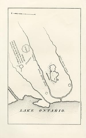
Antique Map-Battle-Big Sandy Creek near Lake Ontario-North America-Pease-1850
Verkäufer ThePrintsCollector, Zeeland, Niederlande
Verkäuferbewertung 5 von 5 Sternen
AbeBooks-Verkäufer seit 3. April 2017
Verkäufer ThePrintsCollector, Zeeland, Niederlande
Verkäuferbewertung 5 von 5 Sternen
AbeBooks-Verkäufer seit 3. April 2017
Beschreibung
Antique Map, titled: 'Lake Ontario.' - Map of the North- and South Sandy Creek near Lake Ontario. Map of the North- and South Sandy Creek near Lake Ontario. Illustrations to: "The documentary history of the state of New-York". Lithography on wove paper. Made by 'Richard H. Pease'. Richard H. Pease (1813-1869) was an engraver / lithographer and printer from Albany. Very good, given age. Small margins. General age-related toning and/or occasional minor defects from handling. Please study scan carefully. The overall size is ca. 21.9 x 13.9 cm. The image size is ca. 21.9 x 13.9 cm. The overall size is ca. 8.6 x 5.5 inch. The image size is ca. 8.6 x 5.5 inch. Storage location: C4-02. Bestandsnummer des Verkäufers 74404
Bibliografische Details
Titel: Antique Map-Battle-Big Sandy Creek near Lake...
Erscheinungsdatum: 1850
Zustand: Very Good
Anbieterinformationen
Zahlungsarten
akzeptiert von diesem Verkäufer