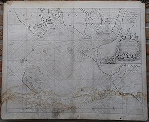
Antique Map-COASTAL MAP-ENGLAND-HARWICH-SEA CHART-Collins-Moll-c.1693
Verkäufer ThePrintsCollector, Zeeland, Niederlande
Verkäuferbewertung 5 von 5 Sternen
AbeBooks-Verkäufer seit 3. April 2017
Verkäufer ThePrintsCollector, Zeeland, Niederlande
Verkäuferbewertung 5 von 5 Sternen
AbeBooks-Verkäufer seit 3. April 2017
Beschreibung
Antique print, titled: 'Harwich Woodbridg and Handfordwater with the Sands from the Nazeland to Hosely Bay.' - A map of the coastal area surrounding Harwich. Dedicatory cartouche (to Samuel Pepys) with scale bar. Description: First published in 1693 in Collins' "Great Britain's Coasting Pilot", the first wholly English marine atlas. These maps were reprinted several times until 1776; we are not sure of the exact edition.Artists and Engravers: Made by 'Herman Moll' after 'Greenville Collins'. Herman Moll (1654-1732) was an English cartographer. Capt. Greenville Collins (1643-1694). Collins, who was made Hydrographer to King Charles II in 1679, was sponsored by Trinity House, the corporation in charge of Britain's lighthouses, buoys and other navigational aids. Engraving, with contemporary hand colouring on hand laid (verge) paper. Anonymous. Good, given age. Original middle fold, as issued. A small hole in the lower margin, and a tear from the lower margin a little into the image (backed and closed with contemporary paper and acid-free archival tape). Closed tears in the top and lower edge of the middle fold, extending into the image. General age-related toning and/or occasional minor defects from handling. Please study scan carefully. The overall size is ca. 59 x 47.5 cm. The image size is ca. 56 x 44 cm. The overall size is ca. 23.2 x 18.7 inch. The image size is ca. 22 x 17.3 inch. Storage location: Overasselt-316. Bestandsnummer des Verkäufers 63182
Bibliografische Details
Titel: Antique Map-COASTAL MAP-ENGLAND-HARWICH-SEA ...
Erscheinungsdatum: 1693
Zustand: Good
Anbieterinformationen
Zahlungsarten
akzeptiert von diesem Verkäufer