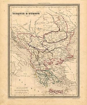
Antique Map-EUROPEAN TURKEY-EUROPE-Vuillemin-1846
Verkäufer ThePrintsCollector, Zeeland, Niederlande
Verkäuferbewertung 5 von 5 Sternen
AbeBooks-Verkäufer seit 3. April 2017
Verkäufer ThePrintsCollector, Zeeland, Niederlande
Verkäuferbewertung 5 von 5 Sternen
AbeBooks-Verkäufer seit 3. April 2017
Beschreibung
Map: 'Turqui D'Europe'. (Map of European Turkey.) We carry slightly different maps from different editions. Please inquire. Original engraving with outline hand colouring. Description: This attractive original old antique print / plate / map originates from: 'Atlas Universal de Geographie Ancienne et Moderne.', published in Paris in 1846.Artists and Engravers: By Alexandre Vuillemin (1812-1880), was a French geographer. Condition: Excellent. General age related toning and occasional light staining from handling as visible on image. Storage location: A166-40 The overall size is ca. 9.4 x 11.4 inch. The image size is ca. 7.7 x 10 inch. The overall size is ca. 24 x 29 cm. The image size is ca. 19.5 x 25.5 cm. Bestandsnummer des Verkäufers 17229
Bibliografische Details
Titel: Antique Map-EUROPEAN TURKEY-EUROPE-Vuillemin...
Anbieterinformationen
Zahlungsarten
akzeptiert von diesem Verkäufer