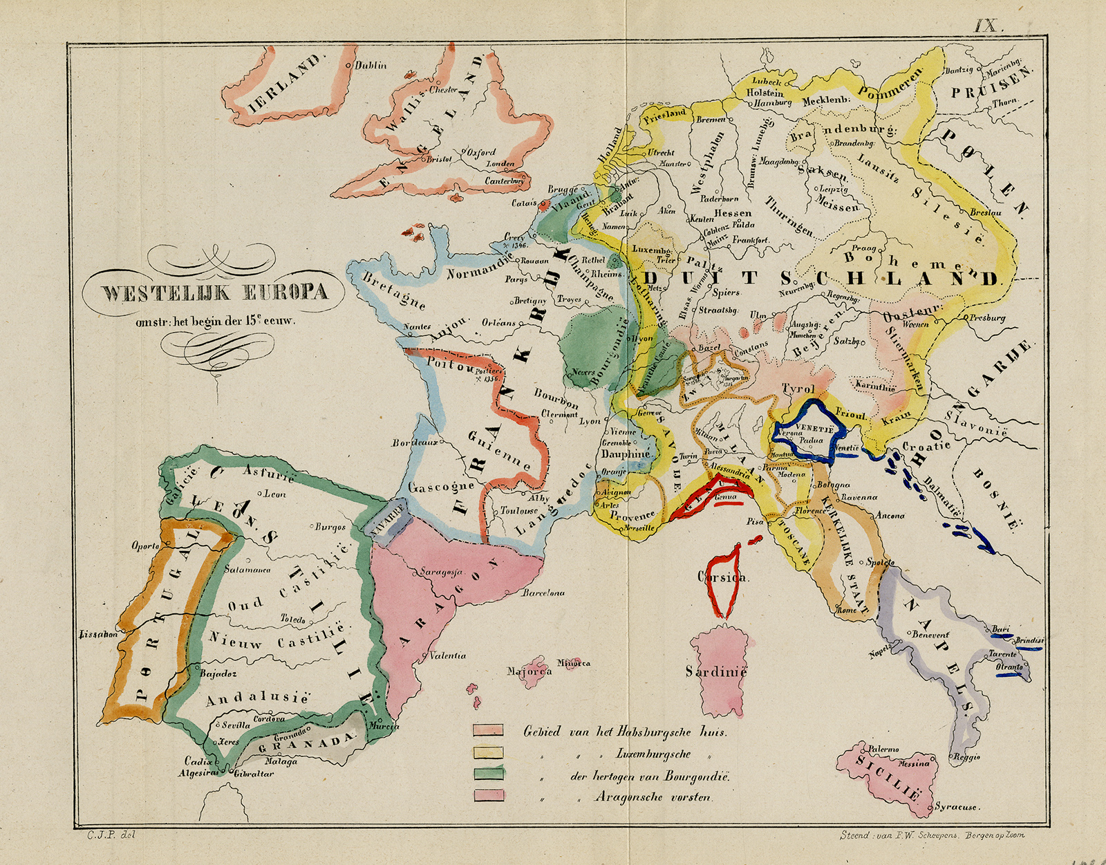
Antique Map-History-View of Europe around 1400 AD-Scheepens-1866
Verkäufer ThePrintsCollector, Zeeland, Niederlande
Verkäuferbewertung 5 von 5 Sternen
AbeBooks-Verkäufer seit 3. April 2017
Verkäufer ThePrintsCollector, Zeeland, Niederlande
Verkäuferbewertung 5 von 5 Sternen
AbeBooks-Verkäufer seit 3. April 2017
Beschreibung
Antique Map, titled: 'Westelijk Europa omstr. het begin der 15e eeuw.' - Map of Europe around 1400. From a historybook printed in Bergen op Zoom by F.W. Scheepens. Map of Europe around 1400. This plate engraved by Monogrammist C.J.P. Lithograph on wove paper. Published by 'F.W. Scheepens'. Good, given age. Small margins, with vertical folds as published. General age-related toning and/or occasional minor defects from handling. Please study scan carefully. The overall size is ca. 25.5 x 18.7 cm. The image size is ca. 25.5 x 18.7 cm. The overall size is ca. 10 x 7.4 inch. The image size is ca. 10 x 7.4 inch. Storage location: C343-44. Bestandsnummer des Verkäufers 74372
Bibliografische Details
Titel: Antique Map-History-View of Europe around ...
Erscheinungsdatum: 1866
Zustand: Good
Anbieterinformationen
Zahlungsarten
akzeptiert von diesem Verkäufer