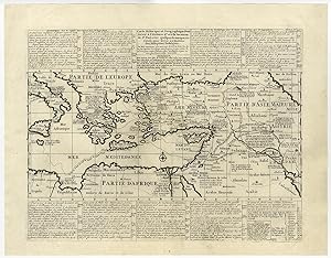
Antique Map-TRAVELS OF ST. PAUL-MIDDLE EAST-MEDITERRANEAN-Chatelain-1732
Verkäufer ThePrintsCollector, Zeeland, Niederlande
Verkäuferbewertung 5 von 5 Sternen
AbeBooks-Verkäufer seit 3. April 2017
Verkäufer ThePrintsCollector, Zeeland, Niederlande
Verkäuferbewertung 5 von 5 Sternen
AbeBooks-Verkäufer seit 3. April 2017
Beschreibung
Antique print, titled: 'Carte Historique et Geographique pour Servir a l'Histoire Saint et a la Vocation de Saint Paul …' - ('Historical map to the Holy history and the calling of Saint Paul'). A historical map of the Mediterranean region and Middle East. It details major trade routes (both on land and over sea). This interesting folio sheet features a detailed map illustrates the travels of St. Paul and several other Biblical travelers throughout the region. The French text provides an historical key to the map. Etching/engraving on hand laid (verge) paper. Description: This print/map originates from: "Atlas Historique." (Historic Atlas.), Published by Zacharie Chatelain, Amsterdam, 1732. Published in seven volumes between 1705 and 1720, (2nd edition in 1732). The maps were accompanied by information on cosmography, geography, history, genealogy, heraldry, and costumes of the world. The maps in the Atlas Historique were mainly based on those of the French cartographer, Guillaume De L'Isle, but were presented by Chatelain in an encyclopaedic form. Artists and Engravers: Made by an anonymous engraver after 'Henri Abraham Chatelain'. Henri Abraham Chatelain (1684-1743), his father Zacharie Chatelain (d.1723) and Zacharie Junior (1690-1754), worked as a partnership publishing the Atlas Historique, Ou Nouvelle Introduction A L'Histoire under several different Chatelain imprints, depending on the Chatelain family partnerships at the time of publication. Condition: Excellent, given age. Original middle fold, as issued. Some faint vertical creasing in the sheet. General age-related toning and/or occasional minor defects from handling. Please study scan carefully. Storage location: (TPCRC) B31-10 The overall size is ca. 20.5 x 16 inch. The image size is ca. 17.6 x 13.6 inch. The overall size is ca. 52 x 40.7 cm. The image size is ca. 44.7 x 34.5 cm. Bestandsnummer des Verkäufers 50551
Bibliografische Details
Titel: Antique Map-TRAVELS OF ST. PAUL-MIDDLE ...
Anbieterinformationen
Zahlungsarten
akzeptiert von diesem Verkäufer