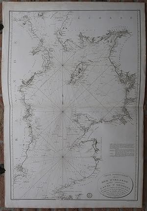
Antique Print-IRISH SEA-IRELAND-ENGLAND-ISLE OF MAN-Depot de la Marine-1798
Verkäufer ThePrintsCollector, Zeeland, Niederlande
Verkäuferbewertung 5 von 5 Sternen
AbeBooks-Verkäufer seit 3. April 2017
Verkäufer ThePrintsCollector, Zeeland, Niederlande
Verkäuferbewertung 5 von 5 Sternen
AbeBooks-Verkäufer seit 3. April 2017
Beschreibung
Antique print, titled: 'Carte Particuliere de la Mer d'Irlande appellee communement Canal St. Georges […].' - A chart of the Irish Sea, St. George's Channel and North Channel, between Ireland and Great Britain. Coastal villages and towns are indicated, depth soundings along the coast and common routes, current directions. This area includes the Isle of Man and Kintyre. This map is based on the map of Joseph Huddart. Description: Published by the Depot General de la Marine in 'An VI', 1797-1798.Artists and Engravers: Made by 'Francois d'Houdan' after an anonymous artist. Francois D'Houdan (1748-1828) was a French geographical engraver. Engraving on hand laid paper. Anonymous. Good, given age. Original middle fold, as issued. Margins foxed and browned. Offsetting (where the map was folded on itself). A few scattered faint or small stains in the image area. General age-related toning and/or occasional minor defects from handling. Please study scan carefully. The overall size is ca. 17.2 x 22 cm. The image size is ca. 16.5 x 21.6 cm. The overall size is ca. 6.8 x 8.7 inch. The image size is ca. 6.5 x 8.5 inch. Storage location: Overasselt-93. Bestandsnummer des Verkäufers 63899
Bibliografische Details
Titel: Antique Print-IRISH SEA-IRELAND-ENGLAND-ISLE...
Erscheinungsdatum: 1798
Zustand: Good
Anbieterinformationen
Zahlungsarten
akzeptiert von diesem Verkäufer