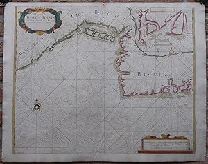
Antique Print-SEA CHART-AFRICA-GULF-GUINEA-BIGHT OF BENIN-Thronton-Lamb-1707
Verkäufer ThePrintsCollector, Zeeland, Niederlande
Verkäuferbewertung 5 von 5 Sternen
AbeBooks-Verkäufer seit 3. April 2017
Verkäufer ThePrintsCollector, Zeeland, Niederlande
Verkäuferbewertung 5 von 5 Sternen
AbeBooks-Verkäufer seit 3. April 2017
Beschreibung
Antique print, titled: 'A Chart of the Bight of Binnin from Ningo Grande to R. Andony.' - A map/chart of the coast of Nigeria to Ghana (Gulf of Guinea). The depicted area spans from the Eastern edge of Nigeria (Calabar), past Benin and Togo to Ghana (Old/New Ningo). This includes the Volta River, Grand-Popo and Lagos. An inset map details the bay around Calabar. The map shows shoals and depth soundings. Description: From "Sea-Atlas, Containing an Hydrographical Description of most of the Sea-Coasts of the Known Parts of the World", published by Seller & Prica, ca. 1707.Artists and Engravers: Made by 'F. Lamb' after 'Samuel Thornton'. Samuel Thornton (d.1715) was the son the English mapmaker John Thornton, an eminent English mapmaker of the late seventeenth and early eighteenth century. After his father's death in 1708, Samuel Thornton continued to re-issue his father s map (often with his imprint substituted). Engraving with handcolouring on hand laid paper. Anonymous. Good, given age. Original middle fold, as issued. Some small damages in the margin edges. Margins faintly soiled and with a few faint stains. The image a little soiled and browned in places. General age-related toning and/or occasional minor defects from handling. Please study scan carefully. The overall size is ca. 36 x 25.5 cm. The image size is ca. 24 x 22 cm. The overall size is ca. 14.2 x 10 inch. The image size is ca. 9.4 x 8.7 inch. Storage location: Overasselt-289. Bestandsnummer des Verkäufers 63713
Bibliografische Details
Titel: Antique Print-SEA ...
Erscheinungsdatum: 1707
Zustand: Good
Anbieterinformationen
Zahlungsarten
akzeptiert von diesem Verkäufer