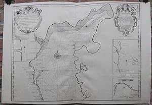
Antique Print-SEA CHART-ASTRAKHAN-CASPIAN SEA-RUSSIA-De l'Isle-c. 1720
Verkäufer ThePrintsCollector, Zeeland, Niederlande
Verkäuferbewertung 5 von 5 Sternen
AbeBooks-Verkäufer seit 3. April 2017
Verkäufer ThePrintsCollector, Zeeland, Niederlande
Verkäuferbewertung 5 von 5 Sternen
AbeBooks-Verkäufer seit 3. April 2017
Beschreibung
Antique print, titled: 'Carte Marine de la Mer Caspiene.' - A map of the Northern half of the Caspain Sea, from Derbent to Astrakhan, and the Ural river in the Northeast. The Wolga delta is identified. With three inset meaps of islands and coastal details. Description: This map was published in Amsterdam by Covens & Mortier, based on the map originally made by Carl Vanverden.Artists and Engravers: Made by an anonymous engraver after 'Guillaume De L'Isle'. The de L'Isle family was one of the most influential Geographers of the early 18th century in France. Claude de L'Isle, born 1644, had four sons, of which Guillaume was the most notable. Guillaume was born 1675 and became member of the "Academie Royale des Sciences" with the age of twenty-seven, and was honoured later with the title "Premier Geographe du Roi". His largest project, the "Atlas de Geographie", was published until 1774 in Paris and Amsterdam (Covens and Mortier). He died in 1726. Engraving on hand laid paper. Anonymous. Good, given age. Original middle fold, as issued. Sheet overall faintly browned. Two wormholes and a sharp crease in the right margin, not affecting image. General age-related toning and/or occasional minor defects from handling. Please study scan carefully. The overall size is ca. 74.2 x 53.5 cm. The image size is ca. 67.1 x 48.6 cm. The overall size is ca. 29.2 x 21.1 inch. The image size is ca. 26.4 x 19.1 inch. Storage location: Overasselt-107. Bestandsnummer des Verkäufers 63718
Bibliografische Details
Titel: Antique Print-SEA CHART-ASTRAKHAN-CASPIAN ...
Erscheinungsdatum: 1720
Zustand: Good
Anbieterinformationen
Zahlungsarten
akzeptiert von diesem Verkäufer