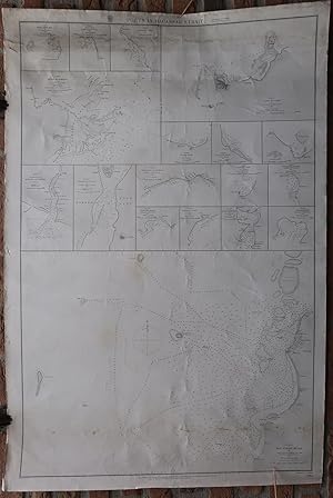
Antique Print-SEA CHART-INDONESIA-CELEBES-MAKASSAR-Belcher-Walker-1869
Verkäufer ThePrintsCollector, Zeeland, Niederlande
Verkäuferbewertung 5 von 5 Sternen
AbeBooks-Verkäufer seit 3. April 2017
Verkäufer ThePrintsCollector, Zeeland, Niederlande
Verkäuferbewertung 5 von 5 Sternen
AbeBooks-Verkäufer seit 3. April 2017
Beschreibung
Antique print, titled: 'Celebes - Macassar Road […] - Ports in Macassar Strait.' - A chart of the coast of Celebes, one of the islands of the Indonesian archipelago. The top half of the sheet shows several (17) inset maps of harbours and bays in the area. Corrected edition of 1869, published by the Admiralty. These type of charts are scarse as they were actually used at sea for navigation. Engraving on wove paper. Watermark: Kent Made by 'J. & C. Walker' after 'Captain Sir Edward Belcher'. Good, given age. Top margin browned and top edge of the image soiled. A few small nicks in the margin edges (not affecting image). Some small creases and faint stains in the image area. Dampstains in the lower image edge. General age-related toning and/or occasional minor defects from handling. Please study scan carefully. The overall size is ca. 68.8 x 102 cm. The image size is ca. 63.4 x 97 cm. The overall size is ca. 27.1 x 40.2 inch. The image size is ca. 25 x 38.2 inch. Storage location: Overasselt-412. Bestandsnummer des Verkäufers 64617
Bibliografische Details
Titel: Antique Print-SEA ...
Erscheinungsdatum: 1869
Zustand: Good
Anbieterinformationen
Zahlungsarten
akzeptiert von diesem Verkäufer