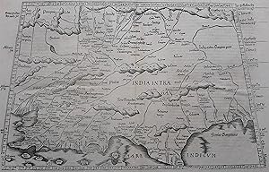
Asiae Tabula decima continet Indiam intra Gangem.
Claudius Ptolemy
Verkäufer Antiquariaat Dat Narrenschip, Middelburg, Niederlande
Verkäuferbewertung 5 von 5 Sternen
AbeBooks-Verkäufer seit 9. August 2021
Verkäufer Antiquariaat Dat Narrenschip, Middelburg, Niederlande
Verkäuferbewertung 5 von 5 Sternen
AbeBooks-Verkäufer seit 9. August 2021
Beschreibung
Trapezoidal map of the region in Asia that largely corresponds to present-day India. This map by Laurent Fries is based on Claudius Ptolemy (87-150), the famous geographer from Antiquity. Woodcut, published in Vienne in 1541 by Gaspar Trechsel in "Claudii Ptolemaei Alexandrini Geographicae Enarrationis, Libri Octo, (.)." Dimensions (picture): 30 x 48. Bestandsnummer des Verkäufers ABE-1631808275322
Bibliografische Details
Titel: Asiae Tabula decima continet Indiam intra ...
Verlag: Gaspar Trechsel
Erscheinungsdatum: 1541
Einband: No Binding
Zustand: Near Fine
Anbieterinformationen
The items offered are exclusively authentic, original engravings, etchings, lithographs or woodcuts, produced and/or published by the indicated cartographers and/or publishers, in or about (approx.) the indicated year.
After payment, the order will be sent by registered mail within two working days. An invoice or packing slip is included in the shipment. Our items are shipped either flat (between a few layers of cardboard) or in a solid tube.
Zahlungsarten
akzeptiert von diesem Verkäufer