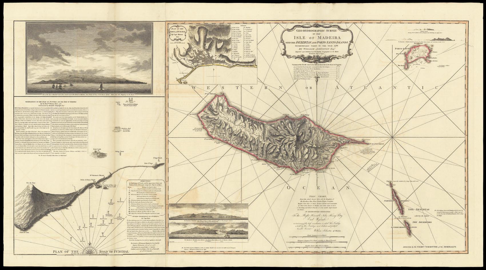
Geo-Hydrographic Survey of the Isle of Madeira with the Dezertas and Porto Santo Islands geometrically taken in the year 1788. By William Johnston Esq[ui]r[e]. This Chart drawn from actual Surveys taken with the Permission of His Excellency Don Diego Perreira Forjas Coutinho, Knight of the Order of Christ, Governor General and Commander in Chief of the Island of Madeira and Porto Santo &c. &c. &c. a discerning and liberal Promoter of every useful improvement in Science. Is respectfully dedicated To the Right Honourable John Henry Petty Earl Wycombe in testimony of the high consideration in which His Lordship is held by His Lordship's most humble and faithful humble Servant William Johnston of Madeira.
JOHNSTON, William
Verlag: Digested and Published by W. Faden, Geographer to the King, Jan[uar]y 1st, 1791., London, 1791
Karte
Verk�ufer Daniel Crouch Rare Books Ltd, London, Vereinigtes K�nigreich
Verk�uferbewertung 4 von 5 Sternen
![]()
AbeBooks-Verk�ufer seit 7. November 2011