

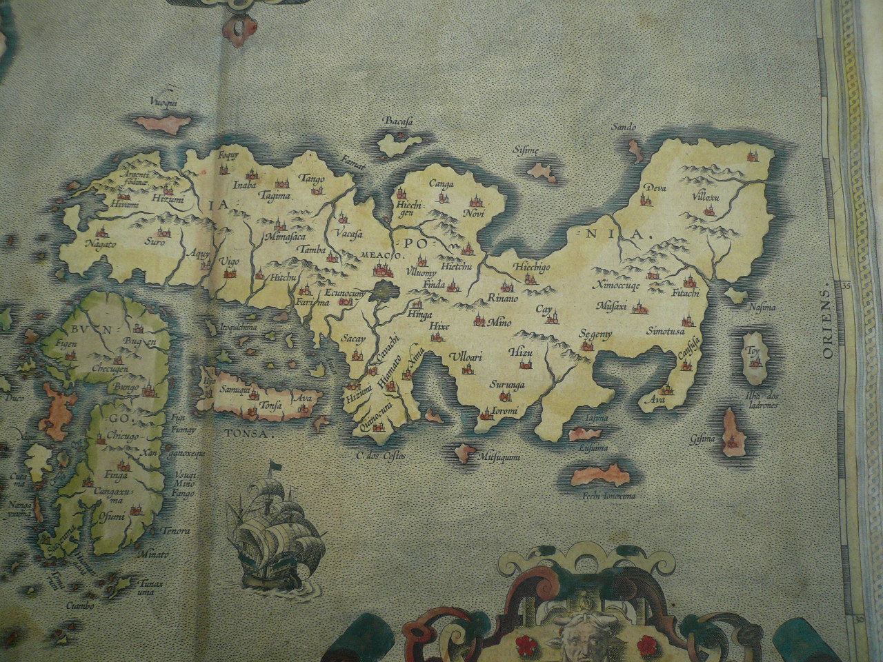
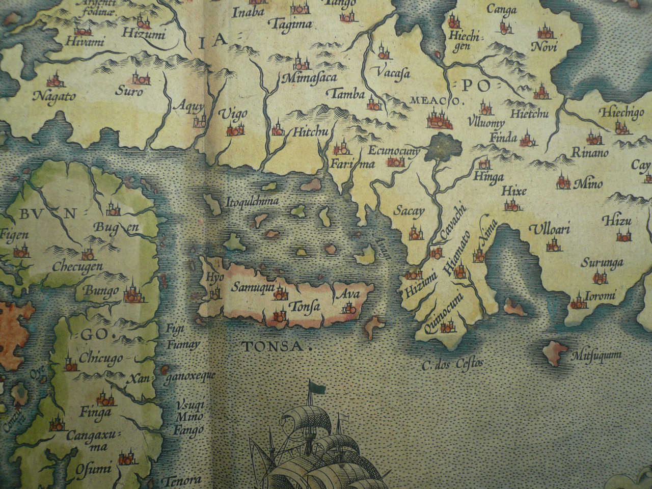
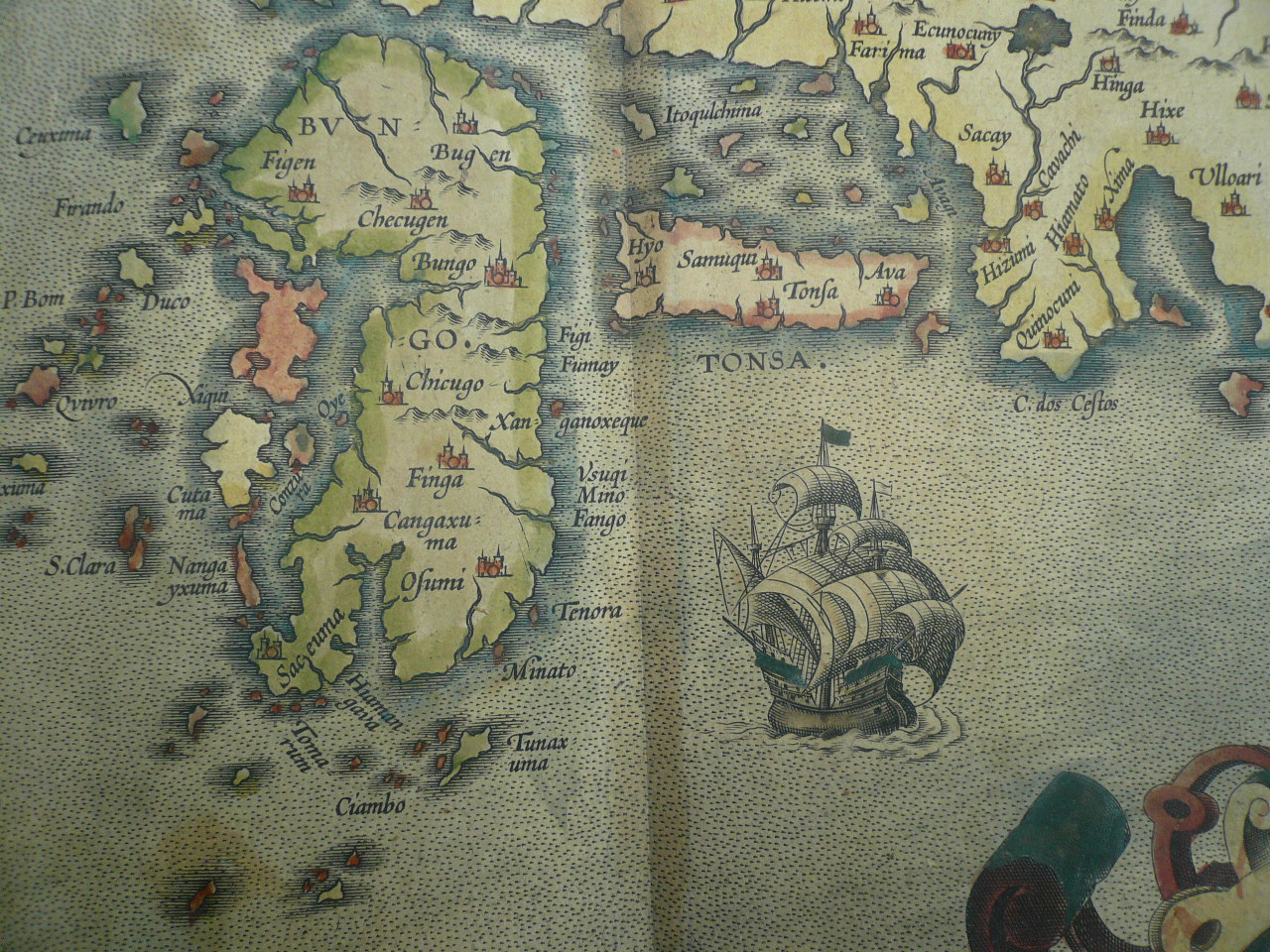
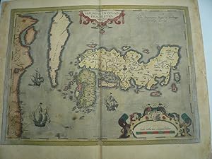
Iaponiae Insulae, map, anno 1603, Ortelius, contemporary full co Coppermap, edited by Abraham Ortelius, in Theatrum Orbis Terrarum, latin edition, anno 1603, full coloured, little brownish on margins, some old restorations on margins. Plate size: 358 x 465 mm. Reference: vdB Nr. 165: "Luis Teixeira, a Portuguese cartographer, sent Ortelius in 1592 two maps of China and Japan (Hessels letter 210) which are based on unknown sources (Meurer p. 253 - 254). Although as early as 1617 the more accurate map of Japan by Blancus appeared, this map retained influence until more than 50 years after another milestone map of Japan appeared, the Martini map of 1655". Since the middle ages Japan was depicted as Chipangu or Zipangu. The Portuguese reache
Ortelius Abraham
Erscheinungsdatum: 1603
Karte
Zustand: Befriedigend
Verk�ufer Hammelburger Antiquariat, Hammelburg, Deutschland
Verk�uferbewertung 4 von 5 Sternen
![]()
AbeBooks-Verk�ufer seit 22. September 2015