Beschreibung
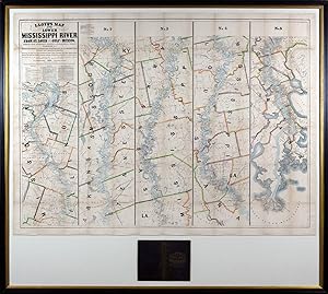
Second edition. Lithograph on five sheets (39 1/2" x 53 1/2"sheet, 52 1/2" x 58 1/2" framed). Repairs to tears, and losses at the folds and margins. A ca. 1" loss to the upper-right. Some tanning to the folds. Not examined out of frame. Presented with the publisher's black blocked cloth gilt binding. Not examined out of frame. This rare pocket edition following the Mississippi River from its mouth to St. Louis was first published in 1862. This second edition includes events from the ongoing war: "Destroyed by Gun Boats June 1862" (Warrenton); "Shelled by Gun Boats May 18, 1862" (Grand Gulf); Confederate batteries at Walnut Hill and Vicksburg; and "Johnsons [sic.] killed 1862" (near Warrenton). Perhaps most notable is the addition of "Grants Vicksburg Cut-Off," referring to General Grant's failed attempt to widen the Williams Canal across the De Soto Peninsula in an effort to circumvent the Walnut Hills and Vicksburg batteries guarding the river. Although the project was abandoned in March of 1863, the river would accomplish the task on its own by 1876. Other notable changes include the elimination of a warrant statement, the inclusion of a legend, and a statement about a dubious publisher of "spurious Lloyd's maps" that are "engraved coarsely" and "very erroneous." The map is divided into 5 numbered strips, beginning with St. Louis at top left and ending with the Gulf of Mexico at bottom right. There is extensive detail of waterways, county and parish lines, roads and railroads, mines, forts, and towns of various sizes. Perhaps most importantly, however, are the names of landowners and the locations of their lots along the Mississippi River that are identified. Incidentally, the William Bowen who is credited in the title with helping revise the Lloyd map, was a childhood friend of Samuel Clemens (alias Mark Twain). It is no surprise then that Clemens, who piloted a steamboat on the Mississippi River from 1857 to 1861, and whose memoir, Life on the Mississippi, details these years, was familiar with Lloyd's map. Moreover, according to a 2010 exhibit on his novel Adventures of Huckleberry Finn at the CCA Wattis Institute for Contemporary Art in San Francisco, Clemens used this very map as one of his sources for the book. The map was available in three formats: a pocket edition (the present example), a sheet map, and a wall map on rollers. There was also an 1875 edition of the map in a long, single strip. Modelski (Railroad Maps of US) #139; Phillips, America, p. 441; Rumsey #4472; Stephenson (Civil War) #41. Bestandsnummer des Verkäufers KMP0007
Verkäufer kontaktieren
Diesen Artikel melden
![]()
