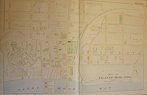
PART OF ATLANTIC HIGHLANDS NJ MAP. FROM WOLVERTON'S ATLAS OF MONMOUTH COUNTY
WOLVERTON, Chester
Verkäufer Antic Hay Books, Asbury Park, NJ, USA
Verkäuferbewertung 4 von 5 Sternen
AbeBooks-Verkäufer seit 5. Juni 1997
Verkäufer Antic Hay Books, Asbury Park, NJ, USA
Verkäuferbewertung 4 von 5 Sternen
AbeBooks-Verkäufer seit 5. Juni 1997
Beschreibung
Very Good. An original 30-inch by 22-inch linen-backed color map published in 1889. Map depicts Part of Atlantic Highlands, from the circular Prospect Park to Avenue D, and from Sandy Hook Bay to Garfield Avenue. Depicts types of structures erected at the time. The original map (Plate 3), not a reproduction! Wolverton maps are among the best you can get of Monmouth County. Bestandsnummer des Verkäufers 56905
Bibliografische Details
Titel: PART OF ATLANTIC HIGHLANDS NJ MAP. FROM ...
Verlag: Chester Wolverton, NY
Erscheinungsdatum: 1889
Anbieterinformationen
Payment: Checks or Paypal- all accepted.
Postage by United States Postal Service
--USA: USPS Media mail: $4.75; Priority Mail $15.00
--Canada: First Class: $22.00; Priority Mail: $40.00
--Other Countries: First Class: $32.00; Priority Mail: $60.00
Special charged may apply for large, heavy, or insured items. Some items may be mailed cheaper if able to ship in Flat Rate Envelope
Shipping costs are based on books weighing 2.2 LB, or 1 KG. If your book order is heavy or oversized, we may contact you to let you know extra shipping is required.
Zahlungsarten
akzeptiert von diesem Verkäufer