
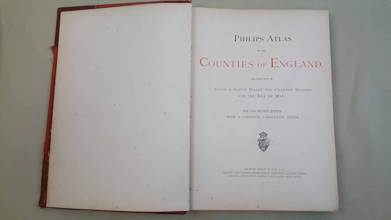
Philips' Atlas of the Counties of England, including Maps of North & South Wales, The Channel Islands and the Isle of Man
Philip, George
Verlag: Published by George Philip & Son Ltd. no date givenapproximately 1868, London & Liverpool, 1868
Gebraucht
Hardcover
Verk�ufer
Keoghs Books, Skipton, Vereinigtes K�nigreich
Verk�uferbewertung 5 von 5 Sternen
![]()
Heritage Bookseller
AbeBooks-Mitglied seit 1996
Verbandsmitglied:
Dieses Exemplar ist nicht mehr verf�gbar. Hier sind die �hnlichsten Treffer f�r Philips' Atlas of the Counties of England, including Maps of North & South Wales, The Channel Islands and the Isle of Man von Philip, George.
Beschreibung
Beschreibung:
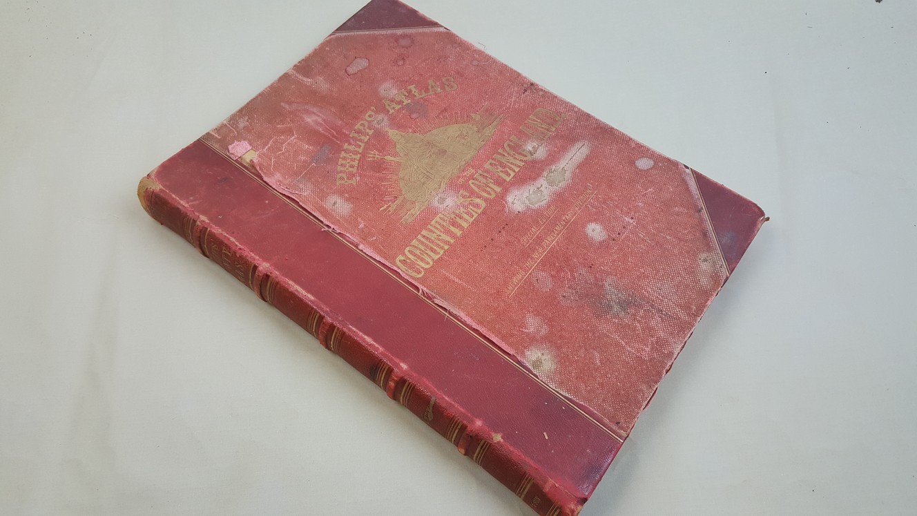
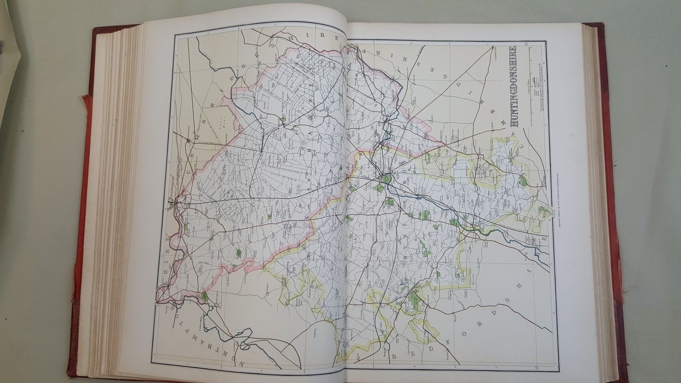
, 49 double page guard mounted lithographed colour maps ( 49 x 37.5 cm ) including a map of the whole of England and Wales, 106 pages of indices New And Revised Edition - A Special Edition Shewing the New Parlliamentary Divisions , corners scuffed, cloth faded and stained, lifting at edge on front cover, edges to spine rubbed, a few map pages show faint marks at margins, Channel Isles have one inch tears at inner margins and some ink marks at margins, otherwise the maps are in fine condition within a somewhat shabby but solid binding , half red leather with red cloth to sides, gilt title and Britannia to front, five raised bands with gilt title and rulings to spine, all edges gilt Folio (over 12 - 15 inches tall) Hardback ISBN: Bestandsnummer des Verk�ufers 24672
Bibliografische Details
Titel: Philips' Atlas of the Counties of England, ...
Verlag: Published by George Philip & Son Ltd. no date givenapproximately 1868, London & Liverpool
Erscheinungsdatum: 1868
Einband: Hardcover
Beste Suchergebnisse bei AbeBooks

Foto des Verk�ufers
Philips' Handy Atlas Of The Counties Of England: Including Maps Of North & South Wales, The Channel Islands, And The Isle Of Man: Reduced From The Ord (Paperback or Softback)
Verlag:
Legare Street Press 10/27/2022, 2022
ISBN 10: 1017782482
ISBN 13: 9781017782486
Neu
Paperback or Softback
Anbieter: BargainBookStores, Grand Rapids, MI, USA
Verk�uferbewertung 5 von 5 Sternen
![]()
Paperback or Softback. Zustand: New. Philips' Handy Atlas Of The Counties Of England: Including Maps Of North & South Wales, The Channel Islands, And The Isle Of Man: Reduced From The Ord. Book. Bestandsnummer des Verk�ufers BBS-9781017782486
Beispielbild f�r diese ISBN
Philips' Handy Atlas Of The Counties Of England: Including Maps Of North & South Wales, The Channel Islands, And The Isle Of Man: Reduced From The Ordnance Survey, And Coloured To Shew The New Parliamentary Divisions, According To The Redistribution
Verlag:
Legare Street Press, 2022
ISBN 10: 1017782482
ISBN 13: 9781017782486
Neu
Paperback / softback
Anbieter: THE SAINT BOOKSTORE, Southport, Vereinigtes K�nigreich
Verk�uferbewertung 5 von 5 Sternen
![]()
Paperback / softback. Zustand: New. This item is printed on demand. New copy - Usually dispatched within 5-9 working days. Bestandsnummer des Verk�ufers C9781017782486
Neu kaufen
EUR 24,44
EUR 14,08 Versand
Versand von Vereinigtes K�nigreich nach USA
Versand von Vereinigtes K�nigreich nach USA
Anzahl: Mehr als 20 verf�gbar
Foto des Verk�ufers
Philips' Handy Atlas Of The Counties Of England: Including Maps Of North & South Wales, The Channel Islands, And The Isle Of Man: Reduced From The Ord
Verlag:
Creative Media Partners, LLC Okt 2022, 2022
ISBN 10: 1017782482
ISBN 13: 9781017782486
Neu
Taschenbuch
Anbieter: AHA-BUCH GmbH, Einbeck, Deutschland
Verk�uferbewertung 5 von 5 Sternen
![]()
Taschenbuch. Zustand: Neu. Neuware. Bestandsnummer des Verk�ufers 9781017782486
Neu kaufen
EUR 32,85
EUR 61,70 Versand
Versand von Deutschland nach USA
Versand von Deutschland nach USA
Anzahl: 2 verf�gbar
Beispielbild f�r diese ISBN
Philips' Handy Atlas Of The Counties Of England: Including Maps Of North & South Wales, The Channel Islands, And The Isle Of Man: Reduced From The Ordnance Survey, And Coloured To Shew The New Parliamentary Divisions, According To The Redistribution
Print-on-DemandAnbieter: THE SAINT BOOKSTORE, Southport, Vereinigtes K�nigreich
Verk�uferbewertung 5 von 5 Sternen
![]()
Hardback. Zustand: New. This item is printed on demand. New copy - Usually dispatched within 5-9 working days. Bestandsnummer des Verk�ufers C9781017777512
Neu kaufen
EUR 36,94
EUR 14,08 Versand
Versand von Vereinigtes K�nigreich nach USA
Versand von Vereinigtes K�nigreich nach USA
Anzahl: Mehr als 20 verf�gbar
Foto des Verk�ufers
Philip's [Philips] handy atlas of the counties of England, including maps of the county of London, North and South Wales, the Channel Islands, the Isle of Man, and plans on an enlarged scale of the environs of six important towns. New and enlarged edition, shewing every railway station in England and Wales. With consulting index.
Verlag:
Philip & Son, London c. 1890., 1890
Gebraucht
Hardcover
Anbieter: Antiquariat An der Vikarie, Grafschaft-Leimersdorf, Deutschland
Verk�uferbewertung 5 von 5 Sternen
![]()
4, 48 colored maps (complete), 58 pp. Index, ex-library copy with label on spine and stamps, binding minimally loosened, index pages slightly creased, else good and clean, text in English, Sprache: Englisch Gewicht in Gramm: 560 c. 13 x 18,5 cm, library hardcover (no dustjacket), Bestandsnummer des Verk�ufers 20419
Gebraucht kaufen
EUR 84,00
EUR 42,00 Versand
Versand von Deutschland nach USA
Versand von Deutschland nach USA
Anzahl: 1 verf�gbar

PHILIPS' ATLAS OF THE COUNTIES OF ENGLAND, INCLUDING MAPS OF NORTH & SOUTH WALES, THE CHANNEL ISLANDS, AND THE ISLE OF MAN.
Verlag:
London ;- George Philip and Son. N.D. Circa., 1885
Gebraucht
Hardcover
Anbieter: HALEWOOD AND SONS ABA ILAB Est. 1867., PRESTON, Vereinigtes K�nigreich
Verk�uferbewertung 4 von 5 Sternen
![]()
New and Revised Edition with a complete consulting index. 48 STRIKING DOUBLE-PAGE COLOUR MAPS IN EXCELLENT STATE. Small Folio. Nice original half maroon morocco. (a little rubbed) Marbled endpapers. A.e.gilt. (Free-endpapers a little soiled.). Bestandsnummer des Verk�ufers 614
Gebraucht kaufen
EUR 376,97
EUR 13,84 Versand
Versand von Vereinigtes K�nigreich nach USA
Versand von Vereinigtes K�nigreich nach USA
Anzahl: 1 verf�gbar