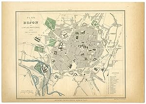
Antique Print-DIJON-PLAN-CITY-FRANCE-Brugere-Trousset-1877
Verkäufer ThePrintsCollector, Zeeland, Niederlande
Verkäuferbewertung 5 von 5 Sternen
AbeBooks-Verkäufer seit 3. April 2017
Verkäufer ThePrintsCollector, Zeeland, Niederlande
Verkäuferbewertung 5 von 5 Sternen
AbeBooks-Verkäufer seit 3. April 2017
Beschreibung
Antique print, titled: 'Plan de Dijon.' - A map of the city Dijon in France, with a keyed legend. Handcoloured lithograph on wove paper. Description: "Atlas National contenant La Geographie de la France et de ses colonies", by F. de La Brugere and Jules Trousset. Published in Paris by Artheme Fayard, 1877.Artists and Engravers: Made by 'L. Sonnet & R. Hausermann' after an anonymous artist. Condition: Very good, given age. Faintly browned right and lower margin edges. Tiny stains in the top right margin. Faint offsetting from letterpress on the opposite page. General age-related toning and/or occasional minor defects from handling. Please study scan carefully. Storage location: LJC-A11-31 The overall size is ca. 12.1 x 9.1 inch. The image size is ca. 9.4 x 7.5 inch. The overall size is ca. 30.8 x 23 cm. The image size is ca. 24 x 19 cm. Bestandsnummer des Verkäufers 52625
Bibliografische Details
Titel: Antique ...
Anbieterinformationen
Zahlungsarten
akzeptiert von diesem Verkäufer