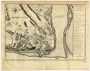
Antique Print-PLAN-QUEBEC-CANADA-Bellin-Schwabe-1758
Verkäufer ThePrintsCollector, Zeeland, Niederlande
Verkäuferbewertung 5 von 5 Sternen
AbeBooks-Verkäufer seit 3. April 2017
Verkäufer ThePrintsCollector, Zeeland, Niederlande
Verkäuferbewertung 5 von 5 Sternen
AbeBooks-Verkäufer seit 3. April 2017
Beschreibung
Antique print, titled: 'Grundriss der Stadt Quebec.' - Plan of the city of Quebec. It shows old fortifications and a city wall. Etching / engraving on hand laid paper. Watermark: Text Description: From: 'Allgemeine Historie der Reisen zu Wasser und Lande; oder Sammlung aller Reisebeschreibungen […]', volume 16, by Johann Joachim Schwabe, published in Leipzig by Arkstee und Merkus, 1758. This series was published 1747-1774 in 21 volumes. It is essentially an enlarged German ed. based on and translated from 'New general collection of voyages and travels [.] (4 volumes, 1745 1747), by Thomas Astley and 'Histoire Generale des voyages [.] (20 volumes, 1746 1791), by Abbe Prevost.Artists and Engravers: Made by an anonymous engraver after 'Jacques Nicolas Bellin'. Jacques-Nicolas Bellin (1703-1772) was a French hydrographer, geographer and member of The Philosophes. His career, spanning over 50 years, caused an enormous output in maps, particular of maritime interest. Author: Johann Joachim Schwabe (1714 -1784) was a German academic, poet and translator. Condition: Very good, given age. Original folds as issued. General age-related toning and/or occasional minor defects from handling. Please study scan carefully. Storage location: C143-45 The overall size is ca. 12 x 9.5 inch. The image size is ca. 10.9 x 7.7 inch. The overall size is ca. 30.6 x 24.2 cm. The image size is ca. 27.8 x 19.5 cm. Bestandsnummer des Verkäufers 60069
Bibliografische Details
Titel: Antique ...
Anbieterinformationen
Zahlungsarten
akzeptiert von diesem Verkäufer