Beschreibung
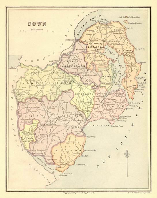
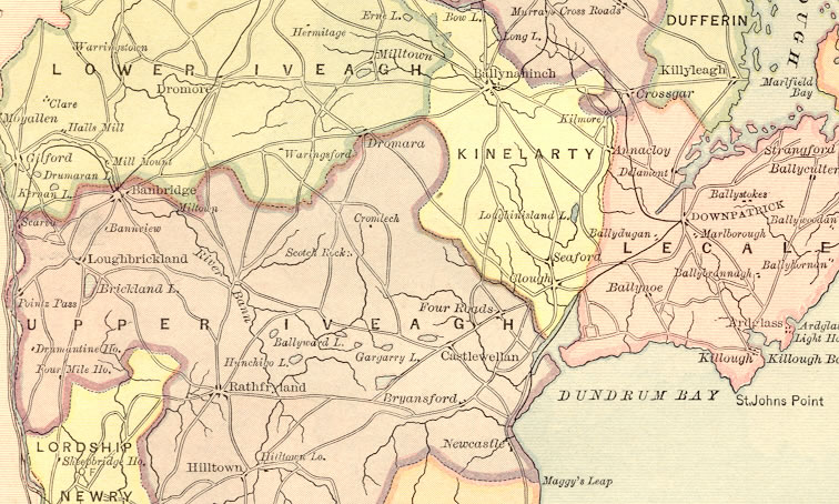
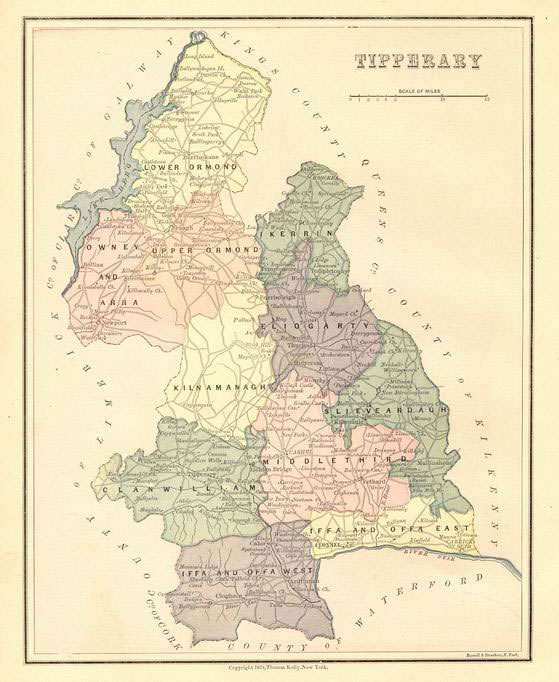
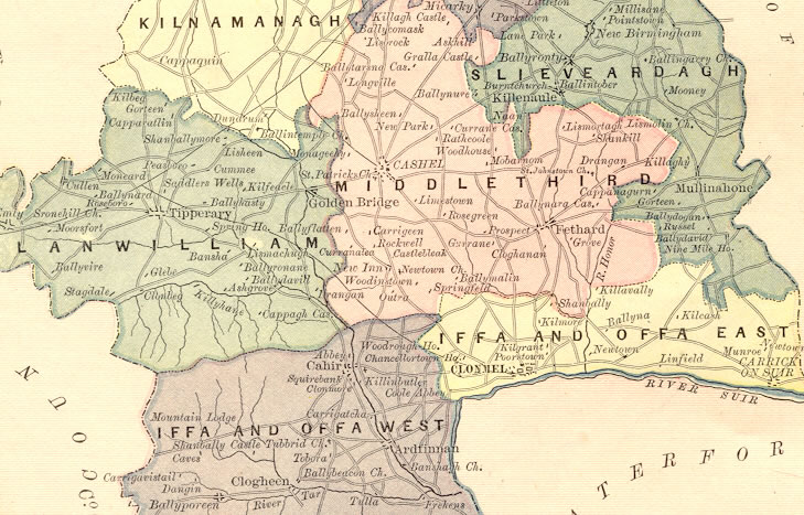
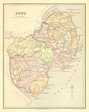
1878/1880 Color Engraved Maps - 2 Coloured Maps - Double Sided TIPPERARY on one side DOWN on reverse side CLOSE-UP OF TIPPERARY and DOWN MAP BELOW 2 Engraved Maps of Ireland Counties - TIPPERARY on one side DOWN on reverse side Published by Thomas Kelly, New York, 1878 & 1880 - Dates appear at bottom of the maps. United Kingdom Geography: Tipperary county, S central Republic of Ireland. The county seat is Tipperary . Administratively, the county is divided into North Riding (its administrative center at Nenagh ) and South Riding (its administrative center at Clonmel ). The region is part of the central plain of Ireland, but the terrain is diversified by several mountain ranges: the Knockmealdown, the Galtee, the Arra, and the Silvermine. The southern portion of the county is drained by the Suir River; the northern by tributaries of the Shannon , which widens into Lough Derg on the northern border. There is much fertile land, especially in the region known as the Golden Vale, one of the richest agricultural areas in Ireland. Dairy farming and cattle raising are the principal occupations. Other industries are slate quarrying and the manufacture of meal and flour. The county was long under the domination of the powerful Butler family (the earls of Ormonde). Antiquarian remains are found in Tipperary, particularly in the vicinity of Cashel . - County Down is one of the six counties of Northern Ireland; A division of the United Kingdom located on the northern part of the island of Ireland Northern Ireland. The Clanrye and Lagan rivers flow through the county. An area of County Down is known as Bront� Country, after Patrick Bront� (originally Prunty). Some of the counties named on the maps are Upper & Lower Iveagh, Kinelarty, Upper & Lower Castlereagh, Iffa and Offa West & East, Upper and Lower Ormond, Eliogarty A great item for the genealogy buff! Old maps can be a great help in tracing your family lineage. Approximate Overall Size: 8 1/4 X 10 1/2 inches CONDITION: There is some offsetting on the sligo map (shadowing from a previous page), otherwise Map Image is clear and sharp with beautiful detail and in Very Good Condition. NOTE THE FOLLOWING BEFORE YOU PURCHASE: This is a GENUINE ANTIQUE MAP PRINT. It is NOT a modern reproduction, ie. a laser scan, photocopy etc. It is the original from the antique atlas or book publication. This map was published on the date mentioned, or circa of the date mentioned at the top of the page. The map print I have for sale, like many antique maps and prints that you see online, originate from an antique book or atlas publication. The publication may not always be known. If you have any questions, emails are welcome.
Bestandsnummer des Verk�ufers 10610
Verk�ufer kontaktieren
Diesen Artikel melden