Great Britain Road Atlas 2018 - Softcover
Zu dieser ISBN ist aktuell kein Angebot verf�gbar.
Alle Exemplare der Ausgabe mit dieser ISBN anzeigen:
Rese�a del editor:
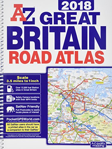
This A-Z map of Great Britain is a full colour, spiral bound road atlas of approximately A4 size. Fully updated for 2018, 170 pages of clear detailed road mapping at a mainland map scale of 3.5 miles to 1 inch, 11 pages of main route mapping covering Greater London, Birmingham and Manchester, Route planning maps, Mileage chart with average journey times, Information on motorway junctions with limited interchanges, 80 city and town centre street plans, 16 port and airport plans, Channel Tunnel terminus maps, Index to cities, towns, villages, hamlets and major destinations and an Index to selected places of interest with postcodes for satnav use, Map reference information also in French and German. Instantly recognizable and easy to use, A-Z road mapping includes the following features:, Clear standard road classification colours for easy identification, Full motorway junction detail, Under construction and proposed roads, Primary route destinations, Service areas, Hill shading sourced from Geo-Innovations� www.geoinnovations.co.uk, Selected safety camera locations with maximum speed limits sourced from PocketGPSWorld.com, Selected fuel stations, Selected truckstop locations, National and county boundaries and a wide range of tourist and ancillary information, including Blue Flag Beaches. A medium sized publication with a spiral binding; a popular choice for those wanting superb map clarity in an easy to keep open publication.
��ber diesen Titel� kann sich auf eine andere Ausgabe dieses Titels beziehen.
- VerlagGeographers' A-Z Map Co Ltd
- Erscheinungsdatum2017
- ISBN 10 1782571868
- ISBN 13 9781782571865
- EinbandEncuadernaci�n en espiral
- Anzahl der Seiten280
Gebraucht kaufen
Zustand: BefriedigendAll orders are dispatched the following... Mehr zu diesem Angebot erfahren

EUR 20,05
Versand:
EUR 7,01
Von Vereinigtes K�nigreich nach USA
Beste Suchergebnisse bei AbeBooks
Beispielbild f�r diese ISBN
Great Britain Road Atlas 2018
Verlag:
Geographers' A-Z Map Co Ltd
(2017)
ISBN 10: 1782571868
ISBN 13: 9781782571865
Gebraucht
Spiral-bound
Anzahl: 1
Anbieter:
Bewertung
Buchbeschreibung Spiral-bound. Zustand: Good. All orders are dispatched the following working day from our UK warehouse. Established in 2004, we have over 500,000 books in stock. No quibble refund if not completely satisfied. Bestandsnummer des Verk�ufers mon0003953222
Weitere Informationen zu diesem Verk�ufer | Verk�ufer kontaktieren
Gebraucht kaufen
EUR 20,05
W�hrung umrechnen