Norwich (NW) 1905: Norfolk Sheet 63.10 (Old O.S. Maps of Norfolk)
Zu dieser ISBN ist aktuell kein Angebot verf�gbar.
Alle Exemplare der Ausgabe mit dieser ISBN anzeigen:
- VerlagAlan Godfrey Maps
- Erscheinungsdatum2004
- ISBN 10 1841517070
- ISBN 13 9781841517070
- EinbandMapa
Neu kaufen
Mehr zu diesem Angebot erfahren
EUR 3,29
Versand:
EUR 35,41
Von Vereinigtes K�nigreich nach USA
Beste Suchergebnisse bei AbeBooks
Beispielbild f�r diese ISBN
Norwich (NW) 1905: Norfolk Sheet 63.10 (Old O.S. Maps of Norfolk)
Anbieter:
Bewertung
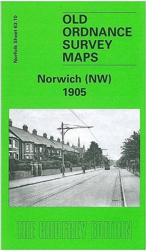
Buchbeschreibung No Binding. Zustand: New. No Jacket. Here are the details of maps for Norwich: Norfolk Sheet 63.10 Norwich (NW) 1905 - published 2004; intro by Robert Malster. ISBN.978-1-84151-707-0 Norfolk Sheet 63.11 Norwich (North) 1905 - published 1999; intro by Robert Malster. ISBN.978-1-84151-094-1 Norfolk Sheet 63.15 Norwich (South) 1905 - published 1999; intro by Robert Malster. ISBN.978-1-84151-095-8 We have published a set of three maps for Norwich, covering the town in detail. The maps link up with each other; here are brief details of each: Norwich (NW) is centred on the Dereham Road area, with suburbs stretching west from the city. Coverage stretches from Gladstone St and Adelaide St westward one and a half miles to Earlham Grove and open country; and from Earlham Road northward to the River Wensum and the Midland & Great Northern Joint Railway. Features include the cemetery, Workhouse, isolation hospital, tramways along Earlham Road and Dereham Road, Northumberland St, Armes St. On the back are street directories for Adelaide Street, Alexandra Road, Armes Street, Connaught Road, Dereham Road, Earlham Road, Havelock Road, Nelson Street, St Philips Road, Sandringham Road, West End Street. Norwich (North covers a very busy area, stretching from Heigham Road and Palace Road eastward to Gas Hill and Thorpe Hamlet, and from Eade Road and Branford Road southward to the Market Place. The many features include the Cathedral, City station, site of Castle, River Wensum, tramways, St Giles church, Pottergate Street and much of the city centre. On the reverse are street directory entries for Botolph Street, Duke Street, Elm Hill, Grapes Hill, London Street, Magdalen Street, Oak Street, Pitt Street, Pottergate Street, Princes Street, Quayside, St Andrew Street. Norwich (South) continues coverage southward to Cecil Road and features on this include Thorpe station, engine works, Victoria station, Carrow Works, Chapelfield Gardens, Norfolk & Norwich Hospital, tramways, Ber Street, Queens Road, St Peter's church, St Stephen's church, cattle market, New Lakenham, Peafield, Mancroft Ward, King St Old Brewery, Carrow Abbey. On the reverse are street directory entries for All Saints Green, Ber Street, Bethel Street, Bracondale, Essex Street, Grove Road, King Street, Queen's Road, Surrey Street. Bestandsnummer des Verk�ufers 001238
Weitere Informationen zu diesem Verk�ufer | Verk�ufer kontaktieren
Neu kaufen
EUR 3,29
W�hrung umrechnen