Doncaster (South) 1928: Yorkshire Sheet 285.01b (Old Ordnance Survey Maps of Yorkshire)
Zu dieser ISBN ist aktuell kein Angebot verf�gbar.
Alle Exemplare der Ausgabe mit dieser ISBN anzeigen:
- VerlagAlan Godfrey Maps
- Erscheinungsdatum2006
- ISBN 10 1841519502
- ISBN 13 9781841519500
- EinbandMapa
Neu kaufen
Mehr zu diesem Angebot erfahren
EUR 3,57
Versand:
EUR 35,74
Von Vereinigtes K�nigreich nach USA
Beste Suchergebnisse bei AbeBooks
Beispielbild f�r diese ISBN
Doncaster (South) 1928: Yorkshire Sheet 285.01b (Old Ordnance Survey Maps of Yorkshire)
Anbieter:
Bewertung
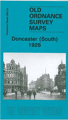
Buchbeschreibung No Binding. Zustand: New. No Jacket. We have published two versions of this map, so you can see how the area changed across the years. The maps cover a busy area of Doncaster, including part of the town centre and the area to the south. Coverage stretches from Priory Place and the station southward to Balby Road and Carr Hill, and from Kirk Street and Stone Close Avenue eastward to Carr House. Features on the map include the railway station and its southern approaches, including the GNR (later LNER) locomotive & carriage works, St James Bridge station, Cherrytree Goods Station, Danum Wagon Works, cattle pens, LNER offices, Balby Road Bridge, Hexthorpe Junction, Bridge Junction, South Yorkshire Junction, and the north end of two engine sheds. Other features include tramways, Belmont Works, cemetery, St James church, Cleveland Street, Station Road, Printing Office Street, Hyde Park, Beechfield Park, Hall Gate, Museum, Scarborough Barracks, Elmfield Park, Glasgow Paddocks, Belle Vue Stables. Directory extracts are given on the reverse, those for the 1924 map including private residents from the 1922 directory, entries I-Z. The maps links up with Yorkshire Sheet 277.13 Doncaster (North) to the north. Bestandsnummer des Verk�ufers 008296
Weitere Informationen zu diesem Verk�ufer | Verk�ufer kontaktieren
Neu kaufen
EUR 3,57
W�hrung umrechnen