Gesamtpreis (1 Artikel Artikel):
Versandziel:

carte maps (27 Ergebnisse)
Direkt zu den wichtigsten Suchergebnissen
Produktart
- Alle Produktarten
- Bücher (25)
- Magazine & Zeitschriften
- Comics
- Noten
- Kunst, Grafik & Poster
- Fotografien
- Karten (2)
-
Manuskripte &
Papierantiquitäten
Zustand
Einband
Weitere Eigenschaften
- Erstausgabe (3)
- Signiert
- Schutzumschlag
- Angebotsfoto (2)
- Kein Print-on-Demand
Gratisversand
Land des Verkäufers
Verkäuferbewertung
-
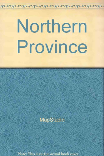
Carte routičre : Northern Province (en anglais)
Verlag: Struik Publishers,South Africa, 2001
ISBN 10: 1868094782ISBN 13: 9781868094783
Buch
Gut/Very good: Buch bzw. Schutzumschlag mit wenigen Gebrauchsspuren an Einband, Schutzumschlag oder Seiten. / Describes a book or dust jacket that does show some signs of wear on either the binding, dust jacket or pages.
-

A La Carte Create Your Own Beijing
Verlag: A la Carte Maps, 2011
ISBN 10: 3905912317ISBN 13: 9783905912319
Anbieter: Better World Books Ltd, Dunfermline, Vereinigtes Königreich
Bewertung:

Buch
Zustand: Very Good. Ships from the UK. Former library book; may include library markings. Used book that is in excellent condition. May show signs of wear or have minor defects.
-
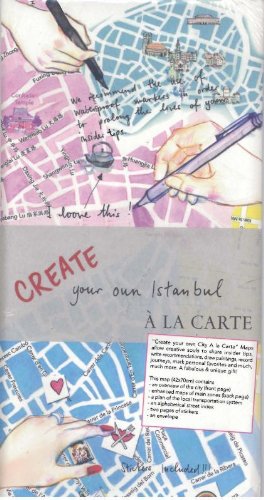
A La Carte Create Your Own Istanbul
Verlag: A la Carte Maps, 2011
ISBN 10: 3905912333ISBN 13: 9783905912333
Anbieter: Better World Books Ltd, Dunfermline, Vereinigtes Königreich
Bewertung:
Buch
Zustand: As New. Ships from the UK. Used book that is in almost brand-new condition.
-

My Berlin a la Carte
Verlag: A la Carte Maps, 2011
ISBN 10: 3905912368ISBN 13: 9783905912364
Anbieter: Better World Books Ltd, Dunfermline, Vereinigtes Königreich
Bewertung:
Buch
Zustand: Very Good. Ships from the UK. Former library book; may include library markings. Used book that is in excellent condition. May show signs of wear or have minor defects.
-
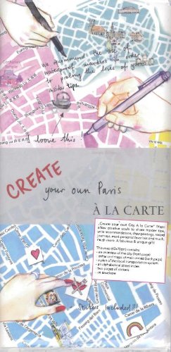
Create Your Own Paris a La Carte: Beautiful City Map to Decorate Yourself
Verlag: A la Carte Maps, 2011
ISBN 10: 3905912120ISBN 13: 9783905912128
Anbieter: Better World Books Ltd, Dunfermline, Vereinigtes Königreich
Bewertung:
Buch
Zustand: As New. 0th Edition. Ships from the UK. Used book that is in almost brand-new condition.
-
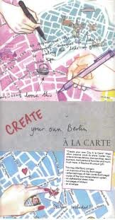
A La Carte Create Your Own Berlin
Verlag: A la Carte Maps, 2011
ISBN 10: 3905912376ISBN 13: 9783905912371
Anbieter: Better World Books Ltd, Dunfermline, Vereinigtes Königreich
Bewertung:
Buch
Zustand: As New. Ships from the UK. Used book that is in almost brand-new condition.
-
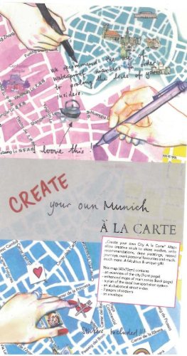
Create Your Own Munich a La Carte: Beautiful City Map to Decorate Yourself
Verlag: A la Carte Maps, 2011
ISBN 10: 3905912058ISBN 13: 9783905912050
Anbieter: Better World Books Ltd, Dunfermline, Vereinigtes Königreich
Bewertung:
Buch
Zustand: As New. 0th Edition. Ships from the UK. Used book that is in almost brand-new condition.
-
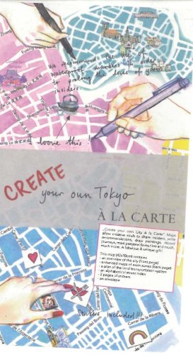
Create Your Own Tokyo a La Carte: Beautiful City Map to Decorate Yourself
Verlag: A la Carte Maps, 2011
ISBN 10: 3905912082ISBN 13: 9783905912081
Anbieter: Better World Books Ltd, Dunfermline, Vereinigtes Königreich
Bewertung:
Buch
Zustand: As New. Ships from the UK. Used book that is in almost brand-new condition.
-

My Washington DC a La Carte: City Map, Guidebook and Piece of Art
Verlag: A la Carte Maps, 2011
ISBN 10: 3905912007ISBN 13: 9783905912005
Anbieter: Better World Books Ltd, Dunfermline, Vereinigtes Königreich
Bewertung:
Buch
Zustand: Good. 0th Edition. Ships from the UK. Former library book; may include library markings. Used book that is in clean, average condition without any missing pages.
Mehr Angebote von anderen Verkäufern bei AbeBooks
Gebraucht ab EUR 4,83
-

Create Your Own Shanghai a La Carte: Beautiful City Map to Decorate Yourself
Verlag: A la Carte Maps, 2011
ISBN 10: 3905912287ISBN 13: 9783905912289
Anbieter: Better World Books Ltd, Dunfermline, Vereinigtes Königreich
Bewertung:
Buch
Zustand: Very Good. 2nd edition. Ships from the UK. Former library book; may include library markings. Used book that is in excellent condition. May show signs of wear or have minor defects.
-

A La Carte Create Your Own Los Angeles (Create Your Own City a La Carte)
Verlag: A la Carte Maps, 2011
ISBN 10: 3905912198ISBN 13: 9783905912197
Karte
Map. Zustand: New.
-

My Zurich a La Carte: City Map, Guidebook and Piece of Art
Verlag: A la Carte Maps, 2011
ISBN 10: 3033018971ISBN 13: 9783033018976
Anbieter: Better World Books Ltd, Dunfermline, Vereinigtes Königreich
Bewertung:
Buch
Zustand: Very Good. 0th Edition. Ships from the UK. Former library book; may include library markings. Used book that is in excellent condition. May show signs of wear or have minor defects.
-

sd, fascicule de 36 pages avec sa carte dépliante au 1:8000 - bon état.
-
Hardcover. Zustand: Good. No Jacket. MAPS (illustrator). Very Small book with red cloth binding and silver print on front cover and spine. Some slight fade on parts of print. Rear cover has two small hole sand some rubwear. Front endpapers are map of the Metropolitain. Rear endpapers have fold-out map. Sound and unmarked. 364 pages plus last block of 40 maps. maps. Contains: Conversion table old street names to current.; White Section, Index to streets indicating Metro stations, 128 pages; Blue pages Indispensible Addresses ,30 pages; Yellow Section Public transportation, 80 pages;
-
Cartes Taride Routieres, Lorraine, Luxembourg. First Edition. Map in Envelop. Circa Mid 1920's. Paris
Verlag: Cartes Taride, Paris
Erstausgabe
Zustand: Very Good. Map Illustrations (illustrator). First Edition. Original envelope contiaining motoring maps of Lorraine and Luxembourg. Very scarce.
-

My Istanbul a la Carte (My City a La Carte Maps)
Verlag: A la Carte Maps, 2011
ISBN 10: 3905912325ISBN 13: 9783905912326
Karte
Map. Zustand: Brand New. 1 pages. 8.50x4.10x0.20 inches. In Stock.
-
-

La mia New York. Ŕ la carte
Verlag: De Agostini, 2012
ISBN 10: 8851116954ISBN 13: 9788851116958
Buch
Map. Zustand: Used: Like New. ATTENZIONE libro nuovo da magazzino copertina lievemente rovinato. Per ogni problema, domanda o necessitŕ non esitate a contattarci troverete personale disponibile a risolvere ogni vostra richiesta! Consegna 24/48 ore 36a8.
-
CARTE DES PAROISSES DE CARL GUSTAF ET DE NEDER TORNEA
Verlag: London, 1817
Anbieter: K Books Ltd ABA ILAB, York, YORKS, Vereinigtes Königreich
Verbandsmitglied: ABA ILAB PBFA
Bewertung:
Buch Erstausgabe
Single Sheet Engraving. Zustand: Very Good. No Jacket. First Edition. CARTE DES PAROISSES DE CARL GUSTAF ET DE NEDER TORNEA , DETAILED MAP, PRINTED IN 1817, good condition, very detailed, too large to mount so would dispatch rolled in a strong tube . MEASURES 13 X 8 INCHES, 36 X 20 CMS, MOUNTED AND READY TO FRAME . VERY GOOD CONDITION, EXCELLENT VALUE .
-
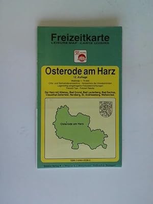
Osterode am Harz. Orts- und Gemeindeverzeichnis, Verzeichnis der Kreisbehörden, Lagerichtig eingetragene Freizeiteinrichtungen, Freizeit-Tips, Freizeit-Tabelle
Buch
12. Auflage, Städte-Verlag E. v. Wagner & J. Mitterhuber, Fellbach b. Stuttgart, (um 1992). 1 farbiger mehrfach gefalteter Stadtplan, broschiert, Maßstab 1 : 75 000---Verlag: Städte-Verlag E. v. Wagner & J. Mitterhuber Verlag: Städte-Verlag E. v. Wagner & J. Mitterhuber - gutes Exemplar 44 Gramm.
-
Zustand: Used: Like New. Libro usato proveniente da collezione privata. La copertina riporta usuali segni del tempo. No segni e sottolineature del testo. Per ogni problema, domanda o necessitŕ non esitate a contattarci troverete personale disponibile a risolvere ogni vostra richiesta! Consegna 24/48 ore 68 A6.
-
Hardcover. Zustand: Good. 40 Gravures (engravings) et 2 Cartes (maps) (illustrator). red cloth, gilt lettering, paste down of man shelf and edge wear. French text. S14 1.
-
HAITI AND DOMINICAN REPUBLIC. ST DOMIMGUE [HAITI AND DOMINICAN REPUBLIC] EARLY ANTIQUE MAP, CARTE REDUITE DE ISLE DE ST DOMINGUE .PAR M. LE CTE DE CHASTENET PUISEGIER .1787
Erscheinungsdatum: 1787
Anbieter: K Books Ltd ABA ILAB, York, YORKS, Vereinigtes Königreich
Verbandsmitglied: ABA ILAB PBFA
Bewertung:
Buch Erstausgabe
Single Sheet Engraving. Zustand: Good. No Jacket. First Edition. ST DOMIMGUE [HAITI AND DOMINICAN REPUBLIC] EARLY ANTIQUE MAP, CARTE REDUITE DE ISLE DE ST DOMINGUE .PAR M. LE CTE DE CHASTENET PUISEGIER .1787. lARGE ORIGINAL ENGRAVED MAP MEASURING 38 X 25 INCHES, 96 X 64 CMS, 4 VIGNETTES SHOWING THE COASTLINE, VERY DETAILED, A LITTLE AGED AND REPAIRED ON VERSO AT FOLDS WITH ARCHIVIST TAPE, WOULD EAILY REPOND TO SIMPLE RESTORATION, PRICED ACCORDING TO EXISTING CONDITION, EXCELLENT VALUE .
-
CARTE GENERALE DE L'ALLEMAGNE comprenant l'ensemble des Etats de L'Europe Centrale. (Faltkarte von Deutschland).
Paris, E. Andriveau-Goujon, 1851, 63 x 92 cm, with border colouring, mounted on cloth, dissected into 21 sections, folding into a publisher's marbled paper portfolio (some discoloring of the cloth, but the whole in fine condition). Schöne französische Faltkarte aus 1851 mit Randkolorierung. Die Namen von Orten, Städte und Länder (40) sind auf französisch benennt.
-
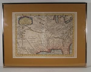
Aucune reliure. Zustand: Trčs bon. Carte originale de Bellin, coloriée ŕ la main, publiée dans l' "Histoire générale des Voyages" de Prévost. Dimensions de la carte : 23 x 32.5 cm. Dimensions du cadre : 33.5 x 44 cm. Encadrement récent de qualité. "Cartographe du Roi", Jacques-Nicolas Bellin est reconnu pour ses cartes de l'Amérique du Nord. Oeuvre encadrée.