
Gesamtpreis (1 Artikel Artikel):
Versandziel:

ordnance survey of northern ireland (148 Ergebnisse)
Direkt zu den wichtigsten Suchergebnissen
Produktart
- Alle Produktarten
- Bücher (109)
- Magazine & Zeitschriften
- Comics
- Noten
- Kunst, Grafik & Poster
- Fotografien
- Karten (39)
-
Manuskripte &
Papierantiquitäten
Zustand
Einband
Weitere Eigenschaften
- Erstausgabe (15)
- Signiert
- Schutzumschlag
- Angebotsfoto (81)
- Kein Print-on-Demand
Gratisversand
Land des Verkäufers
Verkäuferbewertung
-
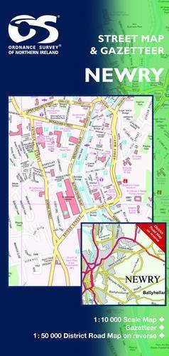
Newry and Mourne Street Map | Enlarged City Centre Map | Ordnance Survey Northern Ireland | OSNI Newry Street Map | Newry | City Centre | Street Map | Maps | Adventure (Irish Street Maps)
Verlag: Ordnance Survey of Northern Ireland, 2008
ISBN 10: 1905306288ISBN 13: 9781905306282
Buch
Paperback. Zustand: Very Good. The book has been read, but is in excellent condition. Pages are intact and not marred by notes or highlighting. The spine remains undamaged.
Mehr Angebote von anderen Verkäufern bei AbeBooks
Neu ab EUR 16,50
Gebraucht ab EUR 3,85
Mehr entdecken Softcover
-

Strabane (Irish Discoverer Maps): Sheet 12 (Irish Discoverer Series)
Verlag: Ordnance Survey of Northern Ireland, 2005
ISBN 10: 1873819986ISBN 13: 9781873819982
Buch
Paperback. Zustand: Very Good. The book has been read, but is in excellent condition. Pages are intact and not marred by notes or highlighting. The spine remains undamaged.
Mehr Angebote von anderen Verkäufern bei AbeBooks
Gebraucht ab EUR 4,54
-

Slieve Croob (Outdoor Pursuits) (Irish Activity Map)
Verlag: Ordnance Survey of Northern Ireland
ISBN 10: 1873819358ISBN 13: 9781873819357
Buch
Paperback. Zustand: Fair. A readable copy of the book which may include some defects such as highlighting and notes. Cover and pages may be creased and show discolouration.
Mehr Angebote von anderen Verkäufern bei AbeBooks
Gebraucht ab EUR 4,72
-

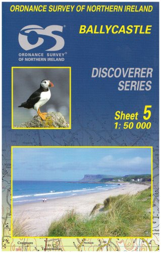
Ballycastle: Sheet 5 (Irish Discoverer Series)
Verlag: Ordnance Survey of Northern Ireland
ISBN 10: 1873819722ISBN 13: 9781873819722
Buch
Paperback. Zustand: Very Good. The book has been read, but is in excellent condition. Pages are intact and not marred by notes or highlighting. The spine remains undamaged.
-
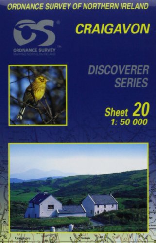
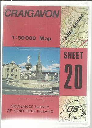
Craigavon: Sheet 20 (Irish Discoverer Series)
Verlag: Ordnance Survey of Northern Ireland, 2004
ISBN 10: 1873819838ISBN 13: 9781873819838
Buch
Paperback. Zustand: Very Good. The book has been read, but is in excellent condition. Pages are intact and not marred by notes or highlighting. The spine remains undamaged.
-
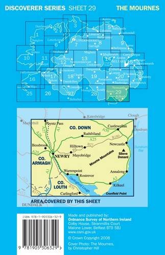
Discoverer Series Sheet 29 The Mournes (Edition D) (Irish Discoverer Series)
Verlag: Ordnance Survey of Northern Ireland, 2008
ISBN 10: 1905306326ISBN 13: 9781905306329
Buch
Paperback. Zustand: Very Good. The book has been read, but is in excellent condition. Pages are intact and not marred by notes or highlighting. The spine remains undamaged.
Mehr Angebote von anderen Verkäufern bei AbeBooks
Gebraucht ab EUR 6,15
-
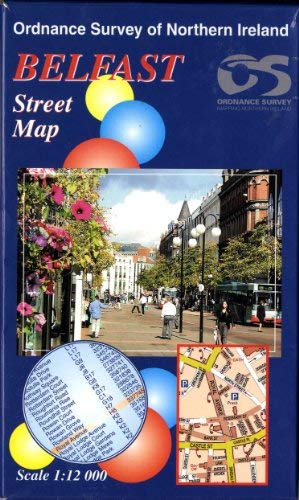
Belfast Street Map (Irish Street Maps)
Verlag: Ordnance Survey of Northern Ireland, 2002
ISBN 10: 1873819897ISBN 13: 9781873819890
Buch
Zustand: Good. Most items will be dispatched the same or the next working day.
-
Ballycastle (Discoverer Maps): No. 5
Verlag: Ordnance Survey of Northern Ireland, 2007
ISBN 10: 1905306199ISBN 13: 9781905306190
Buch
Paperback. Zustand: Good. The book has been read but remains in clean condition. All pages are intact and the cover is intact. Some minor wear to the spine.
Mehr Angebote von anderen Verkäufern bei AbeBooks
Gebraucht ab EUR 8,58
-
Monaghan : Keady
Verlag: Ordnance Survey of Northern Ireland
ISBN 10: 1905306954ISBN 13: 9781905306954
Buch
Zustand: As New. Unread book in perfect condition.
-
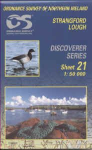
Strangford Lough (Irish Discoverer Maps): Sheet 21 (Irish Discoverer Series)
Verlag: Ordnance Survey of Northern Ireland
ISBN 10: 1873819951ISBN 13: 9781873819951
Buch
Paperback. Zustand: Very Good. The book has been read, but is in excellent condition. Pages are intact and not marred by notes or highlighting. The spine remains undamaged.
Mehr Angebote von anderen Verkäufern bei AbeBooks
Gebraucht ab EUR 10,75
-
1: 50 000 Discoverer Series Sheet 20 Craigavon.
Verlag: Belfast: Ordnance Survey of Northern Ireland, 1984., 1984
Anbieter: Saintfield Antiques & Fine Books, Northern Ireland, Vereinigtes Königreich
Bewertung:

Karte
No Binding. Zustand: Good. 67 x 98 cm, folding to 17 x 12.5 cm. Paper copy, coloured. In very good condition, in a clear plastic folder.
-
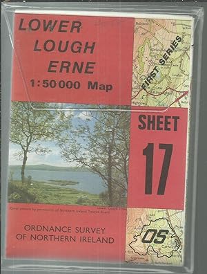
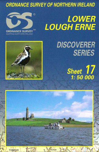
1: 50 000 Discoverer Series Sheet 17 Lower Lough Erne.
Verlag: Belfast: Ordnance Survey of Northern Ireland, 1981., 1981
Anbieter: Saintfield Antiques & Fine Books, Northern Ireland, Vereinigtes Königreich
Bewertung:
Karte
No Binding. Zustand: Good. 67 x 98 cm, folding to 17 x 12.5 cm. Paper copy, coloured. In very good condition, in a clear plastic folder.
-
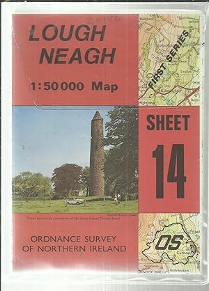
1: 50 000 Discoverer Series Sheet 14 Lough Neagh.
Verlag: Belfast: Ordnance Survey of Northern Ireland, 1981., 1981
Anbieter: Saintfield Antiques & Fine Books, Northern Ireland, Vereinigtes Königreich
Bewertung:
Karte
No Binding. Zustand: Very Good. 67 x 98 cm, folding to 17 x 12.5 cm. Paper copy, coloured. In very good condition, in a clear plastic folder.
-
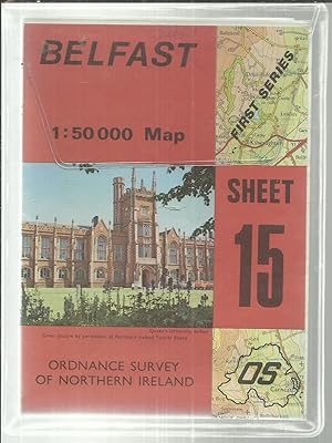
1: 50 000 Discoverer Series Sheet 15 Belfast.
Verlag: Belfast: Ordnance Survey of Northern Ireland, 1981., 1981
Anbieter: Saintfield Antiques & Fine Books, Northern Ireland, Vereinigtes Königreich
Bewertung:
Karte
No Binding. Zustand: Very Good. 67 x 98 cm, folding to 17 x 12.5 cm. Paper copy, coloured. In very good condition, in a clear plastic folder.
-

1: 50 000 Discoverer Series Sheet 18 Enniskillen.
Verlag: Belfast: Ordnance Survey of Northern Ireland, 1984., 1984
Anbieter: Saintfield Antiques & Fine Books, Northern Ireland, Vereinigtes Königreich
Bewertung:
Karte
No Binding. Zustand: Good. 67 x 98 cm, folding to 17 x 12.5 cm. Paper copy, coloured. In very good condition, in a clear plastic folder.
-
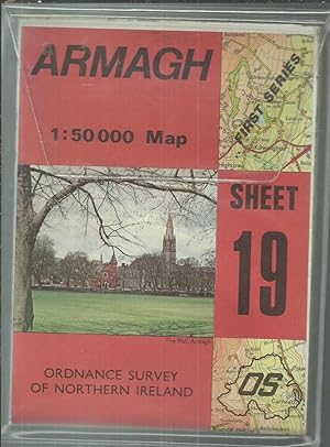
1: 50 000 Discoverer Series Sheet 19 Armagh.
Verlag: Belfast: Ordnance Survey of Northern Ireland, 1980., 1980
Anbieter: Saintfield Antiques & Fine Books, Northern Ireland, Vereinigtes Königreich
Bewertung:
Karte
Soft cover. Zustand: Good. 67 x 98 cm, folding to 17 x 12.5 cm. Paper copy, coloured. In very good condition, in a clear plastic folder.
-
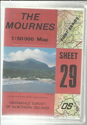
1: 50 000 Discoverer Series Sheet 29 The Mournes.
Verlag: Belfast: Ordnance Survey of Northern Ireland, 1983., 1983
Anbieter: Saintfield Antiques & Fine Books, Northern Ireland, Vereinigtes Königreich
Bewertung:
Karte
No Binding. Zustand: Good. 67 x 98 cm, folding to 17 x 12.5 cm. Paper copy, coloured. In very good condition, in a clear plastic folder.
-

The Mournes (Outdoor Pursuits) (Irish Activity Map)
Verlag: Ordnance Survey of Northern Ireland, 2004
ISBN 10: 1905306091ISBN 13: 9781905306091
Buch
Zustand: Good. Most items will be dispatched the same or the next working day.
-
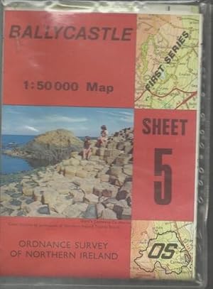
1: 50 000 First Series Sheet 5 Ballycastle.
Verlag: Belfast: Ordnance Survey of Northern Ireland, 1979., 1979
Anbieter: Saintfield Antiques & Fine Books, Northern Ireland, Vereinigtes Königreich
Bewertung:
68 x 99 cm, folding to 17 x 12.5 cm. Paper copy, coloured. In very good condition, in plastic wallet as sold.
-
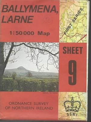
1: 50 000 First Series Sheet 9 Ballymena, Larne.
Verlag: Belfast: Ordnance Survey of Northern Ireland, 1978., 1978
Anbieter: Saintfield Antiques & Fine Books, Northern Ireland, Vereinigtes Königreich
Bewertung:
78 x 98 cm, folding to 17 x 12.5 cm. Paper copy, coloured. In very good condition.
-
Lower Lough Erne (Irish Discoverer Maps) (Irish Discoverer Series)
Verlag: Ordnance Survey of Northern Ireland, 2003
ISBN 10: 1873819803ISBN 13: 9781873819807
Buch
Map. Zustand: Used; Good. Dispatched, from the UK, within 48 hours of ordering. This book is in good condition but will show signs of previous ownership. Please expect some creasing to the spine and/or minor damage to the cover. Damaged book. Slightly damaged in some way typically, a grazed corner or torn cover.
-

Ireland North Holiday Map
Verlag: Ordnance Survey of Northern Ireland, 2005
ISBN 10: 1873819900ISBN 13: 9781873819906
Buch
Map. Zustand: Used; Good. ***Simply Brit*** Welcome to our online used book store, where affordability meets great quality. Dive into a world of captivating reads without breaking the bank. We take pride in offering a wide selection of used books, from classics to hidden gems, ensuring there is something for every literary palate. All orders are shipped within 24 hours and our lightning fast-delivery within 48 hours coupled with our prompt customer service ensures a smooth journey from ordering to delivery. Discover the joy of reading with us, your trusted source for affordable books that do not compromise on quality.
Mehr Angebote von anderen Verkäufern bei AbeBooks
Gebraucht ab EUR 5,83
-
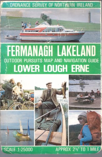
Fermanagh Lakeland outdoor pursuits map and navigation guide: Lower Lough Erne / made and published by the Ordnance Survey Northern Ireland
Verlag: Belfast: Ordnance Survey of Northern Ireland, 1984
ISBN 10: 187381934XISBN 13: 9781873819340
Buch Erstausgabe
First Edition. Very good pamphlet copy; wrappers slightly edge-dulled. Pages tanned as with age. Remains particularly well-preserved overall. Physical description: 1 map: col.; 83 x 107 cm., folded in cover to 22 x 15 cm. Subjects: Fermanagh (Northern Ireland); Maps. Erne, Lower Lough (Northern Ireland); Maps. Scale 1: 25 000. Genre: Map. Topographic maps. 1 Kg.
-
Upper Lough Erne: sheet 27, 1:50 000
Verlag: Belfast: Ordnance Survey of Northern Ireland, 2004
ISBN 10: 1873819862ISBN 13: 9781873819869
Buch Erstausgabe
First Edition. Very good pamphlet copy; edges slightly nicked and dust-dulled as with age. Remains particularly well-preserved overall; bright and clean. Physical Description: 1 map: color; 60 x 80 cm, on sheet 70 x 97 cm, originally folded in cover to 18 x 12 cm. Subjects: Northern Ireland -- Maps. Northern Ireland. Genre: Maps. 1 Kg.
-
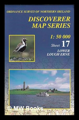
Lower Lough Erne: 1:50,000. 17
Verlag: Belfast: Ordnance Survey of Northern Ireland, 2001
ISBN 10: 1873819579ISBN 13: 9781873819579
Buch
Sheet 17. Near fine pamphlet copy; edges slightly dulled. Particularly well-preserved overall; tight, bright and clean. Physical Description: 1 map; 64 x 84 cm on sheet 69 x 97 cm. Subjects: Karte. Nordirland. Northern Ireland; Maps. Genre: Maps. 1 Kg.
Mehr Angebote von anderen Verkäufern bei AbeBooks
Gebraucht ab EUR 19,97
-

Fermanagh Lakeland outdoor pursuits map and navigation guide: Upper Lough Erne / made and published by the Ordnance Survey Northern Ireland
Verlag: Belfast: Ordnance Survey of Northern Ireland, 1986
Erstausgabe
First Edition. Very good pamphlet copy; wrappers slightly edge-dulled. Pages tanned as with age. Remains particularly well-preserved overall. Physical description: 1 map: col.; 83 x 107 cm., folded in cover to 22 x 15 cm. Subjects: Fermanagh (Northern Ireland); Maps. Erne, Upper Lough (Northern Ireland); Maps. Scale 1: 25 000. Genre: Map. Topographic maps. 1 Kg.
-
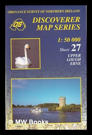
Upper Lough Erne/ Discoverer Map Series/ Sheet 27
Verlag: Belfast: Ordnance Survey of Northern Ireland, 2008
ISBN 10: 1873819633ISBN 13: 9781873819630
Buch
Third Edition. Near fine pamphlet copy; edges slightly dulled. Particularly well-preserved overall; tight, bright and clean. Series: Discovery Series / Ordnance Survey of Ireland; 68. Physical description: 1 map: col.; 64 x 84 cm., on sheet 76 x 99 cm., originally folded to 20 x 12 cm. Subjects: Ireland; Maps. Scale 1:50,000. Genre: Maps. 1 Kg.
Mehr Angebote von anderen Verkäufern bei AbeBooks
Gebraucht ab EUR 19,97
-
BELFAST One-inch Map (Sheet 7)
Verlag: Ordnance Survey of Northern Ireland, Belfast, Belfast, 1953
Anbieter: Books for Amnesty, Malvern, Great Malvern, Vereinigtes Königreich
Bewertung:

Zustand: Very Good. Cloth-backed map opening to 27x40 inches. Card covers handled. Map in excellent condition, not worn along creases. All our UK orders are posted First Class. All profits to Amnesty International. Size: 21.2cm - 12.6cm.
-
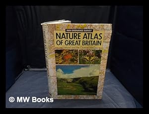
Nature atlas of Great Britain, Ireland and the Channel Isles
Verlag: London : Pan ; Southampton : Ordanance Survey ; Belfast : Ordnance Survey of Northern Ireland ; Dublin : Ordnance Survey of Ireland, 1989
Erstausgabe
First Edition. Fine cloth copy in an equally fine dust-wrapper. Particularly well-preserved overall; tight, bright, clean and especially sharp-cornered. Physical description; 288p. : ill., maps ; 30cm. Subjects; Atlases, Scientific Great Britain. Atlases, Scientific Ireland. Great Britain and Ireland Natural History 1989 ; Atlases. Great Britain. Ordnance Survey. 1 Kg.
-
Fermanagh Lakeland outdoor pursuits map and navigation guide: Upper Lough Erne / made and published by the Ordnance Survey Northern Ireland
Verlag: Belfast: Ordnance Survey of Northern Ireland, 1986
Erstausgabe
First Edition. Very good pamphlet copy; wrappers slightly edge-dulled. Pages tanned as with age. Remains particularly well-preserved overall. Physical description: 1 map: col.; 83 x 107 cm., folded in cover to 22 x 15 cm. Subjects: Fermanagh (Northern Ireland); Maps. Erne, Upper Lough (Northern Ireland); Maps. Scale 1: 25 000. Genre: Map. Topographic maps. 1 Kg.
