Maps of War - Hardcover
Zu dieser ISBN ist aktuell kein Angebot verf�gbar.
Alle Exemplare der Ausgabe mit dieser ISBN anzeigen:
Rare book
Die Inhaltsangabe kann sich auf eine andere Ausgabe dieses Titels beziehen.
Cr�ticas:
"Staggeringly beautiful." "Good Book Guide" on "New Worlds: Maps from the Age of Discovery""
Rese�a del editor:
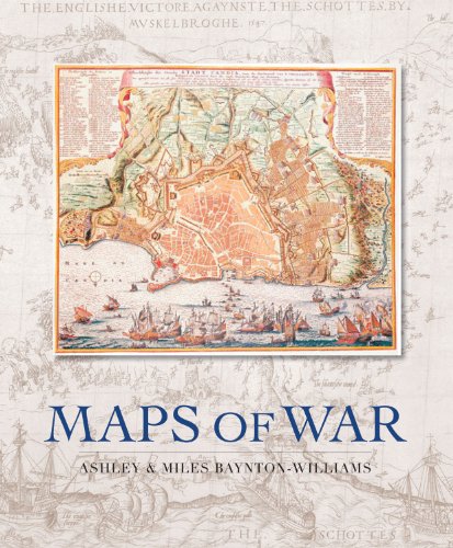
Gaze across history's bloodiest battlefields, as beautifully realised by the cartographers of the time. From the depiction of the battle of Pinkie Cleugh between England and Scotland in 1547 - the earliest map printed in the British Isles - to chartings of the American War of Independence, and from plans of the advance of the British fleet at the Battle of Trafalgar to the trench maps of World War I, this unique collection highlights the extraordinary influence cartography has had on the nature of warfare. Each illustration is accompanied by an extended caption on the background to the war, including the planning and conduct of the battle in question. Whether the map was used to plan a military campaign, or drawn just after the event to record the conflict, each provides a fascinating piece of military history, and brings the drama of the battle to life. This giant book not only allows these important cartographical documents to be showcased, but also provides a captivating illustrated history of the last 500 years of warfare.
��ber diesen Titel� kann sich auf eine andere Ausgabe dieses Titels beziehen.
- VerlagQuercus
- Erscheinungsdatum2007
- ISBN 10 1847242065
- ISBN 13 9781847242068
- EinbandTapa dura
- Anzahl der Seiten224
- Bewertung
Gebraucht kaufen
Zustand: BefriedigendThe book has been read but remains... Mehr zu diesem Angebot erfahren

EUR 31,22
Versand:
EUR 5,60
Von Vereinigtes K�nigreich nach USA
Beste Suchergebnisse bei AbeBooks
Beispielbild f�r diese ISBN
Maps of War
Anbieter:
Bewertung
Buchbeschreibung Hardback. Zustand: Good. The book has been read but remains in clean condition. All pages are intact and the cover is intact. Some minor wear to the spine. Bestandsnummer des Verk�ufers GOR007759511
Weitere Informationen zu diesem Verk�ufer | Verk�ufer kontaktieren
Gebraucht kaufen
EUR 31,22
W�hrung umrechnen
Foto des Verk�ufers
Maps of War
Anbieter:
Bewertung
Buchbeschreibung Hardcover. Zustand: VG-. Zustand des Schutzumschlags: VG-. DJ: some rubbing & edgewear; creases/chips/closed tears at edges & corners; yellowing. Book: some rubbing & edgewear; corner bumps; small spots on edge; some yellowing; otherwise overall clean & tight. 223 pages. Bestandsnummer des Verk�ufers 37426
Weitere Informationen zu diesem Verk�ufer | Verk�ufer kontaktieren
Gebraucht kaufen
EUR 33,61
W�hrung umrechnen
Beispielbild f�r diese ISBN
MAPS OF WAR
Verlag:
Quercus, London
(2007)
ISBN 10: 1847242065
ISBN 13: 9781847242068
Gebraucht
Hardcover
Erstausgabe
Anzahl: 1
Anbieter:
Bewertung
Buchbeschreibung Hardcover. Zustand: As New. Zustand des Schutzumschlags: Fine. 1st Edition. BOOK DESCRIPTION: Folio, 223 pgs, index, illustrations. First printing. CONDITION DESCRIPTION: As new; interior is clean and tight. Unclipped DJ is fine. CONTENTS DESCRIPTION: The story of over 300 years off warfare told through 130 beautiful historic maps. Due to its large size, additional postage is required. Bestandsnummer des Verk�ufers 18503
Weitere Informationen zu diesem Verk�ufer | Verk�ufer kontaktieren
Gebraucht kaufen
EUR 38,41
W�hrung umrechnen
Beispielbild f�r diese ISBN
Maps of War
Verlag:
Quercus Publishing
(2007)
ISBN 10: 1847242065
ISBN 13: 9781847242068
Gebraucht
Hardcover
Anzahl: 1
Anbieter:
Bewertung
Buchbeschreibung Zustand: Good. This is an ex-library book and may have the usual library/used-book markings inside.This book has hardback covers. In good all round condition. Dust jacket in good condition. Please note the Image in this listing is a stock photo and may not match the covers of the actual item,3750grams, ISBN:9781847242068. Bestandsnummer des Verk�ufers 8607442
Weitere Informationen zu diesem Verk�ufer | Verk�ufer kontaktieren
Gebraucht kaufen
EUR 33,28
W�hrung umrechnen
Beispielbild f�r diese ISBN
Maps of War
Anbieter:
Bewertung
Buchbeschreibung Zustand: Good. Buy with confidence! Book is in good condition with minor wear to the pages, binding, and minor marks within. Bestandsnummer des Verk�ufers bk1847242065xvz189zvxgdd
Weitere Informationen zu diesem Verk�ufer | Verk�ufer kontaktieren
Gebraucht kaufen
EUR 48,58
W�hrung umrechnen
Beispielbild f�r diese ISBN
Maps of War
Verlag:
Quercus Publishing
(2007)
ISBN 10: 1847242065
ISBN 13: 9781847242068
Gebraucht
Hardcover
Anzahl: 1
Anbieter:
Bewertung
Buchbeschreibung hardcover. Zustand: Good. NOT an ex-library book. Clean copy in good condition. With Dust Cover. Quick dispatch from UK seller. Bestandsnummer des Verk�ufers mon0000418551
Weitere Informationen zu diesem Verk�ufer | Verk�ufer kontaktieren
Gebraucht kaufen
EUR 31,22
W�hrung umrechnen
Beispielbild f�r diese ISBN
Maps of War -- The Story of Over 300 Years of Warfare,Told Through 130 Beautiful Historic Maps
Verlag:
Quercus
(2007)
ISBN 10: 1847242065
ISBN 13: 9781847242068
Gebraucht
Hardcover
Erstausgabe
Anzahl: 1
Anbieter:
Bewertung
Buchbeschreibung Hard Cover. Zustand: Very Good. Zustand des Schutzumschlags: Very Good. First Edition. Hard Cover -- VG/VG -- SHIPPING ONLY IN U.S. AND BY MEDIA MAIL ONLY -- Book and dust jacket are clean and bright -- First Edition w/full # string -- Maps of War -- The Story of Over 300 Years of Warfare,Told Through 130 Beautiful Historic Map. Bestandsnummer des Verk�ufers 322670
Weitere Informationen zu diesem Verk�ufer | Verk�ufer kontaktieren
Gebraucht kaufen
EUR 93,62
W�hrung umrechnen
Beispielbild f�r diese ISBN
Maps of war.
Verlag:
London: Quercus Publishing, 2007., London:
(2007)
ISBN 10: 1847242065
ISBN 13: 9781847242068
Gebraucht
Hardcover
Anzahl: 1
Anbieter:
Bewertung
Buchbeschreibung Hardcover. Zustand: Near Fine. BAYNTON-WILLIAMS, ASHLEY - MILES BAYNTON-WILLIAMS Maps of war. London: Quercus Publishing, 2007. Elephant folio (44x36 cm.), 223, [1] p., b/w and color ills. Original binding. Dust wrapper. Near fine ISBN: 9781847242068 CATALOG: Maps & Engravings KEYWORDS: Carthography Geography Map War Gaze across history's bloodiest battlefields, as beautifully realised by the cartographers of the time. From the depiction of the battle of Pinkie Cleugh between England and Scotland in 1547 - the earliest map printed in the British Isles - to chartings of the American War of Independence, and from plans of the advance of the British fleet at the Battle of Trafalgar to the trench maps of World War I, this unique collection highlights the extraordinary influence cartography has had on the nature of warfare. Each illustration is accompanied by an extended caption on the background to the war, including the planning and conduct of the battle in question. Whether the map was used to plan a military campaign, or drawn just after the event to record the conflict, each provides a fascinating piece of military history, and brings the drama of the battle to life. This giant book not only allows these important cartographical documents to be showcased, but also provides a captivating illustrated history of the last 500 years of warfare. Bestandsnummer des Verk�ufers 74462
Weitere Informationen zu diesem Verk�ufer | Verk�ufer kontaktieren
Gebraucht kaufen
EUR 80,00
W�hrung umrechnen