
Gesamtpreis (1 Artikel Artikel):
Versandziel:

ORDNANCE SURVEY MAP (125 Ergebnisse)
Direkt zu den wichtigsten Suchergebnissen
Produktart
- Alle Produktarten
- Bücher (65)
- Magazine & Zeitschriften
- Comics
- Noten
- Kunst, Grafik & Poster
- Fotografien
- Karten (60)
-
Manuskripte &
Papierantiquitäten
Zustand
Einband
Weitere Eigenschaften
- Erstausgabe (11)
- Signiert
- Schutzumschlag (2)
- Angebotsfoto (29)
- Kein Print-on-Demand
Land des Verkäufers
Verkäuferbewertung
-
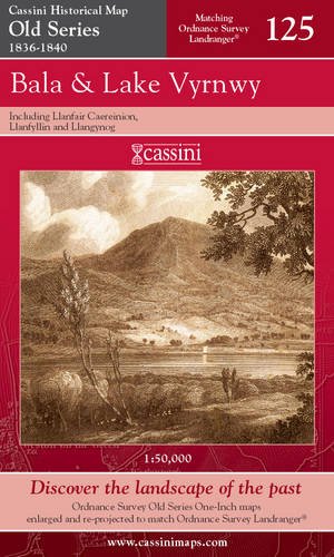
Bala and Lake Vyrnwy (Cassini Old Series Historical Map)
Verlag: Cassini Publishing Ltd, 2006
ISBN 10: 1847360483ISBN 13: 9781847360489
Buch
Paperback. Zustand: Good. The book has been read but remains in clean condition. All pages are intact and the cover is intact. Some minor wear to the spine.
Mehr Angebote von anderen Verkäufern bei AbeBooks
Neu ab EUR 1,14
Gebraucht ab EUR 2,02
Mehr entdecken Softcover
-
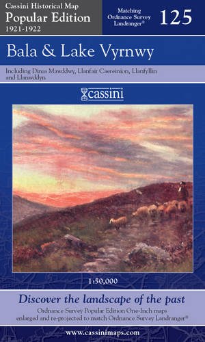
Bala and Lake Vyrnwy (Cassini Popular Edition Historical Map)
Verlag: Cassini Publishing Ltd, United Kingdom, East Garston, 2007
ISBN 10: 1847362397ISBN 13: 9781847362391
Buch
Paperback. Zustand: Very Good. The book has been read, but is in excellent condition. Pages are intact and not marred by notes or highlighting. The spine remains undamaged.
Mehr Angebote von anderen Verkäufern bei AbeBooks
Neu ab EUR 1,14
Gebraucht ab EUR 2,29
Mehr entdecken Softcover Erstausgabe
-
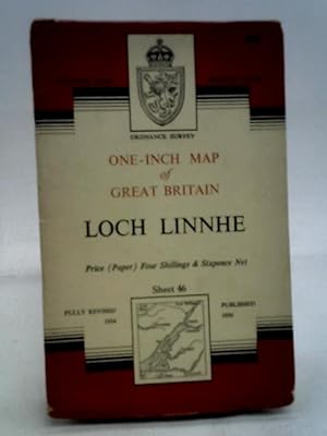
Loch Linnhe Sheet 46 (Ordnance Survey One-inch Map of Great Britain)
Verlag: Ordnance Survey, 1956
Anbieter: World of Rare Books, Goring-by-Sea, SXW, Vereinigtes Königreich
Bewertung:

Zustand: Good. 1956. Revised. Unpaginated. Pictorial paper covers. Coloured map printed on map. Binding remains firm.Pages & illustrations remain bright with minimal tanning. Paper cover has mild edge-wear with light rubbing and creasing.
-
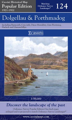
Dolgellau and Porthmadog (Cassini Popular Edition Historical Map)
Verlag: Cassini Publishing Ltd, 2007
ISBN 10: 1847362389ISBN 13: 9781847362384
Buch
Paperback. Zustand: Good. The book has been read but remains in clean condition. All pages are intact and the cover is intact. Some minor wear to the spine.
Mehr Angebote von anderen Verkäufern bei AbeBooks
Neu ab EUR 1,14
Gebraucht ab EUR 4,71
Mehr entdecken Softcover Erstausgabe
-
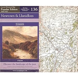
NEWTOWN & LLANIDLOES, including Llangurig and Rhayader. (Cassini Popular Series Historical Map POP 136. 1920-1923). Matching ORDNANCE SURVEY LANDRANGER No. 136. 1:50,000.
Verlag: Cassini Publishing Limited. Southampton, Hampshire. 2007., 2007
ISBN 10: 1847362419ISBN 13: 9781847362414
Anbieter: Coch-y-Bonddu Books Ltd, MACHYNLLETH, Vereinigtes Königreich
Verbandsmitglied: PBFA
Bewertung:
Buch Erstausgabe
Zustand: new. (Map, 2007). (1923) 2007 1st edition thus. Folding map in blue card covers. This map includes Newtown, Llanidloes, Llangurig and Rhayader. Fine new copy. The Cassini Popular Edition series provides a fascinating snapshot of the human geography of Britain in the period between the two world wars. These maps are taken from the Ordnance Survey One-Inch 'Popular Edition' sheets, surveyed between 1920 and 1923. The original series of maps were 1" to the mile, and surveyed on a grid different from that employed today. In this new series, however, the 1" maps have been reprojected onto the OS National Grid so that all the edges match up. This makes the whole country into one single sheet from which positions can be read off in National Grid Numbers. This single sheet has been redivided, creating new sheets each corresponding precisely to a current Landranger map. The scale is now larger, at 1:50,000. This new series is uniquely useful for exploring the land and accurately pin-pointing where things are, or used to be. Uniquely useful for comparisons with current maps on the kitchen table too. Much to be recommended. PREVIOUS PRICE Ł9.99.
-
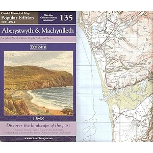
ABERYSTWYTH & MACHYNLLETH, including Aberdyfi, Borth, Devil's Bridge and Tywyn. (Cassini Popular Series Historical Map POP 135. 1921-1923). Matching ORDNANCE SURVEY LANDRANGER No. 135. 1:50,000.
Verlag: Cassini Publishing Limited. Southampton, Hampshire. 2007., 2007
ISBN 10: 1847362400ISBN 13: 9781847362407
Anbieter: Coch-y-Bonddu Books Ltd, MACHYNLLETH, Vereinigtes Königreich
Verbandsmitglied: PBFA
Bewertung:
Buch Erstausgabe
Zustand: new. (Map, 2007). (1923) 2007 1st edition thus. Folding map in blue card covers. This map includes Aberystwyth, Machynlleth, Aberdyfi, Borth, Llanrhystud, Devil's Bridge, and Tywyn. Fine new copy. The Cassini Popular Edition series provides a fascinating snapshot of the human geography of Britain in the period between the two world wars. These maps are taken from the Ordnance Survey One-Inch 'Popular Edition' sheets, surveyed between 1921 and 1923. The original series of maps were 1" to the mile, and surveyed on a grid different from that employed today. In this new series, however, the 1" maps have been reprojected onto the OS National Grid so that all the edges match up. This makes the whole country into one single sheet from which positions can be read off in National Grid Numbers. This single sheet has been redivided, creating new sheets each corresponding precisely to a current Landranger map. The scale is now larger, at 1:50,000. This new series is uniquely useful for exploring the land and accurately pin-pointing where things are, or used to be. Uniquely useful for comparisons with current maps on the kitchen table too. Much to be recommended. PREVIOUS PRICE Ł9.99.
-
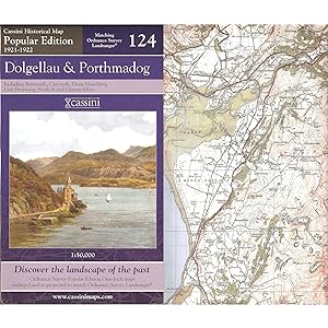
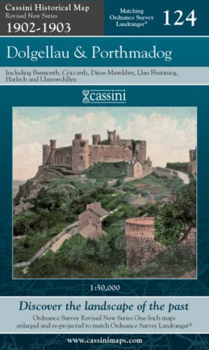
DOLGELLAU & PORTHMADOG, including Barmouth, Dinas Mawddwy, Ffestiniog, Harlech and Llanuwchllyn. (Cassini Popular Series Historical Map POP 124. 1921-1922). Matching ORDNANCE SURVEY LANDRANGER No. 124. 1:50,000.
Verlag: Cassini Publishing Limited. Southampton, Hampshire. 2007., 2007
ISBN 10: 1847362389ISBN 13: 9781847362384
Anbieter: Coch-y-Bonddu Books Ltd, MACHYNLLETH, Vereinigtes Königreich
Verbandsmitglied: PBFA
Bewertung:
Buch Erstausgabe
Zustand: new. (Map, 2007). (1922) 2007 1st edition thus. Folding map in blue card covers. This map includes Barmouth, Dinas Mawddwy, Ffestiniog, Harlech and Llanuwchllyn. Fine new copy. The Cassini Popular Edition series provides a fascinating snapshot of the human geography of britain in the period between the two world wars. These maps are taken from the Ordnance Survey One-Inch 'Popular Edition' sheets, surveyed between 1921 and 1922. The original series of maps were 1" to the mile, and surveyed on a grid different from that employed today. In this new series, however, the 1" maps have been reprojected onto the OS National Grid so that all the edges match up. This makes the whole country into one single sheet from which positions can be read off in National Grid Numbers. This single sheet has been redivided, creating new sheets each corresponding precisely to a current Landranger map. The scale is now larger, at 1:50,000. This new series is uniquely useful for exploring the land and accurately pin-pointing where things are, or used to be. Useful for comparisons with current maps on the kitchen table too. Much to be recommended. PREVIOUS PRICE Ł9.99.
-
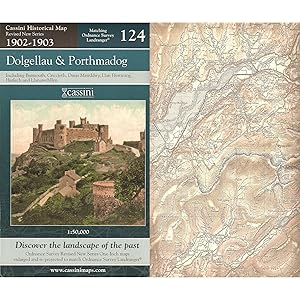
DOLGELLAU & PORTHMADOG, including Barmouth, Dinas Mawddwy, Ffestiniog, Harlech and Llanuwchllyn. (Cassini Revised New Series Historical Map RNC 124. 1902-1903). Matching ORDNANCE SURVEY LANDRANGER No. 124. 1:50,000.
Verlag: Cassini Publishing Limited. Southampton, Hampshire. 2007., 2007
ISBN 10: 1847363962ISBN 13: 9781847363961
Anbieter: Coch-y-Bonddu Books Ltd, MACHYNLLETH, Vereinigtes Königreich
Verbandsmitglied: PBFA
Bewertung:
Buch Erstausgabe
Zustand: new. (Map, 2007). (1903) 2007 1st edition thus. Folding map in green-blue card covers. This map includes Barmouth, Dinas Mawddwy, Ffestiniog, Harlech and Llanuwchllyn. Fine new copy. The Cassini Revised New Series provides a fascinating snapshot of the human geography of Britain at the turn of the twentieth century. These maps are taken from the Ordnance Survey One-Inch 'Revised New Series' sheets, surveyed between 1902 and 1903. The original series of maps were 1" to the mile, and surveyed on a grid different from that employed today. In this new series, however, the 1" maps have been reprojected onto the OS National Grid so that all the edges match up. This makes the whole country into one single sheet from which positions can be read off in National Grid numbers. This single sheet has been redivided, creating new sheets each corresponding precisely to a current Landranger map. The scale is now larger, at 1:50,000. This new series is uniquely useful for exploring the land and accurately pin-pointing where things are, or used to be. Very useful for comparisons with current maps on the kitchen table, too. Much to be recommended. PREVIOUS PRICE Ł9.99.
-
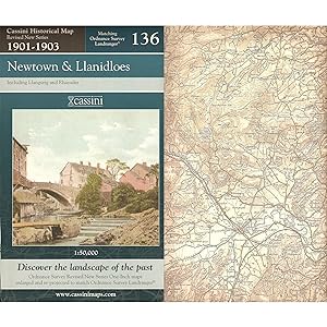
NEWTOWN & LLANIDLOES, including Llangurig and Rhayader. (Cassini Revised New Series Historical Map RNC 136. 1902-1903). Matching ORDNANCE SURVEY LANDRANGER No. 136. 1:50,000.
Verlag: Cassini Publishing Limited. Southampton, Hampshire. 2007., 2007
ISBN 10: 1847363997ISBN 13: 9781847363992
Anbieter: Coch-y-Bonddu Books Ltd, MACHYNLLETH, Vereinigtes Königreich
Verbandsmitglied: PBFA
Bewertung:
Buch Erstausgabe
Zustand: new. (Map, 2007). (1903) 2007 1st edition thus. Folding map in green-blue card covers. This map includes Newtown, Llanidloes, Llangurig and Rhayader. Fine new copy. The Cassini Revised New Series provides a fascinating snapshot of the human geography of Britain at the turn of the twentieth century. These maps are taken from the Ordnance Survey One-Inch 'Revised New Series'sheets, surveyed between 1900 and 1903. The original series of maps were 1" to the mile, and surveyed on a grid different from that employed today. In this new series, however, the 1" maps have been reprojected onto the OS National Grid so that all the edges match up. This makes the whole country into one single sheet from which positions can be read off in National Grid numbers. This single sheet has been redivided, creating new sheets each corresponding precisely to a current Landranger map. The scale is now larger, at 1:50,000. This new series is uniquely useful for exploring the land and accurately pin-pointing where things are, or used to be. Equally useful for comparisons with current maps on the kitchen table. Much to be recommended. PREVIOUS PRICE Ł9.99.
-
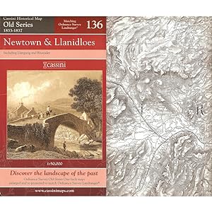
NEWTOWN & LLANIDLOES, including Llangurig and Rhayader. (Cassini Old Series Historical Map OSE 136. 1833-1837). MATCHING ORDNANCE SURVEY LANDRANGER No. 136. 1:50,000.
Verlag: Cassini Publishing Limited. Southampton, Hampshire. 2006., 2006
ISBN 10: 1847360505ISBN 13: 9781847360502
Anbieter: Coch-y-Bonddu Books Ltd, MACHYNLLETH, Vereinigtes Königreich
Verbandsmitglied: PBFA
Bewertung:
Buch
Zustand: new. (Map, 2006). (1837) 2006 1st edition thus. Folding map in red card covers. This map includes Newtown, Llanidloes, Llangurig and Rhayader. Fine new copy. "The Cassini Old Series provides a fascinating snapshot of the human geography of Britain in the mid-19th century. These maps are taken from the Ordnance Survey One-Inch 'Old Series' sheets, surveyed between 1791 and1874 and published - with many revisions and new editions - between 1805 and 1874." The original series of maps were 1" to the mile, and surveyed on a grid different from that employed today. Many of the sheets were printed with four separate copper plates each from separate surveys, the edges of which usually did not quite match. Reprints of all these sheets have been available in recent times. In this new series, however, the 1" maps have been reprojected onto the OS National Grid so that all the edges match up. This makes the whole country into one single sheet from which positions can be read off in National Grid numbers. This single sheet has been redivided, creating new sheets each corresponding precisely to a current Landranger map. The scale is now larger, at 1:50,000. This new series is uniquely useful for exploring the land and accurately pinpointing where things are, or used to be. Uniquely useful for comparisons with current maps on the kitchen table, too. Much to be recommended. PREVIOUS PRICE Ł9.99.
-
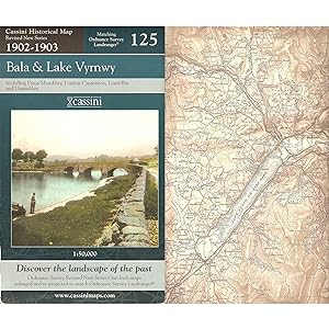
BALA & LAKE VYRNWY, including Llanfair Caereinion, Llanfyllin and Llangynog. (Cassini Revised New Series Historical Map RNC 125. 1902-1903). Matching ORDNANCE SURVEY LANDRANGER No. 125. 1:50,000.
Verlag: Cassini Publishing Limited. Southampton, Hampshire. 2007., 2007
ISBN 10: 1847363970ISBN 13: 9781847363978
Anbieter: Coch-y-Bonddu Books Ltd, MACHYNLLETH, Vereinigtes Königreich
Verbandsmitglied: PBFA
Bewertung:
Buch Erstausgabe
Zustand: new. (Map, 2007). (1903) 2007 1st edition thus. Folding map in green-blue card covers. This map includes Llanfair Caereinion, Dinas Mawddwy, Llanuwcllyn, Bala, Llanfyllin, Llangynog and Corwen. Fine new copy. The Cassini Revised New Series provides a fascinating snapshot of the humangeography of Britain at the turn of the twentieth century. These maps are taken from the Ordnance Survey One-Inch 'Revised New Series' sheets, surveyed between 1902 and 1903. The original series of maps were 1" to the mile, and surveyed on a grid different from that employed today. In this new series, however, the 1" maps have been reprojected onto the OS National Grid so that all the edges match up. This makes the whole country into one single sheet from which positions can be read off in National Grid numbers. This single sheethas been redivided, creating new sheets each corresponding precisely to a current Landranger map. The scale is now larger, at 1:50,000. This new series is uniquely useful for exploring the land and accurately pin-pointing where things are, or used to be. Useful for comparisons with current maps on the kitchen table, too. Much to be recommended. PREVIOUS PRICE Ł9.99.
-
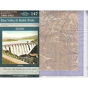
ELAN VALLEY & BUILTH WELLS, including Devil's Bridge, Llangurig, Llandrindod Wells, Llanwrtyd Wells and Rhayader. (Cassini Revised New Series Historical Map RNC 147 1900-1903). Matching ORDNANCE SURVEY LANDRANGER No. 147. 1:50,000.
Verlag: Cassini Publishing Limited. Southampton, Hampshire. 2007., 2007
ISBN 10: 1847363830ISBN 13: 9781847363831
Anbieter: Coch-y-Bonddu Books Ltd, MACHYNLLETH, Vereinigtes Königreich
Verbandsmitglied: PBFA
Bewertung:
Buch Erstausgabe
Zustand: new. (Map, 2007). (1903) 2007 1st edition thus. Folding map in green-blue card covers. This map includes the Elan Valley, Builth Wells, Devil's Bridge, Llangurig, Llandrindod Wells, Llanwrtyd Wells and Rhayader. Fine new copy. The Cassini Revised New Series provides a fascinating snapshot of the human geography of Britain at the turn of the twentieth century. These maps are taken from the Ordnance Survey One-Inch 'Revised New Series'sheets, surveyed between 1900 and 1903. The original series of maps were 1" to the mile, and surveyed on a grid different from that employed today. In this new series, however, the 1" maps have been reprojected onto the OS National Grid so that all the edges match up. This makes the whole country into one single sheet from which positions can be read off in National Grid numbers. This single sheet has been redivided, creating new sheets each corresponding precisely to a current Landranger map. The scale is now larger, at 1:50,000. This new series is uniquely useful for exploring the land and accurately pin-pointing where things are, or used to be. Equally useful for comparisons with current maps on the kitchen table. Much to be recommended. PREVIOUS PRICE Ł6.99.
-
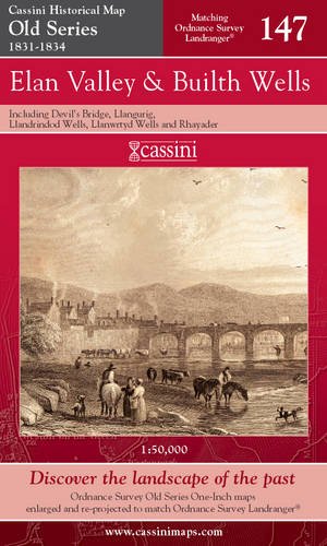
ELAN VALLEY & BUILTH WELLS, including Devil's Bridge, Llangurig, Llandrindod Wells, Llanwrtyd Wells and Rhayader. (Cassini Old Series Historical Map OSE 147 1831-1834). Matching ORDNANCE SURVEY LANDRANGER No. 147. 1:50,000.
Verlag: Cassini Publishing Limited. Southampton, Hampshire. 2006., 2006
ISBN 10: 1847360343ISBN 13: 9781847360342
Anbieter: Coch-y-Bonddu Books Ltd, MACHYNLLETH, Vereinigtes Königreich
Verbandsmitglied: PBFA
Bewertung:
Buch
Zustand: new. (Map, 2006). (1834) 2006 1st edition thus. Folding map in red card covers. This map includes the Elan Valley, Builth Wells, Devil's Bridge, Llangurig, Llandrindod Wells, Llanwrtyd Wells and Rhayader. Fine new copy. "The Cassini Old Series provides a fascinating snapshot of the human geography of Britain in the mid-19th century. These maps are taken from the Ordnance Survey One-Inch 'Old Series' sheets, surveyed between 1791 and1874 and published - with many revisions and new editions - between 1805 and 1874." The original series of maps were 1" to the mile, and surveyed on a grid different from that employed today. Many of the sheets were printed with four separate copper plates each from separate surveys, the edges of which usually did not quite match. Reprints of all these sheets have been available in recent times. In this new series, however, the 1" maps have been reprojected onto the OS National Grid so that all the edges match up. This makes the whole country into one single sheet from which positions can be read off in National Grid numbers. This single sheet has been redivided, creating new sheets each corresponding precisely to a current Landranger map. The scale is now larger, at 1:50,000. This new series is uniquely useful for exploring the land and accurately pinpointing where things are, or used to be. Uniquely useful for comparisons with current maps on the kitchen table, too. Much to be recommended. PREVIOUS PRICE Ł6.49.
-
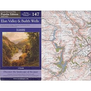
ELAN VALLEY & BUILTH WELLS, including Devil's Bridge, Llangurig, Llandrindod Wells, Llanwrtyd Wells and Rhayader. (Cassini Popular Edition Historical Map POP 147 1919-1923). Matching ORDNANCE SURVEY LANDRANGER No. 147. 1:50,000.
Verlag: Cassini Publishing Limited. Southampton, Hampshire. 2007., 2007
ISBN 10: 1847362257ISBN 13: 9781847362254
Anbieter: Coch-y-Bonddu Books Ltd, MACHYNLLETH, Vereinigtes Königreich
Verbandsmitglied: PBFA
Bewertung:
Buch Erstausgabe
Zustand: new. (Map, 2007). (1923) 2007 1st edition thus. Folding map in blue card covers. This map includes the Elan Valley, Builth Wells, Devil's Bridge, Llangurig, Llandrindod Wells, Llanwrtyd Wells and Rhayader. Fine new copy. The Cassini Popular Edition series provides a fascinating snapshot of the human geography of Britain in the period between the two world wars. These maps are taken from the Ordnance Survey One-Inch 'Popular Edition' sheets, surveyed between 1919 and 1923. The original series of maps were 1" to the mile, and surveyed on a grid different from that employed today. In this new series, however, the 1" maps have been reprojected onto the OS National Grid so that all the edges match up. This makes the whole country into one single sheet from which positions can be read off in National Grid Numbers. This single sheet has been redivided, creating new sheets each corresponding precisely to a current Landranger map. The scale is now larger, at 1:50,000. This new series is uniquely useful for exploring the land and accurately pin-pointing where things are, or used to be. Uniquely useful for comparisons with current maps on the kitchen table too. Much to be recommended. PREVIOUS PRICE Ł6.99.
-

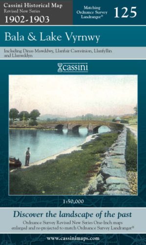
BALA & LAKE VYRNWY, including Llanfair Caereinion, Llanfyllin and Llangynog. (Cassini Popular Series Historical Map POP 125 1921-1922). Matching ORDNANCE SURVEY LANDRANGER No. 125. 1:50,000.
Verlag: Cassini Publishing Limited. Southampton, Hampshire. 2007., 2007
ISBN 10: 1847362397ISBN 13: 9781847362391
Anbieter: Coch-y-Bonddu Books Ltd, MACHYNLLETH, Vereinigtes Königreich
Verbandsmitglied: PBFA
Bewertung:
Buch Erstausgabe
Zustand: new. (Map, 2007). (1921) 2007 1st edition thus. Folding map in blue card covers. This map includes Llanfair Caereinion, Dinas Mawddwy, Llanuwcllyn, Bala, Llanfyllin, Llangynog and Corwen. Fine new copy. The Cassini Popular Edition series provides a fascinating snapshot of the human geography of Britain in the period between the two world wars. These maps are taken from the Ordnance Survey One-Inch 'Popular Edition' sheets, surveyed between 1921 and 1922. The original series of maps were 1" to the mile, and surveyed on a grid different from that employed today. In this new series, however, the 1" maps have been reprojected onto the OS National Grid so that all the edges match up. This makes the whole country into one single sheet from which positions can be read off in National Grid Numbers. This single sheet has been redivided, creating new sheets each corresponding precisely to a current Landranger map. The scale is now larger, at 1:50,000. This new series is uniquely useful for exploring the land and accurately pin-pointing where things are, or used to be. Equally useful for comparisons with current maps on the kitchen table. Much to be recommended. PREVIOUS PRICE Ł9.99.
-
Bala and Lake Vyrnwy: Sheet 125 (Cassini Revised New Series Historical Map)
Verlag: Cassini Publishing Ltd, 2007
ISBN 10: 1847363970ISBN 13: 9781847363978
Buch
Map. Zustand: Used; Good. Dispatched, from the UK, within 48 hours of ordering. This book is in good condition but will show signs of previous ownership. Please expect some creasing to the spine and/or minor damage to the cover. Damaged cover. The cover of is slightly damaged for instance a torn or bent corner.
Mehr Angebote von anderen Verkäufern bei AbeBooks
Neu ab EUR 1,14
Gebraucht ab EUR 2,01
Mehr entdecken Erstausgabe
-
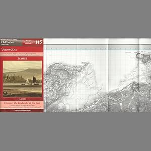
SNOWDON, including Bethesda, Betws-y-Coed, Bangor, Blaenau Ffestiniog, Caernarfon, Llanberis, Llandudno, Menai Bridge and Penmaenmawr. (Cassini Old Series Historical map OSE 115 1840-1841). Matching ORDNANCE SURVEY LANDRANGER No. 115. 1:50,000.
Verlag: Cassini Publishing Limited. Southampton, Hampshire. 2006., 2006
ISBN 10: 1847360440ISBN 13: 9781847360441
Anbieter: Coch-y-Bonddu Books Ltd, MACHYNLLETH, Vereinigtes Königreich
Verbandsmitglied: PBFA
Bewertung:
Buch
Zustand: new. (Map, 2006). (1841) 2006 1st edition thus. Folding map in red card covers. This map includes including Bethesda, Betws-y-Coed, Bangor, Blaenau Ffestiniog, Caernarfon, Llanberis, Llandudno, Menai Bridge and Penmaenmawr, all of the Snowdon area and part of Anglesey. Fine new copy. "The Cassini Old Series provides a fascinating snapshot of the human geography of Britain in the mid-19th century. These maps are taken from the Ordnance Survey One-Inch 'Old Series' sheets, surveyed in 1840 & 1841." The original series of maps were 1" to the mile, and surveyed on a grid different from that employed today. Many of the sheets were printed with four separate copper plates each from separate surveys, the edges of which usually did not quite match. Reprints of all these sheets have been available in recent times. In this new series, however, the 1" maps have been reprojected onto the OS National Grid so that all the edges match up. This makes the whole country into one single sheet from which positions can be read off in National Grid numbers. This single sheet has been redivided, creating new sheets each corresponding precisely to a current Landranger map. The scale is now larger, at 1:50,000. This new series is uniquely useful for exploring the land and accurately pinpointing where things are, or used to be. Uniquely useful for comparisons with current maps on the kitchen table, too. Much to be recommended. PREVIOUS PRICE Ł9.99.
-
Cassini HM, RNC 124: Dolgellau & Porthmadog 124 Revised New Series
Verlag: Cassini Maps, 2007
ISBN 10: 1847363962ISBN 13: 9781847363961
Karte
Map. Zustand: Brand New. 8.43x5.12x0.55 inches. In Stock.
-
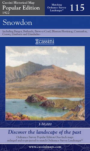
Snowdon (Cassini Popular Edition Historical Map)
Verlag: Cassini Publishing Ltd, 2007
ISBN 10: 1847362354ISBN 13: 9781847362353
Buch
Zustand: Good. Most items will be dispatched the same or the next working day.
-
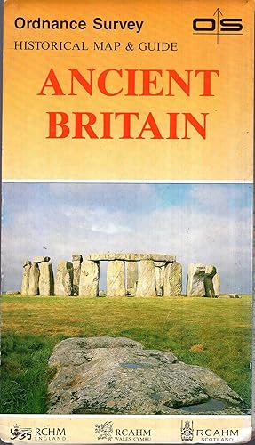
Historical Map & Guide to Ancient Britain : South Sheet
Verlag: Ordnance Survey, 1990
ISBN 10: 0319290247ISBN 13: 9780319290248
Anbieter: Pendleburys - the bookshop in the hills, Llanwrda, Vereinigtes Königreich
Bewertung:
Karte
paperback. Zustand: Very Good. No Jacket. folding sheet map within pictorial card covers, a very good clean and unmarked copy in colours,
-

Card Covers. Zustand: Very Good. No Jacket. First Thus. Linen-backed map. Blue / buff paper covers, showing a motorist reading a map.
-
Ordnance Survey Map Of Dorchester And Weymouth : Sheet 194
Verlag: Ordnance Survey Office Chessington
Anbieter: Wonder Book, Frederick, MD, USA
Bewertung:
Zustand: Good. Good condition. (map) A copy that has been read but remains intact. May contain markings such as bookplates, stamps, limited notes and highlighting, or a few light stains.
-
Gazetteer Of Great Britain Giving the Position of All Features Named on the Ordnance Survey Quarter-inch Maps in Terms of the National Grid
Verlag: Director General at the Ordnance Survey, Chessington, Surrey, 1953
Hardback. Zustand: Very good condition. Zustand des Schutzumschlags: No dust jacket. Fold-out maps. (illustrator). Original card covers rebound in hardback.
-
Penrith - One Inch Map - Ordnance Survey Sheet 83
Verlag: Ordnance Survey, Southampton, 1988
Anbieter: K Books Ltd ABA ILAB, York, YORKS, Vereinigtes Königreich
Verbandsmitglied: ABA ILAB PBFA
Bewertung:
Buch
Soft Covers. Zustand: Very Good. Reprint. folding ordnance survey map - one inch map - excellent condition.
-

Local Red Book Isle of Wight Street Maps with Index 11th Revision
Verlag: Estate Publications, Nigh, United Kingdom, 1111
ISBN 10: 0860846105ISBN 13: 9780860846109
Anbieter: Ryde Bookshop Ltd, Isle of Wight, Vereinigtes Königreich
Bewertung:
Buch
Soft cover. Zustand: Fair. Street plans prepared and published by Estate Publications and based on the Ordnance Survey maps (illustrator). Stapled edition with heavy handling wear mostly on the cover including scuffing and creases.
-
Carlisle - One Inch Map - Ordnance Survey Sheet 76
Verlag: Ordnance Survey, Southampton
Anbieter: K Books Ltd ABA ILAB, York, YORKS, Vereinigtes Königreich
Verbandsmitglied: ABA ILAB PBFA
Bewertung:
Buch
Soft Covers. Zustand: Very Good. Reprint. folding ordnance survey map - one inch map -good condition - (covers slightly marked) Carlisle area.
-
Hexham - One Inch Map - Ordnance Survey Sheet 77
Verlag: Ordnance Survey, Southampton
Anbieter: K Books Ltd ABA ILAB, York, YORKS, Vereinigtes Königreich
Verbandsmitglied: ABA ILAB PBFA
Bewertung:
Buch
Soft Covers. Zustand: Very Good. Reprint. folding ordnance survey map - one inch map -good condition - (covers slightly marked - slighly frayed - internally very good .Hexham area.
-
Ordnance Survey Map, 1.25 Inch to a Mile, Haltwhistle and Bewcastle
Verlag: Ordnance Survey, Southampton, 1947
Anbieter: K Books Ltd ABA ILAB, York, YORKS, Vereinigtes Königreich
Verbandsmitglied: ABA ILAB PBFA
Bewertung:
Karte
Soft cover. Zustand: Very Good. No Jacket. Reprint -. Excellent copy of the 1:50000 Second series Ordnance Survey Map, folding, original printed covers, very good condition . SOFT COVER , NO JACKET, EXCELLENT CONDITION, SPLENDID VALUE . ORDNANCE SURVEY MAP OF BEDFORD AND HUNTINGDON.
-
Ordnance Survey Map, 1.25 Inch to a Mile, Manchester and Surrounding Area
Verlag: Ordnance Survey, Southampton
Anbieter: K Books Ltd ABA ILAB, York, YORKS, Vereinigtes Königreich
Verbandsmitglied: ABA ILAB PBFA
Bewertung:
Karte
Soft cover. Zustand: Very Good. No Jacket. Reprint -. Excellent copy of the 1:50000 Second series Ordnance Survey Map, folding, original printed covers, very good condition . SOFT COVER , NO JACKET, EXCELLENT CONDITION, SPLENDID VALUE . ORDNANCE SURVEY MAP OF MANCHESTER AND SURROUNDING AREA.
-
Ordnance Survey Map, 1.25 Inch to a Mile, Preston Blackpool and the Surrounding Area
Verlag: Ordnance Survey, Southampton
Anbieter: K Books Ltd ABA ILAB, York, YORKS, Vereinigtes Königreich
Verbandsmitglied: ABA ILAB PBFA
Bewertung:
Karte
Soft cover. Zustand: Very Good. No Jacket. Reprint -. Excellent copy of the 1:50000 Second series Ordnance Survey Map, folding, original printed covers, very good condition . SOFT COVER , NO JACKET, EXCELLENT CONDITION, SPLENDID VALUE . ORDNANCE SURVEY MAP OF PRESTON AND SURROUNDING AREA.
