
Nooruddin shaikh (8 Ergebnisse)

Sprache: Englisch
Verlag: VDM Verlag Dr. Mueller Aktiengesellschaft & Co. KG, 2013
- Softcover
Anbieter: Books Puddle, Woodside, NY, USABooks Puddle
Verkäufer/-in kontaktierenVerkäufer/-in mit 4 SternenZustand: Neu
EUR 66,83
EUR 3,56 VersandVersand innerhalb von USAAnzahl: 4 verfügbar
Zustand: New. pp. 84.

- Softcover
Anbieter: preigu, Osnabrück, Deutschlandpreigu
Verkäufer/-in kontaktierenVerkäufer/-in mit 5 SternenZustand: Neu
EUR 36,35
EUR 70,00 VersandVersand von Deutschland nach USAAnzahl: 5 verfügbar
Taschenbuch. Zustand: Neu. Groundwater Modeling: RS & GIS Perspective | Groundwater Zone Prediction | Shaikh Nooruddin (u. a.) | Taschenbuch | 84 S. | Englisch | 2013 | LAP LAMBERT Academic Publishing | EAN 9783659487309 | Verantwortliche Person für die EU: preigu GmbH & Co. KG, Lengericher Landstr. 19, 49078 Osnabrück, mail[at]preigu[dot]de | Anbieter: preigu. …

- Softcover
- Print-on-Demand
Anbieter: BuchWeltWeit Ludwig Meier e.K., Bergisch Gladbach, DeutschlandBuchWeltWeit Ludwig Meier e.K.
Verkäufer/-in kontaktierenVerkäufer/-in mit 5 SternenZustand: Neu
EUR 39,90
EUR 23,00 VersandVersand von Deutschland nach USAAnzahl: 2 verfügbar
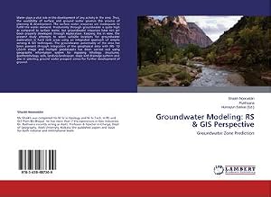
Taschenbuch. Zustand: Neu. This item is printed on demand - it takes 3-4 days longer - Neuware -Water plays a vital role in the development of any activity in the area. Thus, the availability of surface and ground water governs the process of planning & development. The surface water resources are inadequate to fulfill the water demand. Productivity through groundwater is quite high as compared to surface water, but groundwater resources have not yet been properly developed through exploration. Keeping this in view, the present study attempts to select suitable locations for groundwater exploration in hard rock areas using an integrated approach of remote sensing & GIS techniques. The groundwater potentiality of the area has been assessed through integration of the geophysical data with IRS- 1D LISS-III image and multiple geodatasets has been carried out using geographic information system for mapping lithology, structures, geomorphology, soils, landuse/landcopver, slope and drainage pattern and also in selecting ground water prospect zones for further development of ground. 84 pp. Englisch.…
Sprache: Englisch
Verlag: VDM Verlag Dr. Mueller Aktiengesellschaft & Co. KG, 2013
- Softcover
- Print-on-Demand
Anbieter: Majestic Books, Hounslow, Vereinigtes KönigreichMajestic Books
Verkäufer/-in kontaktierenVerkäufer/-in mit 4 SternenZustand: Neu
EUR 66,86
EUR 7,76 VersandVersand von Vereinigtes Königreich nach USAAnzahl: 4 verfügbar
Zustand: New. Print on Demand pp. 84 2:B&W 6 x 9 in or 229 x 152 mm Perfect Bound on Creme w/Gloss Lam.
- Softcover
- Print-on-Demand
Anbieter: AHA-BUCH GmbH, Einbeck, DeutschlandAHA-BUCH GmbH
Verkäufer/-in kontaktierenVerkäufer/-in mit 5 SternenZustand: Neu
EUR 39,90
EUR 35,00 VersandVersand von Deutschland nach USAAnzahl: 1 verfügbar
Taschenbuch. Zustand: Neu. nach der Bestellung gedruckt Neuware - Printed after ordering - Water plays a vital role in the development of any activity in the area. Thus, the availability of surface and ground water governs the process of planning & development. The surface water resources are inadequate to fulfill the water demand. Productivity through groundwater is quite high as compared to surface water, but groundwater resources have not yet been properly developed through exploration. Keeping this in view, the present study attempts to select suitable locations for groundwater exploration in hard rock areas using an integrated approach of remote sensing & GIS techniques. The groundwater potentiality of the area has been assessed through integration of the geophysical data with IRS- 1D LISS-III image and multiple geodatasets has been carried out using geographic information system for mapping lithology, structures, geomorphology, soils, landuse/landcopver, slope and drainage pattern and also in selecting ground water prospect zones for further development of ground.…
Sprache: Englisch
Verlag: VDM Verlag Dr. Mueller Aktiengesellschaft & Co. KG, 2013
- Softcover
- Print-on-Demand
Anbieter: Biblios, frankfurt am main, HESSE, DeutschlandBiblios
Verkäufer/-in kontaktierenVerkäufer/-in mit 4 SternenZustand: Neu
EUR 67,47
EUR 9,95 VersandVersand von Deutschland nach USAAnzahl: 4 verfügbar
Zustand: New. PRINT ON DEMAND pp. 84.

- Softcover
- Print-on-Demand
Anbieter: moluna, Greven, Deutschlandmoluna
Verkäufer/-in kontaktierenVerkäufer/-in mit 5 SternenZustand: Neu
EUR 34,25
EUR 48,99 VersandVersand von Deutschland nach USAAnzahl: Mehr als 20 verfügbar
Zustand: New. Dieser Artikel ist ein Print on Demand Artikel und wird nach Ihrer Bestellung fuer Sie gedruckt. Autor/Autorin: Nooruddin ShaikhMr.Shaikh was completed his M.Sc in Geology and M.Sc.Tech. in RS and GIS from BU,Bhopal. He has more than 7 Yrs experiences in Geo Industries. Dr. Rukhsana recently acting as Asstt. Professor & Teacher-in-Charge, Dep.…

- Softcover
- Print-on-Demand
Anbieter: buchversandmimpf2000, Emtmannsberg, BAYE, Deutschlandbuchversandmimpf2000
Verkäufer/-in kontaktierenVerkäufer/-in mit 5 SternenZustand: Neu
EUR 39,90
EUR 60,00 VersandVersand von Deutschland nach USAAnzahl: 1 verfügbar
Taschenbuch. Zustand: Neu. This item is printed on demand - Print on Demand Titel. Neuware -Water plays a vital role in the development of any activity in the area. Thus, the availability of surface and ground water governs the process of planning & development. The surface water resources are inadequate to fulfill the water demand. Productivity through groundwater is quite high as compared to surface water, but groundwater resources have not yet been properly developed through exploration. Keeping this in view, the present study attempts to select suitable locations for groundwater exploration in hard rock areas using an integrated approach of remote sensing & GIS techniques. The groundwater potentiality of the area has been assessed through integration of the geophysical data with IRS- 1D LISS-III image and multiple geodatasets has been carried out using geographic information system for mapping lithology, structures, geomorphology, soils, landuse/landcopver, slope and drainage pattern and also in selecting ground water prospect zones for further development of ground.VDM Verlag, Dudweiler Landstraße 99, 66123 Saarbrücken 84 pp. Englisch.…


