

Gesamtpreis (1 Artikel Artikel):
Versandziel:

globular projection (18 Ergebnisse)
Direkt zu den wichtigsten Suchergebnissen
Suchfilter
Produktart
- Alle Product Types
- Bücher (10)
- Magazine & Zeitschriften (Keine weiteren Ergebnisse entsprechen dieser Verfeinerung)
- Comics (Keine weiteren Ergebnisse entsprechen dieser Verfeinerung)
- Noten (Keine weiteren Ergebnisse entsprechen dieser Verfeinerung)
- Kunst, Grafik & Poster (1)
- Fotografien (Keine weiteren Ergebnisse entsprechen dieser Verfeinerung)
- Karten (7)
- Manuskripte & Papierantiquitäten (Keine weiteren Ergebnisse entsprechen dieser Verfeinerung)
Zustand Mehr dazu
- Neu (3)
- Wie Neu, Sehr Gut oder Gut Bis Sehr Gut (1)
- Gut oder Befriedigend (4)
- Ausreichend oder Schlecht (Keine weiteren Ergebnisse entsprechen dieser Verfeinerung)
- Wie beschrieben (10)
Einband
- alle Einbände
- Hardcover (5)
- Softcover (Keine weiteren Ergebnisse entsprechen dieser Verfeinerung)
Weitere Eigenschaften
- Erstausgabe (1)
- Signiert (Keine weiteren Ergebnisse entsprechen dieser Verfeinerung)
- Schutzumschlag (Keine weiteren Ergebnisse entsprechen dieser Verfeinerung)
- Angebotsfoto (17)
- Keine Print-on-Demand Angebote (15)
Sprache (3)
Preis
- Beliebiger Preis
- Weniger als EUR 20 (Keine weiteren Ergebnisse entsprechen dieser Verfeinerung)
- EUR 20 bis EUR 45
- Mehr als EUR 45
Gratisversand
Land des Verkäufers
Verkäuferbewertung
-

The World on a Globular Projection/ A Chart Exhibiting the Progress of Christianity from the Birth of Our Savior to the Present Time
Sprache: Englisch
Erscheinungsdatum: 1871
Anbieter: Old Paper Old Ink, Murray, KY, USA
Verkäuferbewertung 5 von 5 Sternen

Karte
No Binding. Zustand: Good. The World on a Globular Projection/ A Chart Exhibiting the Progress of Christianity from the Birth of Our Savior to the Present Time. S. Augustus Mitchell, 1871. *** An engraved lithograph with original hand coloring. The map consists of polar projections of the Northern and Southern hemispheres. Antarctica is not present since there was no information that could be mapped. Below the map is A Chart Exhibiting the progress of Christianity from the birth of our Savior to the present time. It shows the rise and growth of Christianity and Mohometanism [sic] from 100 AD to 1800 in the chief countries of the world. Paganism predominates for much of the world. At the bottom of the chart is a small table with total populations 5 continents and Polynesia. *** Clear, clean images with bright colors, blank verso. Lower left margin corner has small chip. The map title runs to top edge of sheet. *** Sheet is 9 inches high by 11.5 inches, image 8.5 inches high by 11.5 inches.
-

The World upon a Globular Projection and with a Gazetteer of Information.
Verlag: Boston Ottawa DetroitHome Educator Company., 1908
Anbieter: Robert Frew Ltd. ABA ILAB, London, Vereinigtes Königreich
Verbandsmitglied: ABA ILAB PBFA
Verkäuferbewertung 5 von 5 Sternen
Karte
EUR 59,73
EUR 11,60 Versand
Versand von Vereinigtes Königreich nach USAAnzahl: 1 verfügbar
In den WarenkorbLarge (86.5 x 100 cm.) folding map, the oval map (on a scale of 655 miles per inch) printed in colour and surrounded by general information, tables etc., the verso similarly filled with information plius a mapof teh United States, folding into original black boards (23 x 14 cm.) Top left section torn at fold.
-
The World : Upon a Globular Projection and with a Gazetteer of Information.
Verlag: Boston : Bullard Co., 1909
Anbieter: Sequitur Books, Boonsboro, MD, USA
Verbandsmitglied: IOBA
Verkäuferbewertung 5 von 5 Sternen
Hardcover. Zustand: Very Good. Hardcover enclosure. Full fold-out cloth map. Good binding and cover. Clean, unmarked pages. 1 map: 86 x 101 cm. folded to 23 x 14 cm.Includes maps, text and tables on verso.
-
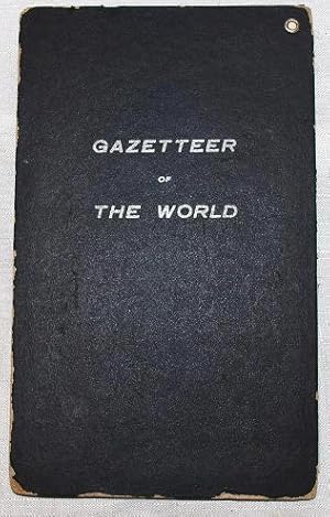
TRAVEL] [MAPS] GAZETTEER OF THE WORLD. THE WORLD: UPON GLOBULAR PROJECTION AND WITH A GAZETTEER OF INFORMATION
Verlag: Home Educator Co, Boston; et al., 1907
Anbieter: BLACK SWAN BOOKS, INC., ABAA, ILAB, Richmond, VA, USA
Verbandsmitglied: ABAA ESA ILAB
Verkäuferbewertung 5 von 5 Sternen
Erstausgabe
Zustand: Very Good binding. Map of the world, with gazetteer; 34 x 39", folded in black paper covered portfolio, lettered in silver; there is a trace of separation at a couple of the folds.~~Includes Railroad mileage, total wealth, debt. Very Good binding.
-
A Survey of the Empire Group Verso Map World on Globular Projection
Verlag: The Bullard Company, Boston, 1915
Anbieter: mediumraremaps.com, Franklin, TN, USA
Verkäuferbewertung 5 von 5 Sternen
Karte
40 x 42 1/2 inches. There are two maps on this cartographic production. The Empire Group, NY,NJ and PA, is the primary focus. Done in 1915, the map capture the spirit of the economies of the states on a combined basis. Through the use of color coding the viewer is able to differentiate between many features. for instance steam railroads are printed in black while electric railways are printed in red. It is a gripping image that is printed in bold colors. The verso map is the world with an index of places and latest populations. Shown are railways in operation and proposed. Cables and steamship lines are also shown along with principal coaling stations. Two maps of importance for this pre-WWI time period.This map seems to be later than other editions in OCLC. Very good with minor separations a fold intersections.
-
A New Map of the World on the Globular Projection
Verlag: H.S. Tanner, Philadelphia, 1841
Anbieter: Michael Treloar Booksellers ANZAAB/ILAB, Adelaide, SA, Australien
Verkäuferbewertung 5 von 5 Sternen
Karte
Zustand: Very Good. Philadelphia, H.S. Tanner, 1841/ [1836]. An engraved map with original hand-colouring (printed surface 227 × 345 mm, sheet size approximately 340 × 440 mm). Engraved by E.B. Dawson. Edges lightly chipped and tanned (well clear of the printed surface); an excellent copy with wide margins. A double-hemisphere map of the world, being Plate 1 from an edition of Tanner's 'A New Universal Atlas containing Maps of the various Empires, Kingdoms, States and Republics of The World .' (first published in 1836). The tracks of Cook's voyages are shown, as well as those of other eighteenth-century explorers.
-

'A NEW MAP OF THE WORLD ON THE GLOBULAR PROJECTION'. Double hemisphere world map with decorative border
Verlag: Thomas and Cowperthwait in Philadelphia for Mitchell ca. 1850, 1850
Anbieter: Garwood & Voigt, Sevenoaks, Vereinigtes Königreich
Verkäuferbewertung 5 von 5 Sternen
Karte
EUR 179,19
EUR 34,79 Versand
Versand von Vereinigtes Königreich nach USAAnzahl: 1 verfügbar
In den Warenkorb24x36cm. Full original colour. Excellent condition.
-
![Bild des Verkäufers für Map of the World [The World, on the Globular Projection, with all the New Discoveries; to which have been lately added, the Tracks of Vancouver and Pe- rouse, finely engraved and ornamented] zum Verkauf von Trillium Antique Prints & Rare Books](https://pictures.abebooks.com/inventory/md/md32124299846.jpg)
Map of the World [The World, on the Globular Projection, with all the New Discoveries; to which have been lately added, the Tracks of Vancouver and Pe- rouse, finely engraved and ornamented]
Verlag: London, 1814
Anbieter: Trillium Antique Prints & Rare Books, Franklin, TN, USA
Verkäuferbewertung 2 von 5 Sternen

Kunst / Grafik / Poster
Zustand: Fine. This exceptional map is from the very handsome atlas entitled "A New and Elegant Imperial Sheet Atlas; Comprehending general and particular maps of every part of the world." The work was published by Robert Holmes Laurie and James Whittle in London in 1814. --- Each engraving from the atlas has original hand-coloring and is on a large fold out sheet. The maps are after the work of cartographers d'Anville, Dunn, Jefferys, Kitchin and others. Some of the maps from the atlas date to 1794.The map itself is dated to 1794. --- Robert Laurie and James Whittle meant as apprentices to leading publisher, Robert Sayer. They took over his establishment in 1794 and acquired a large stock of maps. The map here was from the last and most complete edition published in 1814. --- The work is in very good to excellent condition overall. The fold out plates may havd some faint offset. There may be a few minor imperfections or faint marks or fox marks to be expected with age. Please review the image carefully for condition and contact us with any questions. --- Paper Size ~ 29 1/2" by 20 1/2" (Fold Out).
-
![Bild des Verkäufers für [Map of the World on a Globular Projection Exhibiting particularly the nautical researches of Captain James Cook, F.R.S. with all the recent discoveries to the present time, carefully drawn by A. Arrowsmith, Hydrographer to H.R.H. the Prince of Wales.] zum Verkauf von Daniel Crouch Rare Books Ltd](https://pictures.abebooks.com/inventory/md/md31936703370.jpg)
[Map of the World on a Globular Projection Exhibiting particularly the nautical researches of Captain James Cook, F.R.S. with all the recent discoveries to the present time, carefully drawn by A. Arrowsmith, Hydrographer to H.R.H. the Prince of Wales.]
Verlag: A. Arrowsmith, 10 Soho Square, 1808]., [London,, 1808
Anbieter: Daniel Crouch Rare Books Ltd, London, Vereinigtes Königreich
Verbandsmitglied: ABA ILAB PBFA
Verkäuferbewertung 4 von 5 Sternen

EUR 14.335,27
EUR 23,20 Versand
Versand von Vereinigtes Königreich nach USAAnzahl: 1 verfügbar
In den WarenkorbArrowsmith's fine twin-hemisphere map detailing Cook's voyages Engraved map, with fine original hand-colour in outline, on four sheets, joined in two parts, dissected and mounted on linen, some off-setting, housed in original green marbled paper slipcase, rubbed and scuffed, with bookseller's label pasted to upper cover. Arrowsmith's iconic world map on a twin-hemisphere, or globular, projection, charting the routes of Captain Cook's three voyages. First published in 1794, the map is on the same scale (five equatorial degrees to one inch) as Arrowsmith's 1790 'Chart of the World on Mercator's Projection'. The two maps were intended, as he states, to complement one another, exhibiting "the contrast between the two best projections upon which general maps of the world can be constructed". The map is typical of Arrowsmith's work. With myth, misconception, and guesswork stripped away, the style is sparse and elegant, prioritizing cutting-edge geographical detail over decorative flourish. All three voyages made by Captain Cook are plotted (1768-1771, 1772-1775, and 1776-1779). Visible, too, are the routes of other explorers, including that taken in 1773 by Captain Constantine John Phipps, later Baron Mulgrave, towards the North Pole. The present example appears without the title and dedication, which, as these were printed on separate sheets, is not unusual for this map. The following features can, however, date it to 1808: the appearance of "Bass's Strait", separating Australia from Tasmania; the increased detail on the "Stony Mountains" (that is, the Rockies); the removal of "Doegg Nation" and the lake that sits to its right from western North America; and the lack of detail in the southern coastline of Australia. Aaron Arrowsmith (1750-1823) was the finest cartographer of his generation. Although he received little formal education, it is believed that he was taught some mathematical instruction by William Emerson, an author of several books on the application of mathematics to the area of cartography. Around 1770, Arrowsmith moved to London to seek employment. He seems to have worked for William Faden before joining John Cary Sr. in the early 1780s. There, he provided the measurements for John Cary's early publication detailing the roads from London to Falmouth, his first signed work. Arrowsmith set up on his own in 1790 and over the next 30 years produced some of the most beautiful and elegant maps of the era. The label pasted to the upper cover of the slipcase names the bookseller as "Wm. Allen (32) Dame Strt". This is likely to be William Allen, the leading Dublin printseller of the late-eighteenth and early-nineteenth centuries, who traded from 32 Dame Street from 1786, until his death in 1825.
-

Die Oestliche Halbkugel nach den zuverlässigsten und neuesten Nachrichten besonders aber nach der 2 ten Ausgaben von Arrowsmiths Weltkarte und dessen Globular Projection den Gattererschen Angaben gemäss entworfen von S.n, herausgegeben mit Kayserl. Allergnädigsten Privilegio Nürnberg bey Adam Gottl. Schneider u. Weigel 1805.
Verlag: Nürnberg, 1805
Anbieter: Antiquariat Reinhold Berg eK Inh. R.Berg, Regensburg, Deutschland
Verkäuferbewertung 5 von 5 Sternen
Karte
Other. Original antique copper engraving, hand colored in outline and wash when published. This is a hemispherical map of Eastern Hemisphere with notes and dates of discovery. In very good condition. 557 by 695mm (22 by 27 inches). 557 by 695mm (22 by 27 inches).
-

Mitchellâs 1846 Map of the World on the Globular Projection
Erscheinungsdatum: 1846
Anbieter: Art Source International Inc., Boulder, CO, USA
Verkäuferbewertung 5 von 5 Sternen
This map of the World was issued as part of Samuel Augustus Mitchell's "New Universal Atlas" in 1846. This was the very first year of publication of this atlas. The atlas was comprised of finely engraved and delicately colored maps and plans of all areas of the world. A resurgence of atlas production in North America during the 1840's and 1850's reflected an emerging mass market fueled by prosperity and mobility. Mitchell was in the right place at the right time. A native of Scotland, Mitchell became a prolific publisher of geographical works when he emigrated to the United States. Walter Ristow, famous map historian, notes that Mitchell employed as many as 250 persons in his Philadelphia establishment, which he took over from Henry S. Tanner in the mid-nineteenth century. We hope you enjoy this very rare Mitchell map! This map measures 14 inches by 9.25 inches.
-

World on the Globular Projection
Erscheinungsdatum: 1851
Anbieter: Art Source International Inc., Boulder, CO, USA
Verkäuferbewertung 5 von 5 Sternen
We are privileged to offer this map of the World on the Globular Projection, issued as part of S. Augustus Mitchells New Universal Atlas of 1851. Mitchell, one of America's premier mapmakers, published this atlas from 1846-1849. In 1850, Thomas, Cowperthwait and Co. purchased the copyright for this atlas. He enlarged the atlas to include more maps and also added the new features of a chromolithographed title page and contents page. The lithographed maps issued by Cowperthwait and Co. are what we consider the finest maps produced in this era of mapmaking. One of the reasons that these maps by Cowperthwait are exceptionally difficult to find is because of their short period of publication from 1850-1854. The copyrights on some of these maps show Mitchell or Cowperthwait's name. This map measures 14.5 inches by 9.5 inches.
-
![Bild des Verkäufers für A general coasting pilot containing directions for sailing into, and out of, the principal ports and harbours thro'out the known world : with a sett of sea-charts, some laid down after Mercator, but the greater part according to a new globular projection . to all which are prefix'd directions to mariners . / by Nathaniel Cutler 1728 [LeatherBound] zum Verkauf von S N Books World](https://pictures.abebooks.com/inventory/md/md30637253468.jpg)
A general coasting pilot containing directions for sailing into, and out of, the principal ports and harbours thro'out the known world : with a sett of sea-charts, some laid down after Mercator, but the greater part according to a new globular projection . to all which are prefix'd directions to mariners . / by Nathaniel Cutler 1728 [LeatherBound]
Sprache: Englisch
Erscheinungsdatum: 2025
Leatherbound. Zustand: NEW. BOOKS ARE EXEMPT FROM IMPORT DUTIES AND TARIFFS; NO EXTRA CHARGES APPLY. Leatherbound edition. Condition: New. Leather Binding on Spine and Corners with Golden leaf printing on spine. Bound in genuine leather with Satin ribbon page markers and Spine with raised gilt bands. Pages: 1213. A perfect gift for your loved ones. Reprinted from 1728 edition. NO changes have been made to the original text. This is NOT a retyped or an ocr'd reprint. Illustrations, Index, if any, are included in black and white. Each page is checked manually before printing. As this print on demand book is reprinted from a very old book, there could be some missing or flawed pages, but we always try to make the book as complete as possible. Fold-outs, if any, are not part of the book. If the original book was published in multiple volumes then this reprint is of only one volume, not the whole set. IF YOU WISH TO ORDER PARTICULAR VOLUME OR ALL THE VOLUMES YOU CAN CONTACT US. Resized as per current standards. Sewing binding for longer life, where the book block is actually sewn (smythe sewn/section sewn) with thread before binding which results in a more durable type of binding. Language: English Pages: 1213.
-

THE NEW ENGLAND COMMERCIAL AND ROUTE SURVEY Together with a Chart of the World on the Globular Projection.
Anbieter: John K King Used & Rare Books, Detroit, MI, USA
Verkäuferbewertung 4 von 5 Sternen
The Bullard Co.: Boston (1913). Large folding map 34x45", with only front cover, worn and soiled with holes starting at intersecting folds, blank piece torn off when back cover ws lost but not affecting map. Loads of statistics printed in border incl. Data on "The American Negro".
-
America nach der zweyten Ausgabe von Arrowsmiths Weltcharte und dessen Globular-Projection
Sprache: Deutsch
Erscheinungsdatum: 1806
Anbieter: Kunstantiquariat Andreas Senger, Hamburg, Deutschland
Verkäuferbewertung 5 von 5 Sternen
Karte
Kein Einband. Zustand: Gut. Es handelt sich hierbei um eine originale, kolorierte Kupferstich-Landkarte Gesamtamerikas von Conrad Mannert aus dem Jahr 1806. *** Titel: America nach der zweyten Ausgabe von Arrowsmiths Weltcharte und dessen Globular-Projection *** Gebiet bzw. Ort: Nord- und Südamerika *** Kartograph: Conrad Mannert (1756 - 1834) bei Schneider & Weigel *** Jahr: 1806 *** Größe des Plattenbereichs: 53 x 60 cm *** Technik: Kupferstich *** Zustand (Perfekt/ Sehr gut/ Gut/ Ordentlich/ Mäßig/ Schlecht): In gutem Erhaltungszustand. Oberer Rand hinterlegt, eine geglättete vertikale Knickspur *** Bemerkungen: Eine dekorative und seltene Karte des amerikanischen Kontinents. Unten links Farblegende zu den Besitzungen der Engländer, Portugiesen, Holländer, Franzosen, Spanier, Nordamerikanern und Russen. -- Tooley's Dic. of Mapm. Rev. Ed. K - P, S. 201 (Conrad (Konrad) Mannert, 1756-1834. Historian and geographer. .); Tooley's Dic. of Mapm. Rev. Ed. Q - Z, S. 124 f. (Adam Gottlieb Schneider, 1745-1815. Cartographer and publisher of Nuremberg. Worked with Weigel. .). - - - International buyers welcome. If you have any questions, please don't hesitate to ask. - - - America USA United states ----- Auf Wunsch stellen wir Ihnen gerne ein kostenfreies Echtheitszertifikat aus ------ If you wish, we will gladly provide a certificate of authenticity free of charge ---.
-

Globular Projection
Erscheinungsdatum: 1938
Anbieter: Art Source International Inc., Boulder, CO, USA
Verkäuferbewertung 5 von 5 Sternen
This very unique map by George F. Cram Company. There are several globular projections of different hemispheres and views. The main map shows the Eastern hemisphereof Europe, Asia, Africa, Australia with three rings, corresponding to temperature zones, the Zodiac, and the outer ring shows the months of the year in comparison with the Zodiac. The main map shows wind stream lines in the ocean and distance lines in miles from and to major cities in the eastern hemisphere. There are four hemisphere globular projections of the southern, northern, land, and water hemispheres. Two small diagrams of the mountains(elevations in feet) and rivers (length in miles). The date of published is not printed, but there is a stamp from Nov 23, 1938, that may correspond to its printed or close to that date. This map measures 38 inches by 44 inches.
-
A general coasting pilot : containing directions for sailing into, and out of, the principal ports and harbours thro'out the known world : with a sett of sea-charts, some laid down after Mercator, but the greater part according to a new globular projection . to all which are prefix'd directions to mariners . 1728 [Leather Bound]
Erscheinungsdatum: 2024
Anbieter: Gyan Books Pvt. Ltd., Delhi, Indien
Verkäuferbewertung 5 von 5 Sternen
Leather Bound. Zustand: New. Language: English. Language: English. Presenting an Exquisite Leather-Bound Edition, expertly crafted with Original Natural Leather that gracefully adorns the spine and corners. The allure continues with Golden Leaf Printing that adds a touch of elegance, while Hand Embossing on the rounded spine lends an artistic flair. This masterpiece has been meticulously reprinted in 2024, utilizing the invaluable guidance of the original edition published many years ago in 1728. The contents of this book are presented in classic black and white. Its durability is ensured through a meticulous sewing binding technique, enhancing its longevity. Imprinted on top-tier quality paper. A team of professionals has expertly processed each page, delicately preserving its content without alteration. Due to the vintage nature of these books, every page has been manually restored for legibility. However, in certain instances, occasional blurriness, missing segments, or faint black spots might persist. We sincerely hope for your understanding of the challenges we faced with these books. Recognizing their significance for readers seeking insight into our historical treasure, we've diligently restored and reissued them. Our intention is to offer this valuable resource once again. We eagerly await your feedback, hoping that you'll find it appealing and will generously share your thoughts and recommendations. Lang: - English, Pages: - 1213, Print on Demand. If it is a multi-volume set, then it is only a single volume. We are specialised in Customisation of books, if you wish to opt different color leather binding, you may contact us. This service is chargeable. Product Disclaimer: Kindly be informed that, owing to the inherent nature of leather as a natural material, minor discolorations or textural variations may be perceptible. Explore the FOLIO EDITION (12x19 Inches): Available Upon Request. 1213 1213.
-
A general coasting pilot containing directions for sailing into, and out of, the principal ports and harbours thro'out the known world : with a sett of sea-charts, some laid down after Mercator, but the greater part according to a new globular projection . to all which are prefix'd directions to mariners . / by Nathaniel Cutler. 1728 [Leather Bound]
Erscheinungsdatum: 2024
Anbieter: Gyan Books Pvt. Ltd., Delhi, Indien
Verkäuferbewertung 5 von 5 Sternen
EUR 100,77
Versand gratis
Versand von Indien nach USAAnzahl: Mehr als 20 verfügbar
In den WarenkorbLeather Bound. Zustand: New. Language: English. Language: English. Presenting an Exquisite Leather-Bound Edition, expertly crafted with Original Natural Leather that gracefully adorns the spine and corners. The allure continues with Golden Leaf Printing that adds a touch of elegance, while Hand Embossing on the rounded spine lends an artistic flair. This masterpiece has been meticulously reprinted in 2024, utilizing the invaluable guidance of the original edition published many years ago in 1728. The contents of this book are presented in classic black and white. Its durability is ensured through a meticulous sewing binding technique, enhancing its longevity. Imprinted on top-tier quality paper. A team of professionals has expertly processed each page, delicately preserving its content without alteration. Due to the vintage nature of these books, every page has been manually restored for legibility. However, in certain instances, occasional blurriness, missing segments, or faint black spots might persist. We sincerely hope for your understanding of the challenges we faced with these books. Recognizing their significance for readers seeking insight into our historical treasure, we've diligently restored and reissued them. Our intention is to offer this valuable resource once again. We eagerly await your feedback, hoping that you'll find it appealing and will generously share your thoughts and recommendations. Lang: - English, Pages: - 1213, Print on Demand. If it is a multi-volume set, then it is only a single volume. We are specialised in Customisation of books, if you wish to opt different color leather binding, you may contact us. This service is chargeable. Product Disclaimer: Kindly be informed that, owing to the inherent nature of leather as a natural material, minor discolorations or textural variations may be perceptible. Explore the FOLIO EDITION (12x19 Inches): Available Upon Request. 1213 1213.

![Bild des Verkäufers für TRAVEL] [MAPS] GAZETTEER OF THE WORLD. THE WORLD: UPON GLOBULAR PROJECTION AND WITH A GAZETTEER OF INFORMATION zum Verkauf von BLACK SWAN BOOKS, INC., ABAA, ILAB](https://pictures.abebooks.com/inventory/md/md32183396282.jpg)


![Bild des Verkäufers für A general coasting pilot : containing directions for sailing into, and out of, the principal ports and harbours thro'out the known world : with a sett of sea-charts, some laid down after Mercator, but the greater part according to a new globular projection . to all which are prefix'd directions to mariners . 1728 [Leather Bound] zum Verkauf von Gyan Books Pvt. Ltd.](https://pictures.abebooks.com/inventory/md/md30265005459.jpg)
![Bild des Verkäufers für A general coasting pilot containing directions for sailing into, and out of, the principal ports and harbours thro'out the known world : with a sett of sea-charts, some laid down after Mercator, but the greater part according to a new globular projection . to all which are prefix'd directions to mariners . / by Nathaniel Cutler. 1728 [Leather Bound] zum Verkauf von Gyan Books Pvt. Ltd.](https://pictures.abebooks.com/inventory/md/md30267479120.jpg)