
Gesamtpreis (1 Artikel Artikel):
Versandziel:

historical atlas north pacific von hayes derek (55 Ergebnisse)
Direkt zu den wichtigsten Suchergebnissen
Produktart
- Alle Produktarten
- Bücher (55)
- Magazine & Zeitschriften
- Comics
- Noten
- Kunst, Grafik & Poster
- Fotografien
- Karten
-
Manuskripte &
Papierantiquitäten
Zustand
Einband
- alle Einbände
- Hardcover (54)
- Softcover
Weitere Eigenschaften
- Erstausgabe (14)
- Signiert (1)
- Schutzumschlag (25)
- Angebotsfoto (8)
- Kein Print-on-Demand
Gratisversand
Land des Verkäufers
Verkäuferbewertung
-
An Historical Atlas of the North Pacific Ocean: Maps of Discovery and Scientific Exploration 1500-2000 (Visions of Ireland)
Verlag: British Museum Press, 2001
ISBN 10: 0714125601ISBN 13: 9780714125602
Anbieter: Wonder Book, Frederick, MD, USA
Bewertung:

Buch
Zustand: Very Good. Very Good condition. Very Good dust jacket. A copy that may have a few cosmetic defects. May also contain light spine creasing or a few markings such as an owner's name, short gifter's inscription or light stamp. NOT AVAILABLE FOR SHIPMENT OUTSIDE OF THE UNITED STATES.
-
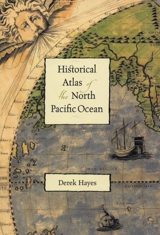
Historical Atlas of the North Pacific Ocean: Maps of Discovery and Scientific Exploration, 1500-2000
Verlag: Sasquatch Books, 2002
ISBN 10: 1570613117ISBN 13: 9781570613111
Buch
Hardcover. Zustand: Good. No Jacket. Former library book; Pages can have notes/highlighting. Spine may show signs of wear. ~ ThriftBooks: Read More, Spend Less 3.3.
Mehr Angebote von anderen Verkäufern bei AbeBooks
Neu ab EUR 33,96
Gebraucht ab EUR 7,48
Mehr entdecken Hardcover Erstausgabe Signiert
-
Historical Atlas of the North Pacific Ocean Maps of Discovery Scientific Exploration
Verlag: Sasquatch, Seattle, 2001
ISBN 10: 1570613117ISBN 13: 9781570613111
Buch Erstausgabe
HARDCOVER. Zustand des Schutzumschlags: very good. First edition. 224pp color, b/w facsimile quarto cloth. very good in slightly worn dustwrapper.
-

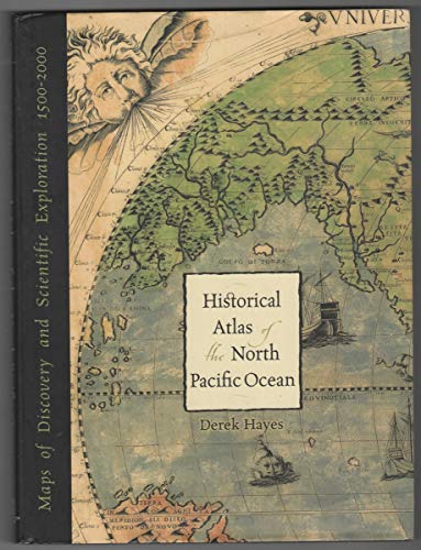
Historical Atlas of the North Pacific Ocean: Maps of Discovery and Scientific Exploration 1500-2000
Verlag: Sasquatch Books, Seattle, WA, 2001
Zustand: Very Good. Zustand des Schutzumschlags: Very Good. 224 pages. Profusely illustrated in both color and black & white, mostly map illustrations. Very good pictorial dust jacket with minor tear in lower right corner. Record # 803923.
-
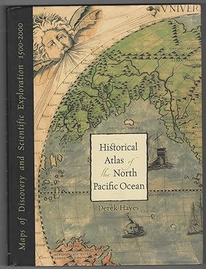
Historical Atlas of the North Pacific Ocean Maps of Discovery and Scientific Exploration, 1500-2000
Verlag: Sasquatch Books, Seattle, WA, 2001
ISBN 10: 1570613117ISBN 13: 9781570613111
Buch Erstausgabe
Hardcover. Zustand: Near Fine. Zustand des Schutzumschlags: Very Good+. First Edition; First Printing. Light wear to dustjacket; A bright, solid book dustjacket in Mylar, unclipped.; B&W and Colour Illustrations; 13.3 X 10.3 X 0.9 inches; 224 pages; "Over five hundred years of maps depicting the North Pacific Ocean and the lands that border it - the United States, Canada, Alaska, Russia, Japan, Korea, and China have been collected into this new atlas. From antique maps of the sixteenth century to modern satellite images, this volume covers all the major explorations, such as Magellan, Bering, Cook, and Vancouver; Perry's opening of Japan; and the U.S. North Pacific Exploring Expedition. It also includes modern maps that use the latest technology to show ocean currents, fault lines, and the seabed in astounding detail.".
-

Historical Atlas of the North Pacific Ocean
Verlag: Sasquatch Books, Seattle, 2001
Anbieter: Pacific Coast Books, ABAA,ILAB, Gleneden Beach, OR, USA
Verbandsmitglied: ABAA CBA ILAB
Bewertung:

Hardcover. Zustand: Fine. Zustand des Schutzumschlags: Near Fine. Maps of Discovery and Scientific Exploration 1500-2000, Folio 13 inches in height by 9.75 inches in width, 224 pages heavily illustrated with vintage maps, Book is Fine, tight and square with sharp points, ultra clean black cloth with bright silver titles to spine, No previous owner bookplate or writing, Jacket is near Fine, full color ancient chart on front board, some light rubbing on rear panel else Fine, shows nicely in a new mylar sleeve. An ultra clean and most presentable Edition.
-
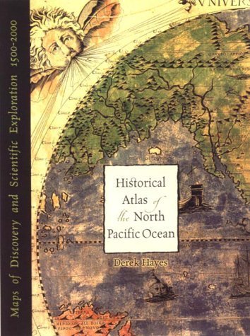
![Bild des Verkäufers für HISTORICAL ATLAS OF THE NORTH PACIFIC OCEAN: MAPS OF DISCOVERY AND SCIENTIFIC EXPLORATION 1500-2000 [SIGNED] zum Verkauf von RON RAMSWICK BOOKS, IOBA](https://pictures.abebooks.com/inventory/md/md3548691659.jpg)
HISTORICAL ATLAS OF THE NORTH PACIFIC OCEAN: MAPS OF DISCOVERY AND SCIENTIFIC EXPLORATION 1500-2000 [SIGNED]
Verlag: Sasquatch Books, Seattle, Washington, U.S.A., 2001
ISBN 10: 1570613117ISBN 13: 9781570613111
Buch Erstausgabe Signiert
Hard Cover. Zustand: Fine. Zustand des Schutzumschlags: Fine. First Edition. SIGNED BY THE AUTHOR. A bright and fine copy in dust jacket. Size: Folio - over 12" - 15" tall. Signed.
-
Historical Atlas of the North Pacific Ocean: Maps of Discovery & Scientific Exploration, 1500-2000
Verlag: Douglas & McIntyre, Vancouver, 2001
ISBN 10: 1550548654ISBN 13: 9781550548655
Buch
Cloth. Zustand: As New. Zustand des Schutzumschlags: As New. First Edition, First Printing. Historical atleas of the North Pacific Ocean including Dutch, Chinese, Korean, Japanese, Russian, American, Spanish, French and British. 224pp, . illustrated with 285 maps in color and in b&w. Bright, fresh copy - 'as new' - still in sealed, transparent cover. Weight, 1.5kg [extra postage applies] NB - Postal Rates shown by ABE are frequently incorrect and are vague estimates NOT guaranteed rates. Postage, at Cost, to be determined when location of potential buyer is known and when type/s of postage required are known. Uniform postal charges usually do not work. When cost is determined, buyer can then freely accept or decline the charges. We ship to so many different locations and to over 60 different countries, a single pre-determined amount makes little sense. Ships to anywhere within Canada for US$15.00, boxed, tracked, insured, faster than parcel post. This rate is good to ANY location within Canada. Ships for somewhat less to the United States via the USPS / Canada Post. Please enquire for postal rates to any other destinations ? postage at our cost.
-
Historical Atlas of the North Pacific Ocean: Maps of Discovery and Scientific Exploration 1500-2000
Verlag: The British Museum Press 2001, 2001
Anbieter: Hard to Find Books NZ (Internet) Ltd., Dunedin, OTAGO, Neuseeland
Verbandsmitglied: IOBA
Bewertung:
Lg quarto, black heavy card boards, silver coloured lettering to spine, illus eps & prelims, 224pp, illus, Near FINE (light creasing to spine extrems) in d/w, VG+ (light creasing to edges, light foxing to internal sides).
-
Historical Atlas of the North Pacific Ocean Maps of Discovery and Scientific Exploration 1500 -2000.
Verlag: London; The British Museum Press; 2001., 2001
Anbieter: Time Booksellers, Somerville, VIC, Australien
Bewertung:
First English Edition; Roy. 4to; pp. 224; endpaper maps, colour illustrated frontispiece and title page, text illustrated with 285 maps mostly coloured, map sources, bibliography, index, bound in original black cloth, title lettered on spine in silver, dustjacket, fine copy.
-

Historical Atlas of the North Pacific Ocean: Maps of Discovery and Scientific Exploration 1500-2000
Verlag: Douglas & McIntyre, Vancouver/Toronto, 2001
Anbieter: Minotavros Books, ABAC ILAB, Whitby, ON, Kanada
Bewertung:
Hardcover. Zustand: Fine. Zustand des Schutzumschlags: Fine. Folio. Published under the auspices of the North Pacific Marine Science Organization. 224pp. About fine.
-
Historical Atlas of the North Pacific Ocean: Maps of Discovery and Scientific Exploration, 1500-2000
Verlag: British Museum Press London 2001, 2001
Anbieter: Andrew Barnes Books / Military Melbourne, Melbourne, VIC, Australien
Bewertung:
Erstausgabe
1st edition hardback with dust jacket As New folio 224pp., col. & b/w pls., text ills., maps, index, 'Over five hundred years of maps depicting the North Pacific Ocean and the lands that border it; the US, Canada, Alaska, Russia, Japan, Korea, & China have been collected. From 16th Century to modern satellite maps; this volume covers all the major explorations; such as Magellan, Bering, Cook, Vancouver Perry etc.
-
Historical Atlas of the North Pacific Ocean Maps of Discovery and Scientific Exploration 1500-2000.
Verlag: Vancouver & Toronto: Douglas & McIntyre, under the auspices of the North Pacific Marine Science Organization, [2001]., 2001
ISBN 10: 1550548654ISBN 13: 9781550548655
Anbieter: D & E LAKE LTD. (ABAC/ILAB), Toronto, ON, Kanada
Bewertung:

Buch Erstausgabe
Hardcover. Zustand: Fine. Dust Jacket Included. 1st Edition. folio. pp. 224. 285 maps (many colour) & a few other illus. biblio. index. bds. dw. First Edition.
-

Historical Atlas of the North Pacific Ocean Maps of Discovery and Scientific Exploration 1500-2000 Special Collection
Verlag: British Museum Press, 2001
Buch Erstausgabe
Hardcover. Zustand: Fine. First Edition. First Edition thus, very fine condition. Historical Atlas of the North Pacific Ocean Maps of Discovery and Scientific Exploration 1500-2000 Special Collection by Derek Hayes. Published by British Museum Press in 2001. Hardcover. The Spaniard Vasco Nunez de Balboa was in 1513 the first European to confirm that another ocean lay to the west of America. Geographical knowledge of the North Pacific grew only slowly, and it was not until James Cook's third voyage in 1778/9 that the bounds of the ocean were truly revealed. Now, with the advent of modern technology, the fine details of the sea bed can be plotted and the behaviour of the ocean itself can begin to be understood. This book looks at the history of the North Pacific i. Collectible item in excellent condition.
