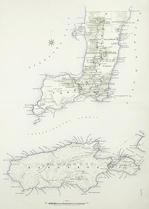
Sheet no. 4 [Yorke Peninsula & Kangaroo Island]
Goyder, George Woodroffe
Verkäufer Antique Print & Map Room, Ultimo, NSW, Australien
Verkäuferbewertung 5 von 5 Sternen
AbeBooks-Verkäufer seit 1. August 2017
Verkäufer Antique Print & Map Room, Ultimo, NSW, Australien
Verkäuferbewertung 5 von 5 Sternen
AbeBooks-Verkäufer seit 1. August 2017
Beschreibung
Rare and important detailed map of part of South Australia by George Goyder (1826-1898). The map extends from Yorke's Peninsula and Kangaroo Island, with the following detailed information: Railways, existing marked in narrow blue segment lines. Railways, in course of construction, two narrow blue lines. Railways recommended to be constructed, space double blue bars Land Sold and Selected in green Land held under mineral leases, in cross hatched diagonal blue lines. Land held under mineral claims, thin blue line Boundaries of Counties, black bars with alternating dots. Boundaries of Hundreds black bars Pastoral Lands are all the untinted areas (except a small area near the northern boundary of South Australia proper). From Goyder's, Plan of the southern portion of the province of South Australia: as divided into counties and hundreds, showing the most important settlements, post towns, telegraph stations, main roads, railways, &c compiled from official documents in the Office of the Surveyor General, Adelaide 1877 Collections: National Library Australia: Bib ID 1641997 State Library South Australia: 912.9423 P699d State Library New South Wales: Reference code (AuSN)b23940281-61slnsw_inst State Library Victoria: RARELTEF 912.942 So8P Paper Size: 650mm x 920mm (25.6" x 36.2"). Condition: In good condition, with centre fold as issued. Technique: Lithograph printed in colour. Bestandsnummer des Verkäufers GOYSAT 004 SA
Bibliografische Details
Titel: Sheet no. 4 [Yorke Peninsula & Kangaroo ...
Erscheinungsdatum: 1877
Einband: No Binding
Zustand: Very Good
Auflage: 1st Edition
Anbieterinformationen
Zahlungsarten
akzeptiert von diesem Verkäufer