Bagrow leo (217 Ergebnisse)

Sprache: Englisch
Verlag: Precedent Publishing, Chicago, 1985
- Hardcover
Anbieter: Rivertown Fine Books, McGregor, IA, USARivertown Fine Books
Verkäufer/-in kontaktierenVerkäufer/-in mit 5 SternenVerbandsmitglied: MWABA
Zustand: Gebraucht - Gut
EUR 18,04
EUR 5,24 VersandVersand innerhalb von USAAnzahl: 1 verfügbar
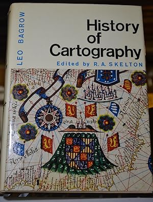
Hardcover. Zustand: Very Good. Pub by Precedent Publishing, Inc., Chicago, 1985, stated 2nd Edition, revised and enlarged. NOT exLib. VG+ or better cond. hardcover, no dj. Blue cloth over bds w/ bright silver lettering on spine. P/O's name, date & place on ffep, & 4 modest notes inside rear cover, o/w book is complete, intact &…unmarked. Very nicely illustrated in color & b&w. 312pp incl index. Square, straight, tight, bright & clean except as noted, overall VG+ or better used cond. Same or next day shipping. Please email any questions.

- Hardcover
Anbieter: ThriftBooks-Dallas, Dallas, TX, USAThriftBooks-Dallas
Verkäufer/-in kontaktierenVerkäufer/-in mit 5 SternenZustand: Gebraucht - Gut
EUR 26,14
Versand nach gratisVersand innerhalb von USAAnzahl: 1 verfügbar
Hardcover. Zustand: Very Good. No Jacket. May have limited writing in cover pages. Pages are unmarked. ~ ThriftBooks: Read More, Spend Less.
Sprache: Englisch
Verlag: Harvard University Press, 1964
- Hardcover
Anbieter: Richard J Barbrick, Bloomington, IN, USARichard J Barbrick
Verkäufer/-in kontaktierenVerkäufer/-in mit 5 SternenZustand: Gebraucht - Befriedigend
EUR 22,51
EUR 4,95 VersandVersand innerhalb von USAAnzahl: 1 verfügbar
Hardcover. Zustand: Good. Hardcover with dust jacket in Good condition. Clean pages. Good binding. Carefully packaged to avoid damage in shipping.
Verlag: Harvard University Press, 1964
- Hardcover
Anbieter: Midtown Scholar Bookstore, Harrisburg, PA, USAMidtown Scholar Bookstore
Verkäufer/-in kontaktierenVerkäufer/-in mit 5 SternenZustand: Gebraucht - Ausreichend
EUR 15,49
EUR 5,25 VersandVersand innerhalb von USAAnzahl: 1 verfügbar
hardcover. Zustand: Acceptable. Ex-library with usual stamps and markings This is a damaged book. May be ex-library, water-damaged, or spine creased/broken. Acceptable, Reading copy only, with writing/markings and heavy wear. Oversized.
Sprache: Englisch
Verlag: Harvard Univ. and C A Watts, Cambridge, MA & London, 1966
- Hardcover
Anbieter: Terra Firma Books, San Diego, CA, USATerra Firma Books
Verkäufer/-in kontaktierenVerkäufer/-in mit 5 SternenZustand: Gebraucht - Gut
EUR 27,05
EUR 5,25 VersandVersand innerhalb von USAAnzahl: 1 verfügbar
Hardcover. Zustand: Very Good. Zustand des Schutzumschlags: Very Good. Essential for study of antique maps! No name or writing. CLEAN.
Verlag: Transaction Publishers, U.S.A., 1966
- Hardcover
Anbieter: Conover Books, Martinsville, VA, USAConover Books
Verkäufer/-in kontaktierenVerkäufer/-in mit 5 SternenZustand: Gebraucht - Befriedigend
EUR 17,14
EUR 4,37 VersandVersand innerhalb von USAAnzahl: 1 verfügbar
Blue Cloth. Zustand: Good. No Jacket. Revised Edition. Minor edge and corner wear; no dj; lightly scuffed and scratched; corners are lightly bumped and rubbed; some light shelf wear; ex-library with the usual library markings; overall a nice used copy! Blue cloth with gilt lettering and illustration on the spine and front board.… 312 informative and historical pages of text and over 70 pages of historic black and white photographs and illustrations! "This illustrated work is intended to acquaint readers with the early maps produced in both Europe and the rest of the world, and to tell us something of their development, their makers and printers, their varieties and characteristics. The authors chief concern is with the appearance of maps: they exclude any examination of their content, or of scientific methods of mapmaking. This book ends in the second half of the eighteenth century, when craftsmanship was superseded by specialized science and the machine. As a history of the evolution of the early map, it is a stunning work of art and science. This expanded second edition of Bagrow and Skeltons History of Cartography marks the reappearance of this seminal work after a hiatus of nearly a half century. As a reprint project undertaken many years after the book last appeared, finding suitable materials to work from proved to be no easy task. Because of the wealth of monochrome and color plates, the book could only be properly reproduced using the original materials. Ultimately the authors were able to obtain materials from the original printer Scotchprints or contact films made directly from original plates, thus allowing the work to preserve the beauty and clarity of the illustrations. Old maps, collated with other materials, help us to elucidate the course of human history. It was not until the eighteenth century, however, that maps were gradually stripped of their artistic decoration and transformed into plain, specialist sources of information based upon measurement. Maps are objects of historical, artistic, and cultural significance, and thus collecting them seems to need no justification, simply enjoyment." Size: 4to - over 9¾" - 12" tall. Ex-Library.

- Hardcover
Anbieter: Solr Books, Lincolnwood, IL, USASolr Books
Verkäufer/-in kontaktierenVerkäufer/-in mit 5 SternenZustand: Gebraucht - Befriedigend
EUR 25,84
EUR 6,99 VersandVersand innerhalb von USAAnzahl: 1 verfügbar
Zustand: good. This book is in Good condition. There may be some notes and highligting but otherwise the book is in overall good condition.
Verlag: Nico Israel
Anbieter: Wonder Book, Frederick, MD, USAWonder Book
Verkäufer/-in kontaktierenVerkäufer/-in mit 5 SternenZustand: Gebraucht - Ausreichend
EUR 17,86
Versand nach gratisVersand innerhalb von USAAnzahl: 1 verfügbar
Zustand: Fair. Acceptable condition. Volume 25. Hinges cracked. (Cartography, early maps).
Verlag: Harvard University Press, 1964
- Hardcover
Anbieter: BooksElleven, Three Oaks, MI, USABooksElleven
Verkäufer/-in kontaktierenVerkäufer/-in mit 5 SternenZustand: Gebraucht - Befriedigend
EUR 21,64
EUR 3,49 VersandVersand innerhalb von USAAnzahl: 1 verfügbar
hardcover. Zustand: Good. Dust jacket has a couple chips and tears along extremities. Nice cover. Previous owner name occurs in prelims. Clean pages. Binding is secure.
Verlag: Precedent, 1985
- Hardcover
Anbieter: Arader Galleries of Philadelphia, PA, Philadelphia, PA, USAArader Galleries of Philadelphia, PA
Verkäufer/-in kontaktierenVerkäufer/-in mit 4 SternenHardcover. Zustand: New. Zustand des Schutzumschlags: new. still in publisher shrink wrap orange dust jacket all new.
Verlag: Harvard University Press, 1966
- Hardcover
Anbieter: Tom Davies Rare Books, Albuquerque, NM, USATom Davies Rare Books
Verkäufer/-in kontaktierenVerkäufer/-in mit 5 SternenZustand: Gebraucht - Gut bis sehr gut
EUR 22,55
EUR 5,25 VersandVersand innerhalb von USAAnzahl: 1 verfügbar
Hardcover. Zustand: Near Fine. Zustand des Schutzumschlags: Near Fine. Cambridge, Harvard Univ.Press,1966. 8vo,312pp. Pictorial dj over gilt blue boards. 200-odd maps are reproduced, some in color. Dj protected by Mylar. The top inch of the front inner hinge is open, else near fine condition.
- Hardcover
Anbieter: Dogwood Books, Rome, GA, USADogwood Books
Verkäufer/-in kontaktierenVerkäufer/-in mit 5 SternenZustand: Gebraucht - Gut
EUR 36,07
EUR 5,69 VersandVersand innerhalb von USAAnzahl: 1 verfügbar
Hardcover. Zustand: Very Good. Zustand des Schutzumschlags: Very Good. The dustjacket shows some edgewear and is protected in a mylar cover. The binding is sound.

- Hardcover
Anbieter: Book House in Dinkytown, IOBA, Minneapolis, MN, USABook House in Dinkytown, IOBA
Verkäufer/-in kontaktierenVerkäufer/-in mit 5 SternenVerbandsmitglied: IOBA
Zustand: Gebraucht - Gut
EUR 36,08
EUR 5,69 VersandVersand innerhalb von USAAnzahl: 1 verfügbar
Hardcover. Zustand: Very Good. Zustand des Schutzumschlags: Good+. Second Edition, revised and enlarged with additional maps and illustrations. Precedent Publishers, 1985; no later printings indicated; 312pp. Binding is tight, sturdy, and square; very minor wear to edges of navy blue cloth boards, silver foil titling remains bri…ght and bold; illustrations and text very good. Small closed tear over foot of spine, else only minor wear to edges of unclipped dust jacket; spine panel toned; jacket arrives wrapped in protective mylar. Due to the size/weight of this book extra charges will apply for international and/or expedited shipping. Ships same or next business day from Dinkytown in Minneapolis, Minnesota.
Verlag: Harvard Univ Press, Cambridge, MA, 1964
- Hardcover
Anbieter: Larry W Price Books, Portland, OR, USALarry W Price Books
Verkäufer/-in kontaktierenVerkäufer/-in mit 5 SternenZustand: Gebraucht - Gut
EUR 26,61
EUR 4,33 VersandVersand innerhalb von USAAnzahl: 1 verfügbar
Hardcover. Zustand: Very Good. Zustand des Schutzumschlags: Good. 312 pp.+ 21 Color Map Illus (Many are FoldOuts), Orig Brn Hardback, Gilt title & Map Illus on F Cover, small spots on T edgepapers else VG in torn DJ, Revised Ed.
Verlag: HARVARD UNIVERSITY PRESS, Cambridge, Massachsetts, 1964
- Hardcover
Anbieter: T. W. Palmer Books, Eugene, OR, USAT. W. Palmer Books
Verkäufer/-in kontaktierenVerkäufer/-in mit 5 SternenZustand: Gebraucht - Gut bis sehr gut
EUR 27,06
EUR 4,38 VersandVersand innerhalb von USAAnzahl: 1 verfügbar
Hardcover. Zustand: Near Fine. Zustand des Schutzumschlags: Fair. 27 x 19 cm, 312 pp. color title page of Mercators-Atlas, (1593), many maps, Revised and enlarged English edition by R. A. Skelton of Leo Bagrow's 1951 edition of Geschichte der Kartographie. First published in 1944. Includes list of cartographers, bibliography & i…ndex some in color, dust jacket in mylar unclipped, however back of dust jacket torn and badly repaired.

- Hardcover
Anbieter: medimops, Berlin, Deutschlandmedimops
Verkäufer/-in kontaktierenVerkäufer/-in mit 5 SternenZustand: Gebraucht - Gut
EUR 16,88
EUR 10,00 VersandVersand von Deutschland nach USAAnzahl: 1 verfügbar
Zustand: very good. Gut/Very good: Buch bzw. Schutzumschlag mit wenigen Gebrauchsspuren an Einband, Schutzumschlag oder Seiten. / Describes a book or dust jacket that does show some signs of wear on either the binding, dust jacket or pages.

Verlag: C A Watts, 1964
- Hardcover
Anbieter: Birkitt's Books, SARASOTA, FL, USABirkitt's Books
Verkäufer/-in kontaktierenVerkäufer/-in mit 4 SternenZustand: Gebraucht - Befriedigend
EUR 27,06
EUR 5,91 VersandVersand innerhalb von USAAnzahl: 1 verfügbar
Hardcover. Zustand: Good. Missing. No dust jacket, moderate wear, beige cloth covers are soiled, top of spine cover is warped, binding sound, internally clean.
- Hardcover
- Erstausgabe
Anbieter: Saucony Book Shop, Kutztown, PA, USASaucony Book Shop
Verkäufer/-in kontaktierenVerkäufer/-in mit 5 SternenZustand: Gebraucht - Sehr gut
EUR 45,10
EUR 5,25 VersandVersand innerhalb von USAAnzahl: 1 verfügbar
Hardcover. Zustand: Fine. Zustand des Schutzumschlags: Very Good. First Thus. Tan cloth, lettered and with front cover device in gilt. Minor foxing to text block edges, a bit soiled at bottom text block corner, otherwise about as issued. 1st edition thus (revised and enlarged). 312 pp., illus. Color illus. dust jacket VG, foxed,… with tanned spine panel, price-clipped front flap, now in mylar. Size: 4to - over 9¾" - 12" tall. Book.
Sprache: Englisch
Verlag: Harvard University Press, Cambridge, MA, 1964
- Hardcover
Anbieter: Bryn Mawr Bookstore, Cambridge, MA, USABryn Mawr Bookstore
Verkäufer/-in kontaktierenVerkäufer/-in mit 5 SternenVerbandsmitglied: SNEAB
Zustand: Gebraucht - Sehr gut
EUR 45,10
EUR 6,57 VersandVersand innerhalb von USAAnzahl: 1 verfügbar
Hardcover. Zustand: Fine. Zustand des Schutzumschlags: Fine. Revised and Enlarged by R.A. Skelton, Superintendent of the Map Room in the British Museum. Quarto. 312 pp. Liberally illustrated in color and in black and white. Owner's small ink inscription on ffep, else as new, in fine d/w and slipcase.

Verlag: Harvard University Press, Cambridge, 1966
- Hardcover
Anbieter: Oak Knoll Books, ABAA, ILAB, NEW CASTLE, DE, USAOak Knoll Books, ABAA, ILAB
Verkäufer/-in kontaktierenVerkäufer/-in mit 5 SternenZustand: Gebraucht
EUR 27,06
EUR 7,44 VersandVersand innerhalb von USAAnzahl: 1 verfügbar
cloth, dust jacket. small 4to. cloth, dust jacket. 312 pages. Second edition, revised and enlarged by R.A. Skelton with 116 illustrations and 22 maps reproduced in color. Fine in near fine jacket. Reprinted, with corrections, from the 1964 edition. Maps (illustrator).
 Weitere Bilder
Verlag: Cambridge: Harvard University Press, 1964., 1964
- Hardcover
Anbieter: Free Play Books, NEW HAVEN, CT, USAFree Play Books
Verkäufer/-in kontaktierenVerkäufer/-in mit 4 SternenZustand: Gebraucht - Gut bis sehr gut
EUR 31,57
EUR 3,94 VersandVersand innerhalb von USAAnzahl: 1 verfügbar
Hardcover. Zustand: Near Fine. Zustand des Schutzumschlags: Very Good. Large 8vo. 312 pp. b/w and color illustrations. Pale pink cloth lettered in gold. Faint shelf-wear. Jacket lightly soiled, minor edge-wear, a few small chips and tears. Near Fine in Very Good dust jacket. In archival mylar sleeve.
Verlag: N. Israel, Amsterdam, Netherlands, 1967
- Softcover
Anbieter: Book Booth, Berea, OH, USABook Booth
Verkäufer/-in kontaktierenVerkäufer/-in mit 5 SternenZustand: Gebraucht - Befriedigend
EUR 30,67
EUR 5,17 VersandVersand innerhalb von USAAnzahl: 1 verfügbar
Paperback. Zustand: Good. Reprint edition. Includes all eight fold-outs. Text clean & bright; binding tight; minor wear to covers. 184 pages. Illustrated. Articles on Catalan Portolan maps, Vespucci's third voyage, Castiglioni Planisphere, early Florida maps, Nicolas Witsen, Semyon Remezov, Ricci's China maps, and more. Reprint…edition (1967) of Imago Mundi XI. We also carry other volumes of this journal. Size: 8.5" x 11.5".
Verlag: N. Israel, Amsterdam, Netherlands, 1970
- Softcover
Anbieter: Book Booth, Berea, OH, USABook Booth
Verkäufer/-in kontaktierenVerkäufer/-in mit 5 SternenZustand: Gebraucht - Befriedigend
EUR 30,67
EUR 5,17 VersandVersand innerhalb von USAAnzahl: 1 verfügbar
Paperback. Zustand: Good. Reprint edition. Includes all nine fold-outs. Text clean & bright; binding tight; minor wear to covers. 192 pages. Illustrated. Articles on early Missouri River map, history of map projection, chart of Magellan, early Scandinavian maps, Stephanus Florentinus, Gaubil maps of Japan, Renat's Kalmuck maps,…and more. Reprint of Imago Mundi XII (1955). We also carry other volumes of this journal. Size: 8.5" x 11.5".
Verlag: N. Israel, Amsterdam, Netherlands, 1967
- Softcover
Anbieter: Book Booth, Berea, OH, USABook Booth
Verkäufer/-in kontaktierenVerkäufer/-in mit 5 SternenZustand: Gebraucht - Befriedigend
EUR 30,67
EUR 5,17 VersandVersand innerhalb von USAAnzahl: 1 verfügbar
Paperback. Zustand: Good. Reprint edition. Includes all five fold-outs. Text clean & bright; binding tight; minor wear to covers. 124 pages. Illustrated. Articles on Erhard Etzlaub, Francesco Rosselli, Olaus Magnus, Sancho Gutierrez, Petrus Plancius, Johannes Janssonius, and more. Reprint edition (1967) of Imago Mundi VIII first… issued in 1951. We also carry other volumes of this journal. Size: 8.5" x 11.5".
Verlag: N. Israel, Amsterdam, Netherlands, 1967
- Softcover
Anbieter: Book Booth, Berea, OH, USABook Booth
Verkäufer/-in kontaktierenVerkäufer/-in mit 5 SternenZustand: Gebraucht - Befriedigend
EUR 30,67
EUR 5,17 VersandVersand innerhalb von USAAnzahl: 1 verfügbar
Paperback. Zustand: Good. Reprint edition. Includes all four fold-outs. Text clean & bright; binding tight; minor wear to covers. 123 pages. Illustrated. Articles on early Siberian maps, Boym's China map, Petrus Roselli, Ambrosius Thoms, Martin Faber, cosmographic loggia of the Vatican, Girolamo de Angelis, and more. Reprint edi…tion (1967) of Imago Mundi IX first issued in 1952. We also carry other volumes of this journal. Size: 8.5" x 11.5".
Verlag: [København : Johnsen] [1949?], 1949
- Softcover
Anbieter: Stony Hill Books, Madison, WI, USAStony Hill Books
Verkäufer/-in kontaktierenVerkäufer/-in mit 5 SternenZustand: Gebraucht - Gut
EUR 31,57
EUR 4,82 VersandVersand innerhalb von USAAnzahl: 2 verfügbar
Soft cover. Zustand: Very Good. Offprint / extraction paginated 32-40 plus numerous blank pages as filler, side-stapled in plain light green paper covers 6.3 x 9.3 inches, Saertryk af "Geografisk tidsskrift", Bd. 49 (1948/49).
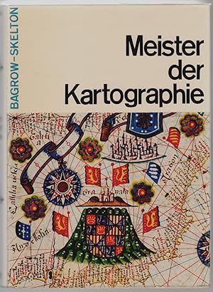
Verlag: Safari, Berlin, 1964
- Hardcover
Anbieter: Walkabout Books, ABAA, Curtis, WA, USAWalkabout Books, ABAA
Verkäufer/-in kontaktierenVerkäufer/-in mit 4 SternenZustand: Gebraucht - Sehr gut
EUR 31,57
EUR 5,04 VersandVersand innerhalb von USAAnzahl: 1 verfügbar
Hardcover. Zustand: Fine. Near Fine. 579 pp, with maps, illustrations, list of cartographers, bibliography, index. A fine copy, in dust jacket with very light wear to edges, in original cardboard slipcase. Text is in German. A beautiful volume on cartography illustrated throughout with a variety of maps of Europe and Asia dating… from ancient times to the 16th century. Due to size, shipping charges will be more than standard for priority or international orders.
Verlag: N. Israel, Amsterdam. 1972., 1972
- Softcover
Anbieter: Sainsbury's Books Pty. Ltd., Camberwell, VIC, AustralienSainsbury's Books Pty. Ltd.
Verkäufer/-in kontaktierenVerkäufer/-in mit 4 SternenZustand: Gebraucht
EUR 15,52
EUR 21,02 VersandVersand von Australien nach USAAnzahl: 1 verfügbar
4to. A very good paperback copy.
Verlag: N. Israel, Amsterdam. 1971., 1971
- Softcover
Anbieter: Sainsbury's Books Pty. Ltd., Camberwell, VIC, AustralienSainsbury's Books Pty. Ltd.
Verkäufer/-in kontaktierenVerkäufer/-in mit 4 SternenZustand: Gebraucht
EUR 15,52
EUR 21,02 VersandVersand von Australien nach USAAnzahl: 1 verfügbar
4to. A very good paperback copy.
Verlag: N. Israel, Amsterdam. 1969., 1969
- Softcover
Anbieter: Sainsbury's Books Pty. Ltd., Camberwell, VIC, AustralienSainsbury's Books Pty. Ltd.
Verkäufer/-in kontaktierenVerkäufer/-in mit 4 SternenZustand: Gebraucht
EUR 15,52
EUR 21,02 VersandVersand von Australien nach USAAnzahl: 1 verfügbar
4to. A very good paperback copy.


